
Hurst Castle
Hurst Castle is a device fort. Look for it 1.8 km northwest of Freshwater and Totland. It is maintained by English Heritage.
Castle near Freshwater and Totland
One of the best-known places to visit in England, Scotland, Wales and Northern Ireland
#410 of the 8,556 museums, castles, gardens and other attractions we list, by how widely it is covered (12 Wikipedias). About ↓
Just outside Freshwater and Totland
Hurst Castle is 1.8 km northwest of Freshwater and Totland. Towns near it ↓
Cared for by English Heritage
One of the places English Heritage looks after; members usually get in free. About ↓
Written from OpenStreetMap, Wikidata, the ONS built-up areas and Met Office 1991–2020 averages.
Warm months and wet ones
May to September are the warmest in Freshwater and Totland, with afternoon highs of 17–22°C.
Hurst Castle
12 Wikipedia editions have an article on it. Our list has 44 more places within 15 km; first among them is Yarmouth Castle, at 3.7 km.
- Type
- Castle
- Run by
- English Heritage
- Wikipedias
- Covered in 12 languages
- Town
- 1.8 km northwest of Freshwater and Totland
- Official site
- english-heritage.org.uk/visit/places/hurst-castle
Know before you go
- EntryA fee is charged
Around Hurst Castle, mapped
Find Hurst Castle in orange; each number is a place listed below.
© OpenStreetMap contributors · ONS built-up area 2022
Towns that list Hurst Castle
Among the 8, Lymington is the biggest, home to 14,870 people. The town it is in comes first, then the others whose pages list it, nearest first.
Freshwater and Totland
Norton
Milford on Sea
Yarmouth
Compare the 8 towns
| Town | Where Hurst Castle is | People | Places to visit |
|---|---|---|---|
| Freshwater and Totland | 1.8 km southeast of it | 7,523 | 24 |
| Norton | 2.4 km east of it | 252 | 18 |
| Milford on Sea | 2.5 km northwest of it | 4,364 | 6 |
| Yarmouth | 3.4 km east of it | 470 | 16 |
| Lymington | 4.1 km north of it | 14,870 | 4 |
| Everton | 4.4 km northwest of it | 1,615 | 2 |
| Bouldnor | 4.5 km east of it | 367 | 18 |
| Hordle | 6.7 km northwest of it | 1,158 | 2 |
Pair Hurst Castle with these
The 44 places within 15 km include 2 castles, 2 forts and a garden.
 Castle · English HeritageYarmouth Castle3.7 km away2
 CastleFort Victoria2.2 km away3
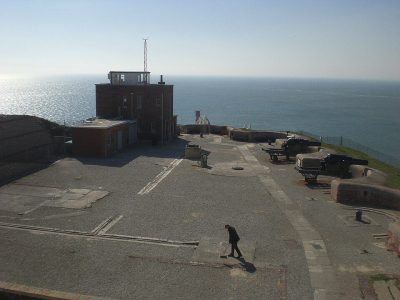 Fort · National TrustThe Needles Batteries5.4 km away4
 GardenFarringford House Gardens4 km away5
 MuseumNational Motor Museum15 km away6
 FortGolden Hill Fort2.9 km away7
 Abbey or prioryBeaulieu Abbey15 km away8
 Historic housePalace House14 km away
Within 15 km, close and well known first. Numbers match the map.
Hurst Castle, answered
Where is Hurst Castle?
Hurst Castle is 1.8 km northwest of Freshwater and Totland, Isle of Wight.
What is Hurst Castle?
Device Fort in Hampshire, England.
Who runs Hurst Castle?
English Heritage, so members usually get in free; check opening times before you go.
When is the best time to visit Hurst Castle?
May to September are the warmest months in Freshwater and Totland, with afternoon highs of 17–22°C (Met Office 1991–2020 averages).
What else is there to see near Hurst Castle?
Within 15 km: Yarmouth Castle (3.7 km), Fort Victoria (2.2 km), The Needles Batteries (5.4 km) and Farringford House Gardens (4 km).
Places: OpenStreetMap (© OpenStreetMap contributors, Open Database Licence) and Wikidata (CC0), placed in the ONS 2022 built-up area (Open Government Licence v3.0). Visitor counts are the latest Wikidata gives, with their year.
Photos: each place’s Wikidata image, from Wikimedia Commons under the licence below (our copy, resized).
Photo credits (9)
- Hurst Castle: Dave Pape, Public domain, Wikimedia Commons
- Yarmouth Castle: Christophe.Finot, CC BY-SA 2.5, Wikimedia Commons
- Fort Victoria: Ranger Steve, Public domain, Wikimedia Commons
- The Needles Batteries: Editor5807, Public domain, Wikimedia Commons
- Farringford House Gardens: Public domain, Wikimedia Commons
- National Motor Museum: Paul Hermans, CC BY-SA 3.0, Wikimedia Commons
- Golden Hill Fort: Warren Whyte, CC BY-SA 4.0, Wikimedia Commons
- Beaulieu Abbey: E Gammie, CC BY-SA 2.0, Wikimedia Commons
- Palace House: This photo was taken by Przemysław Jahr Autorem zdjęcia jest Przemysław Jahr Wykorzystując zdjęcie proszę podać jako autora: Przemysław Jahr / Wikimedia Commons, Public domain, Wikimedia Commons
Contains public sector information licensed under the Open Government Licence v3.0. Contains HM Land Registry data © Crown copyright and database right 2026. Contains OS data © Crown copyright and database right 2026 (ONS boundaries). Northern Ireland: Source: NISRA; contains Land & Property Services data and Ordnance Survey of Northern Ireland information, © Crown copyright, licensed under the Open Government Licence v3.0. Scotland: contains National Records of Scotland data, Registers of Scotland data and SEPA data, © Crown copyright / © SEPA 2025, licensed under the Open Government Licence v3.0.