
Farringford House Gardens
Farringford House Gardens is a country house on the Isle of Wight. Its setting is 100 m south of Freshwater and Totland. It holds the status of a Grade I listed building.
Garden near Freshwater and Totland
Just outside Freshwater and Totland
Farringford House Gardens is 100 m south of Freshwater and Totland. Towns near it ↓
Grade I listed building
On the official list of protected heritage; Freshwater and Totland has 67 listed buildings in all, on its History page. About ↓
Written from OpenStreetMap, Wikidata, the ONS built-up areas and Met Office 1991–2020 averages.
The seasons here
Afternoons in Freshwater and Totland peak at 17–22°C, May to September.
Farringford House Gardens
Wikipedia covers it in 3 languages. 36 other places to visit are within 15 km, led by Yarmouth Castle (3.9 km).
- Type
- Garden
- Listed
- Grade I listed building
- Wikipedias
- Covered in 3 languages
- Town
- 100 m south of Freshwater and Totland
- Official site
- farringford.co.uk
Around Farringford House Gardens, mapped
The map puts Farringford House Gardens in orange and numbers its neighbours as in the list.
© OpenStreetMap contributors · ONS built-up area 2022
Towns that list Farringford House Gardens
The 4 towns are led in size by Freshwater and Totland, with 7,523 people. Its home town tops the list; the rest follow by distance.
Freshwater and Totland
Norton
Yarmouth
Bouldnor
Compare the 4 towns
| Town | Where Farringford House Gardens is | People | Places to visit |
|---|---|---|---|
| Freshwater and Totland | 100 m north of it | 7,523 | 24 |
| Norton | 2.4 km north of it | 252 | 18 |
| Yarmouth | 3.5 km northeast of it | 470 | 16 |
| Bouldnor | 4.3 km northeast of it | 367 | 18 |
What else is near Farringford House Gardens
Nearby, 36 places within 15 km include 3 castles, 2 museums and 2 forts.
 Castle · English HeritageYarmouth Castle3.9 km away2
 Castle · English HeritageHurst Castle4 km away3
 MuseumDimbola Museum and Galleries700 m away4
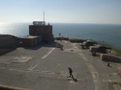 Fort · National TrustThe Needles Batteries4.4 km away5
 FortGolden Hill Fort1.6 km away6
 CastleFort Victoria3.5 km away7
 PierYarmouth Pier4 km away8
 Museum · National TrustOld Battery Museum4.3 km away
Within 15 km, close and well known first. Numbers match the map.
Visiting Farringford House Gardens
Where is Farringford House Gardens?
Farringford House Gardens is 100 m south of Freshwater and Totland, Isle of Wight.
What is Farringford House Gardens?
Country house on the Isle of Wight, England, UK.
When is the best time to visit Farringford House Gardens?
May to September are the warmest months in Freshwater and Totland, with afternoon highs of 17–22°C (Met Office 1991–2020 averages).
Is Farringford House Gardens a listed building?
Yes: Grade I listed building.
What else is there to see near Farringford House Gardens?
Within 15 km: Yarmouth Castle (3.9 km), Hurst Castle (4 km), Dimbola Museum and Galleries (700 m) and The Needles Batteries (4.4 km).
Places: OpenStreetMap (© OpenStreetMap contributors, Open Database Licence) and Wikidata (CC0), placed in the ONS 2022 built-up area (Open Government Licence v3.0). Visitor counts are the latest Wikidata gives, with their year.
Photos: each place’s Wikidata image, from Wikimedia Commons under the licence below (our copy, resized).
Photo credits (9)
- Farringford House Gardens: Public domain, Wikimedia Commons
- Yarmouth Castle: Christophe.Finot, CC BY-SA 2.5, Wikimedia Commons
- Hurst Castle: Dave Pape, Public domain, Wikimedia Commons
- Dimbola Museum and Galleries: Editor5807, Public domain, Wikimedia Commons
- The Needles Batteries: Editor5807, Public domain, Wikimedia Commons
- Golden Hill Fort: Warren Whyte, CC BY-SA 4.0, Wikimedia Commons
- Fort Victoria: Ranger Steve, Public domain, Wikimedia Commons
- Yarmouth Pier: Editor5807, CC BY 3.0, Wikimedia Commons
- Old Battery Museum: Stefan Wolmarans, CC BY-SA 4.0, Wikimedia Commons
Contains public sector information licensed under the Open Government Licence v3.0. Contains HM Land Registry data © Crown copyright and database right 2026. Contains OS data © Crown copyright and database right 2026 (ONS boundaries). Northern Ireland: Source: NISRA; contains Land & Property Services data and Ordnance Survey of Northern Ireland information, © Crown copyright, licensed under the Open Government Licence v3.0. Scotland: contains National Records of Scotland data, Registers of Scotland data and SEPA data, © Crown copyright / © SEPA 2025, licensed under the Open Government Licence v3.0.