Crook Hall Gardens
One of the places to visit in Durham is Crook Hall Gardens, an attraction. Another 8 places to visit lie within 5 km. Its upkeep is handled by the National Trust.
Attraction in Durham
Inside Durham
Crook Hall Gardens is inside Durham’s built-up area, with 8 more places to visit within 5 km. Towns near it ↓
Cared for by the National Trust
One of the places the National Trust looks after; members usually get in free. About ↓
Written from OpenStreetMap, Wikidata, the ONS built-up areas and Met Office 1991–2020 averages.
Weather, month by month
Highs of 17–20°C mark June to September in Durham.
Crook Hall Gardens
Around it, Durham Castle (800 m) comes first on our list.
- Type
- Attraction
- Run by
- National Trust
- Town
- in Durham
The area around Crook Hall Gardens
Numbered points are the places near Crook Hall Gardens, which is in orange.
© OpenStreetMap contributors · The dashed line is Durham’s built-up area. · ONS built-up area 2022
Where to base yourself
Of these 8 towns, the largest is Durham (50,502 people). The towns whose pages list it: the one it is in, those within 5 km of it, then larger towns further out.
- 1Durham
- 2Ushaw Moor and Bearpark
- 3Brandon
- 4High Shincliffe
- 5Nettlesworth and Kimblesworth
- 6Sherburn
- 7Sacriston
- 8Witton Gilbert
Durham
Ushaw Moor and Bearpark
Brandon
High Shincliffe
Compare the 8 towns
| Town | Where Crook Hall Gardens is | People | Places to visit |
|---|---|---|---|
| Durham | It’s in town | 50,502 | 15 |
| Ushaw Moor and Bearpark | 2.5 km west of it | 6,483 | 11 |
| Brandon | 3 km southwest of it | 9,508 | 10 |
| High Shincliffe | 3.3 km southeast of it | 1,045 | 8 |
| Nettlesworth and Kimblesworth | 4 km north of it | 899 | 9 |
| Sherburn | 4 km east of it | 2,796 | 10 |
| Sacriston | 4.3 km northwest of it | 5,186 | 7 |
| Witton Gilbert | 4.4 km northwest of it | 2,525 | 8 |
Each has its own grades, prices and things to do.
Also within reach
There are 31 within 15 km, 3 castles, 3 museums and a cathedral among them.
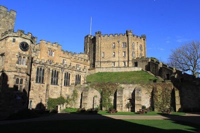 CastleDurham Castle800 m away2
 CathedralDurham Cathedral1 km away3
 MuseumOriental Museum2.1 km away · 19K visitors a year4
 MuseumBeamish Museum13 km away · 350K visitors a year5
 CastleLumley Castle8 km away6
 Abbey or priory · English HeritageFinchale Priory4.6 km away7MuseumMuseumDurham University Museum of Archaeology900 m away8
 CastleBrancepeth Castle7.4 km away
Within 15 km, close and well known first. Numbers match the map.
Good to know about Crook Hall Gardens
Where is Crook Hall Gardens?
Crook Hall Gardens is in Durham, County Durham, inside the town’s built-up area.
What is Crook Hall Gardens?
Attraction.
Who runs Crook Hall Gardens?
National Trust, so members usually get in free; check opening times before you go.
When is the best time to visit Crook Hall Gardens?
June to September are the warmest months in Durham, with afternoon highs of 17–20°C (Met Office 1991–2020 averages).
What else is there to see near Crook Hall Gardens?
Within 15 km: Durham Castle (800 m), Durham Cathedral (1 km), Oriental Museum (2.1 km) and Beamish Museum (13 km).
Places: OpenStreetMap (© OpenStreetMap contributors, Open Database Licence) and Wikidata (CC0), placed in the ONS 2022 built-up area (Open Government Licence v3.0). Visitor counts are the latest Wikidata gives, with their year.
Photos: each place’s Wikidata image, from Wikimedia Commons under the licence below (our copy, resized).
Photo credits (7)
- Durham Castle: Carla Brain, CC BY-SA 2.0, Wikimedia Commons
- Durham Cathedral: Benjamin Smith, CC BY-SA 4.0, Wikimedia Commons
- Oriental Museum: Wereon, CC BY-SA 2.0, Wikimedia Commons
- Beamish Museum: Benjamin Smith, CC BY-SA 4.0, Wikimedia Commons
- Lumley Castle: Bill Henderson, CC BY-SA 2.0, Wikimedia Commons
- Finchale Priory: Public domain, Wikimedia Commons
- Brancepeth Castle: Oliver Dixon, CC BY-SA 2.0, Wikimedia Commons
Contains public sector information licensed under the Open Government Licence v3.0. Contains HM Land Registry data © Crown copyright and database right 2026. Contains OS data © Crown copyright and database right 2026 (ONS boundaries). Northern Ireland: Source: NISRA; contains Land & Property Services data and Ordnance Survey of Northern Ireland information, © Crown copyright, licensed under the Open Government Licence v3.0. Scotland: contains National Records of Scotland data, Registers of Scotland data and SEPA data, © Crown copyright / © SEPA 2025, licensed under the Open Government Licence v3.0.