
Beamish Museum
Beamish Museum is an open-air museum in County Durham. Visitors find it 1.4 km northeast of Stanley. About 350K people visit each year.
Museum near Stanley
One of the best-known places to visit in England, Scotland, Wales and Northern Ireland
#194 of the 8,556 museums, castles, gardens and other attractions we list, by how widely it is covered (13 Wikipedias). About ↓
Just outside Stanley
Beamish Museum is 1.4 km northeast of Stanley. Towns near it ↓
Written from OpenStreetMap, Wikidata, the ONS built-up areas and Met Office 1991–2020 averages.
The year in Stanley
If warmth matters, go June to August: Stanley reaches 17–20°C.
Beamish Museum
There are Wikipedia articles on it in 13 languages. Within 15 km there are 71 more places to visit, starting with Durham Castle (13 km).
- Type
- Museum
- Visitors
- 350K visitors a year
- Wikipedias
- Covered in 13 languages
- Town
- 1.4 km northeast of Stanley
- Official site
- beamish.org.uk
Practical information
- EntryA fee is charged
Getting to Beamish Museum
Each numbered point is one of the places listed below; Beamish Museum is the orange one.
© OpenStreetMap contributors · ONS built-up area 2022
Which towns are near Beamish Museum
Of these 8 towns, the largest is Stanley (19,423 people). Nearest first, every town here counts it among its places to visit.
Stanley
West Pelton
Pelton and Ouston
Tanfield Lea
Compare the 8 towns
| Town | Where Beamish Museum is | People | Places to visit |
|---|---|---|---|
| Stanley | 1.4 km southwest of it | 19,423 | 6 |
| West Pelton | 1.7 km southeast of it | 680 | 5 |
| Pelton and Ouston | 2.6 km east of it | 7,305 | 9 |
| Tanfield Lea | 2.6 km west of it | 2,399 | 6 |
| Urpeth | 2.8 km east of it | 2,048 | 8 |
| Newfield | 2.8 km southeast of it | 1,529 | 5 |
| Kibblesworth | 2.9 km northeast of it | 1,500 | 7 |
| Craghead | 3.3 km south of it | 921 | 3 |
Other places close by
Among the 71 within 15 km are 3 cathedrals, 3 museums and 2 castles.
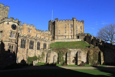 CastleDurham Castle13 km away2
 CathedralDurham Cathedral14 km away3
 MuseumTurbinia9.6 km away4
 CathedralNewcastle Cathedral10 km away5
 CastleNewcastle upon Tyne Castle9.9 km away6
 CathedralSt Mary's Cathedral9.7 km away7
 Big drawMuseumGreat North Museum: Hancock11 km away · 638K visitors a year8
 MuseumCentre for Life9.5 km away · 225K visitors a year
Within 15 km, close and well known first. Numbers match the map.
Questions before you go
Where is Beamish Museum?
Beamish Museum is 1.4 km northeast of Stanley, County Durham.
What is Beamish Museum?
Open-air museum in County Durham, United Kingdom.
How many people visit Beamish Museum?
About 350K visitors a year.
When is the best time to visit Beamish Museum?
June to August are the warmest months in Stanley, with afternoon highs of 17–20°C (Met Office 1991–2020 averages).
What else is there to see near Beamish Museum?
Within 15 km: Durham Castle (13 km), Durham Cathedral (14 km), Turbinia (9.6 km) and Newcastle Cathedral (10 km).
Places: OpenStreetMap (© OpenStreetMap contributors, Open Database Licence) and Wikidata (CC0), placed in the ONS 2022 built-up area (Open Government Licence v3.0). Visitor counts are the latest Wikidata gives, with their year.
Photos: each place’s Wikidata image, from Wikimedia Commons under the licence below (our copy, resized).
Photo credits (9)
- Beamish Museum: Benjamin Smith, CC BY-SA 4.0, Wikimedia Commons
- Durham Castle: Carla Brain, CC BY-SA 2.0, Wikimedia Commons
- Durham Cathedral: Benjamin Smith, CC BY-SA 4.0, Wikimedia Commons
- Turbinia: Alfred John West, Public domain, Wikimedia Commons
- Newcastle Cathedral: The original uploader was Soloist at English Wikipedia., CC BY-SA 3.0, Wikimedia Commons
- Newcastle upon Tyne Castle: Benjamin Smith, CC BY-SA 4.0, Wikimedia Commons
- St Mary's Cathedral: James@hopgrove at English Wikipedia, Public domain, Wikimedia Commons
- Great North Museum: Hancock: TubularWorld, CC BY-SA 3.0, Wikimedia Commons
- Centre for Life: Simon Cobb, CC0, Wikimedia Commons
Contains public sector information licensed under the Open Government Licence v3.0. Contains HM Land Registry data © Crown copyright and database right 2026. Contains OS data © Crown copyright and database right 2026 (ONS boundaries). Northern Ireland: Source: NISRA; contains Land & Property Services data and Ordnance Survey of Northern Ireland information, © Crown copyright, licensed under the Open Government Licence v3.0. Scotland: contains National Records of Scotland data, Registers of Scotland data and SEPA data, © Crown copyright / © SEPA 2025, licensed under the Open Government Licence v3.0.