Carshalton Water Tower
Set in Sutton, Carshalton Water Tower is a museum. Its neighbours on our list number 11 within 5 km. Our list goes on with Crystal Palace High Level Station Entry, 8.9 km away.
Museum in Sutton
Inside Sutton
Carshalton Water Tower is inside Sutton’s built-up area, with 11 more places to visit within 5 km. Towns near it ↓
Written from OpenStreetMap, Wikidata, the ONS built-up areas and Met Office 1991–2020 averages.
When to go
Expect highs of 18–23°C in Sutton from May to September.
Carshalton Water Tower
Museum.
In Sutton, inside the town’s built-up area.
- Type
- Museum
- Town
- in Sutton
- Official site
- carshaltonwatertower.co.uk
Address and hours
- EntryA fee is charged
Carshalton Water Tower on the map
The map centres on Carshalton Water Tower, in orange, with nearby places numbered.
© OpenStreetMap contributors · The dashed line is Sutton’s built-up area. · ONS built-up area 2022
Towns a short way from Carshalton Water Tower
Largest of the 8 is Croydon, home to 389,242. These are the towns that list it, beginning with its own.
- 1Sutton
- 2Merton
- 3Croydon
- 4Banstead
- 5Chipstead and Woodmansterne
- 6Ewell
- 7Worcester Park and Stoneleigh
- 8Tadworth and Epsom Downs
Sutton
Merton
Croydon
Banstead
Compare the 8 towns
| Town | Where Carshalton Water Tower is | People | Places to visit |
|---|---|---|---|
| Sutton | It’s in town | 208,858 | 26 |
| Merton | 2.6 km north of it | 214,931 | 58 |
| Croydon | 2.9 km east of it | 389,242 | 49 |
| Banstead | 3.4 km southwest of it | 8,929 | 11 |
| Chipstead and Woodmansterne | 3.9 km south of it | 4,523 | 10 |
| Ewell | 4 km west of it | 27,509 | 30 |
| Worcester Park and Stoneleigh | 4.6 km west of it | 15,851 | 30 |
| Tadworth and Epsom Downs | 4.9 km southwest of it | 27,095 | 20 |
Nearby, too
4 museums, 2 historic houses and a cathedral are among the 188 within 15 km.
 MuseumCrystal Palace High Level Station Entry8.9 km away2
 Big drawMuseumVictoria and Albert Museum15 km away · 858K visitors a year (2021)3
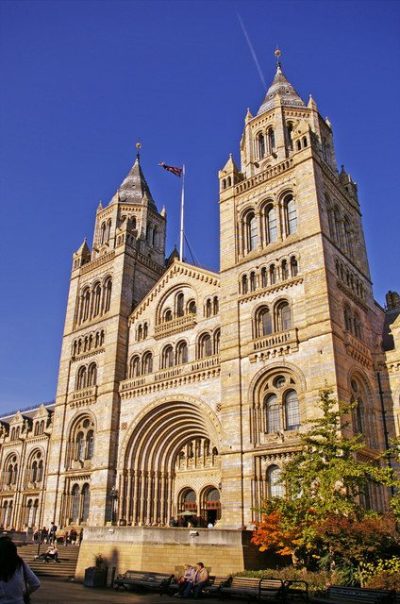 Big drawMuseumNatural History Museum15 km away · 1.6M visitors a year (2021)4
 Historic house · Historic Royal PalacesHampton Court Palace13 km away5
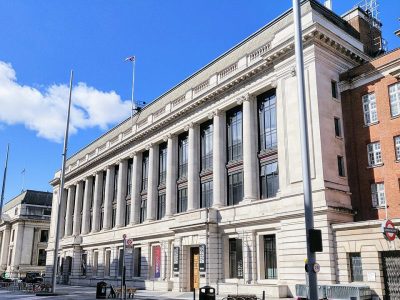 Big drawMuseumScience Museum15 km away · 3M visitors a year (2012)6
 CathedralWestminster Cathedral15 km away7
 Big drawArt galleryTate Britain14 km away · 525K visitors a year (2021)8
 Historic houseNonsuch Palace5.1 km away
Within 15 km, close and well known first. Numbers match the map.
Before visiting Carshalton Water Tower
Where is Carshalton Water Tower?
Carshalton Water Tower is in Sutton, London, inside the town’s built-up area.
What is Carshalton Water Tower?
Museum.
When is the best time to visit Carshalton Water Tower?
May to September are the warmest months in Sutton, with afternoon highs of 18–23°C (Met Office 1991–2020 averages).
What else is there to see near Carshalton Water Tower?
Within 15 km: Crystal Palace High Level Station Entry (8.9 km), Victoria and Albert Museum (15 km), Natural History Museum (15 km) and Hampton Court Palace (13 km).
Places: OpenStreetMap (© OpenStreetMap contributors, Open Database Licence) and Wikidata (CC0), placed in the ONS 2022 built-up area (Open Government Licence v3.0). Visitor counts are the latest Wikidata gives, with their year.
Photos: each place’s Wikidata image, from Wikimedia Commons under the licence below (our copy, resized).
Photo credits (8)
- Crystal Palace High Level Station Entry: Dickinson Brothers, Public domain, Wikimedia Commons
- Victoria and Albert Museum: Diliff, CC BY-SA 3.0, Wikimedia Commons
- Natural History Museum: Christine Matthews, CC BY-SA 2.0, Wikimedia Commons
- Hampton Court Palace: Ricardalovesmonuments, CC BY-SA 4.0, Wikimedia Commons
- Science Museum: Shadowssettle, CC BY-SA 4.0, Wikimedia Commons
- Westminster Cathedral: Frank Kovalchek, CC BY 2.0, Wikimedia Commons
- Tate Britain: Carlos Cunha, CC BY-SA 3.0, Wikimedia Commons
- Nonsuch Palace: Joris Hoefnagel, Public domain, Wikimedia Commons
Contains public sector information licensed under the Open Government Licence v3.0. Contains HM Land Registry data © Crown copyright and database right 2026. Contains OS data © Crown copyright and database right 2026 (ONS boundaries). Northern Ireland: Source: NISRA; contains Land & Property Services data and Ordnance Survey of Northern Ireland information, © Crown copyright, licensed under the Open Government Licence v3.0. Scotland: contains National Records of Scotland data, Registers of Scotland data and SEPA data, © Crown copyright / © SEPA 2025, licensed under the Open Government Licence v3.0.