Guest, Sign inJoin

Post to Plano

We’ll email a one-tap link to publish your post. No password, and nothing is public until you click it.
Already a member? Sign in
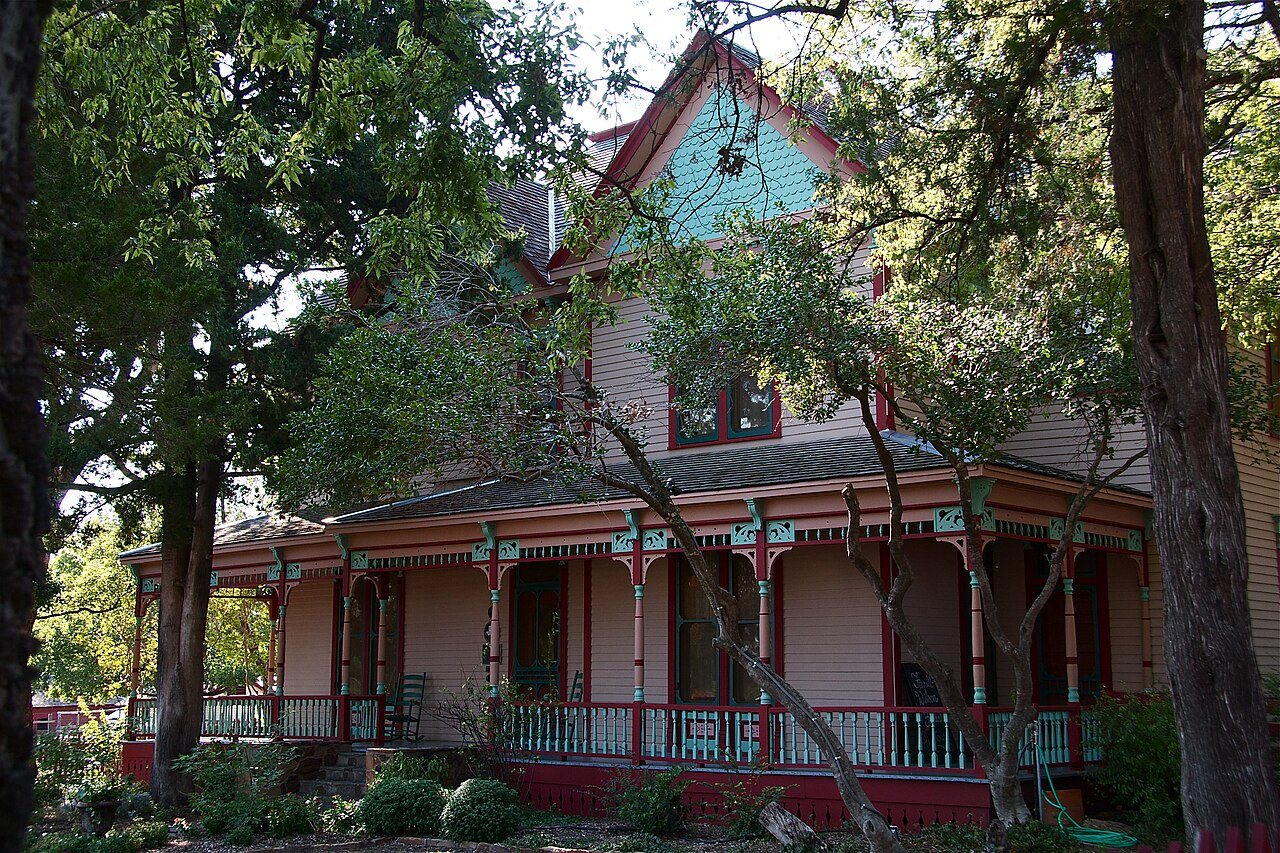
Ammie Wilson HouseAmmie Wilson House · Photo: Susan Bartley · CC BY-SA 3.0
A−Outdoors
Outdoors in Plano

10% of Plano’s land is conserved: 4,743 acres

94% of residents live within a half mile of a park. The biggest trail networks: Oak Point Park and Nature Preserve (6.9 mi), Arbor Hills Nature Preserve (6.6 mi), Bob Woodruff Park (North) (3.1 mi). 49 miles of mapped trail cross Plano, 0.7 per square mile of land.

Ahead of 83% of U.S. towns · #51 of 642 in Texas. What drives it

Conserved land
10%
4,743 acres · of 71.7 sq mi of land
Trails
49 mi
0.7 per sq mi of land
Park land
4,669 ac
16 acres per 1,000 residents
Near a park
94%
of residents within ½ mile
Bike routes
98 mi
1.9 mi lanes · 87 mi paths
Lakes & rivers
10

What kind of outdoors town is Plano?

Read from the map. The page puts what stands out first.

Outdoors grade

How much outdoors does Plano have?

On conserved land, trails, park land and how close residents live to a park, Plano is ahead of 83% of U.S. towns, #51 of 642 in Texas. All four inputs are above most U.S. towns; the share of residents near a park ranks highest, park acres per resident lowest.

A−
OutdoorsA character grade: shown, never part of Plano’s overall grade.
All U.S. towns we grade (21,298)Ahead of 83%
LessMore
Texas towns of 2,500+ (642)Ahead of 92%

Among the 400 U.S. cities of 100,000 or more, Plano ranks #158 on Outdoors.

Few Texas towns conserve much land (a typical one, 2%; the U.S., 4%), so Plano’s 10% is ahead of 90% of Texas towns, while its trails per square mile lead 80% of them.

How sure. Graded on any three of the four inputs instead, the letter would range from A− to A. Trails and many small parks come from OpenStreetMap, mapped by volunteers, so coverage varies from town to town; the half mile is a straight line from each census block, so a river or highway in the way isn’t counted against it.

PAD-US, OpenStreetMap (© OpenStreetMap contributors), Census 2025 Gazetteer and 2020 blocks; details in Sources below. How TownRatings grades the outdoors →

The map

Conserved land, trails & bike routes

Tap a number to zoom to a park. Tap a layer to hide it.

12345678
Easements protect land from building but are usually private.© OpenStreetMap contributors · USGS PAD-US
Places to walk

Pick a walk

The longest trail network is Oak Point Park and Nature Preserve, with 6.9 miles. Directions go to the nearest trailhead or public parking.

Oak Point Park and Nature Preserve

Park
830 acres6.9 mi of trail
Rowlett Creek TrailCaddo TrailWillow Springs TrailBobcat Run+1
Dog rules not recorded
Directionsto the parking lot

Arbor Hills Nature Preserve

Managed by City of Plano
208 acres6.6 mi of trail
Outer Loop TrailPrairie TrailRiparian Loop TrailOpen Field Trail+1
Dog rules not recorded
Directionsto the parking lotWebsite ↗

Bob Woodruff Park (North)

Managed by Plano Parks and Recreation
218 acres3.1 mi of trail
Dog rules not recorded
Directionsto the parking lotWebsite ↗

Willow Creek Park

Park
18 acres1 mi of trail
Willow Creek Trail
Dog rules not recorded
Directionsto the parking lot

Preston Meadow Park

Park
25 acres0.9 mi of trail
Dog rules not recorded
Directionsto the parking lot

Connemara Meadow Preserve

Managed by Connemara Conservancy
69 acres0.8 mi of trail
Dog rules not recorded
No trailhead mapped yetWebsite ↗

Bob Woodruff Park (South)

Park
122 acres0.6 mi of trail
Dogs allowed
Directionsto the parking lotWebsite ↗

Haggard Park

Park
11 acres0.6 mi of trail
Haggard Park Trail
Dog rules not recorded
Directionsto the parking lot
All 68 parks & preserves
Oak Point Park and Nature Preserve830 acres · 6.9 mi of trail
Directions
Arbor Hills Nature Preserve208 acres · 6.6 mi of trail · City of Plano
Directions
Bob Woodruff Park (North)218 acres · 3.1 mi of trail · Plano Parks and Recreation
Directions
Willow Creek Park18 acres · 1 mi of trail
Directions
Preston Meadow Park25 acres · 0.9 mi of trail
Directions
Connemara Meadow Preserve69 acres · 0.8 mi of trail · Connemara Conservancy
Bob Woodruff Park (South)122 acres · 0.6 mi of trail
Directions
Haggard Park11 acres · 0.6 mi of trail
Directions
Russell Creek Park186 acres · 0.5 mi of trail
Directions
Stoney Hollow Park92 acres · 0.5 mi of trail
Shawnee Park24 acres · 0.5 mi of trail
Directions
Enfield Park49 acres · 0.4 mi of trail
Directions
Old Shepard Place Park16 acres · 0.4 mi of trail
Directions
Liberty Park13 acres · 0.4 mi of trail
Directions
Caddo Park9 acres · 0.4 mi of trail · Plano Parks and Recreation
Directions
Jack Carter Park76 acres · 0.3 mi of trail
Directions
Coyote Creek Park17 acres · 0.3 mi of trail
Directions
Longhorn Park8 acres · 0.3 mi of trail
Directions
Hackberry Park6 acres · 0.3 mi of trail
Parkwood Green Park5 acres · 0.3 mi of trail · Plano Parks & Recreation
Directions
Archgate Park55 acres · 0.2 mi of trail
Directions
Eldorado Park6 acres · 0.2 mi of trail · City of Plano
Prairie Meadow Park6 acres · 0.2 mi of trail
Directions
Hoblitzelle Park138 acres · 0.1 mi of trail
Directions
Carpenter Park105 acres · 0.1 mi of trail
Directions
Schell Park24 acres · 0.1 mi of trail
Directions
Cheyenne Park24 acres · 0.1 mi of trail
Directions
Harrington Park15 acres · 0.1 mi of trail
Directions
Chisholm Trail14 acres · 0.1 mi of trail
Directions
Suncreek Park13 acres · 0.1 mi of trail
Launch Field10 acres · 0.1 mi of trail
Veterans Memorial Park9 acres · 0.1 mi of trail
Directions
Lone Star Park9 acres · 0.1 mi of trail
Horseshoe Park8 acres · 0.1 mi of trail
Directions
Big Lake Park4 acres · 0.1 mi of trail
Directions
Bishop Park3 acres · 0.1 mi of trail
Directions
Glen Meadows Park3 acres · 0.1 mi of trail
Directions
Baccus Plaza3 acres · 0.1 mi of trail
Directions
Windhaven Meadows Park139 acres · Plano Parks and Recreation Department
Directions
Heritage Yards at Plano64 acres
Directions
High Point Park55 acres
Directions
Cottonwood Creek Greenbelt48 acres
Bluebonnet Trail Park41 acres
Directions
Cottonwood Park16 acres · City of Plano
Sunset Park15 acres
Russell Creek Preserve12 acres
Directions
Hoblitzelle Park East11 acres
Tejas Park11 acres
Evans Park11 acres
Directions
W.H. "Buzz" Rasor Park11 acres
Directions
Frank Beverly Park10 acres
Directions
Overland Trail Park10 acres
Directions
Buckhorn Park9 acres · Plano Parks and Recreation
Directions
Capstone Park8 acres · City of Plano
Directions
Timber Brook Park8 acres
Blue Ridge Park7 acres · Plano Parks and Recreation
Clearview Park7 acres
Directions
Lieutenant Russell Steindam Park6 acres
Directions
Hidden Meadow Park6 acres
Arrowhead Park6 acres · Plano Parks and Recreation
Directions
Wagon Wheel Park6 acres
Patriot Park6 acres
Directions
Shoshoni Park4 acres
Westwood Park3 acres
Directions
Bonita Park3 acres
Rustic Park2 acres
Directions
Ruth Back Toler Park1 acres
Baccus Park1 acres
Directions
Who protects it

4,743 conserved acres

10% of Plano’s land. Who manages Plano’s conserved land, from the USGS Protected Areas Database. Approximate, because parcels can overlap.

Town or city9,828 ac
Land trusts & nonprofits143 ac
County107 ac
Regional agency15 ac
Private owners10 ac
Conservation Easement · 4,300 acLocal Park · 2,294 acLocal Recreation Area · 1,701 acLocal Conservation Area · 1,202 acRecreation or Education Easement · 587 ac
Good to know

Conserved doesn’t always mean open to visitors. 274 acres are conservation easements, usually private land. Public access isn’t recorded for 6 of 217 parcels. The walks above are places people visit.

The biggest protected parcels
Parcel (PAD-US)Managed byAcresPublic access
Oak Point Park & Nature Preserve
Local Conservation Area
Town or city920Open
Pecan Hollow Golf Course
Local Recreation Area
Town or city508Open
Ridgeview Ranch Golf Course
Local Recreation Area
Town or city409Open
Los Rios Golf Club
Local Recreation Area
Town or city388Open
Bob Woodruff Park
Local Recreation Area
Town or city326Open
The Courses At Watters Creek
Local Park
Town or city231Open
Arbor Hills Nature Preserve
Local Conservation Area
Town or city210Open
Russell Creek Park
Local Park
Town or city184Open
Legacy Trail
Local Park
Town or city150Open
Hoblitzelle Park
Local Park
Town or city137Open

5 smaller protected places aren’t shown.

Things to do

171 places to go in Plano

Beaches, playgrounds, peaks, falls and more. Pick a kind.

Dog parks in Plano
Bob Woodruff Dog ParkIn Bob Woodruff Park (South)
Directions
Gateway Village Apartment Dog Park
Directions
Jack Carter Dog ParkIn Jack Carter Park
Directions
Large Dog ParkIn Windhaven Meadows Park
Directions
Small Dog ParkIn Windhaven Meadows Park
Directions

Plus 5 dog parks without a name on the map. Tap “Show all on map” to see them.

Trails & water

25 named trails and 10 lakes & rivers

Named trails
Open to bikes · 9.0 miUnpaved · 13.3 mi
Outer Loop Trail1.6 mi
Rowlett Creek Trail1.5 mi
Willow Creek Trail1.4 mi
Caddo Trail0.8 mi
Chisholm Hike and Bike Trail0.6 mi
Willow Springs Trail0.5 mi
Stoney Hollow Park Trail0.5 mi
Hackberry Park Trail0.4 mi
Liberty Park Trail0.4 mi
Haggard Park Trail0.4 mi
15 more trails
Prairie Trail
0.4 mi
Riparian Loop Trail
0.4 mi
Prairie Meadow Trail
0.3 mi
Parkwood Green Park Trail
0.3 mi
Preston Ridge Trail
0.3 mi
Bobcat Run
0.3 mi
High Meadow Trail
0.3 mi
Open Field Trail
0.3 mi
Old Oaks Trail
0.3 mi
Arbor Hills Nature Preserve Trail
0.2 mi
Timber Chase
0.2 mi
Trestle Loop Trail
0.2 mi
Day Camp Trail North
0.2 mi
Blue-Eyed Trail
0.1 mi
Lake View Trail
0.1 mi
Lakes & rivers tap for directions
Biking & sports

98 miles of bike routes

Bike lanes are often missing from the map in smaller towns, so that number is likely low.

1.9 mi
painted or protected bike lanes
87 mi
off-road bike paths
9.5 mi
shoulders & shared lanes
Chisholm TrailBike route
0.7 mi
On-Street Route 30Bike route
0.3 mi
Courts & fields
201Tennis
73Soccer
64Baseball
50Basketball
45Football
24Pickleball
21Softball
9Beach volleyball

Includes school and college facilities, which aren’t always open to the public.

History along the way

3 places on the National Register

The country’s official list of places worth saving (National Park Service). The map also marks 23 historic points from OpenStreetMap: plaques, memorials and old buildings.

History →
Ammie Wilson HouseBuilding · listed 1978
About it
Saigling HouseBuilding · listed 2018
About it
Texas PoolStructure · listed 2019
About it
When to get out

April is the best month for walking in Plano

NOAA’s 1991–2020 normals for the town and the daylight at its latitude. Outlined months have long days, highs of 59 to 86 °F and little rain for the place.

JanFebMarAprMayJunJulAugSepOctNovDec
Daylight (h)10.211.011.913.013.814.314.113.412.311.310.410.0
High (°F)555967758290959588776657
Rain (in)2.63.03.83.64.93.82.22.43.14.93.13.3

July is the driest month (2.2 in) and August the warmest (highs of 95 °F). 4.9 inches fall in October, the wettest month. Summer highs reach 95 °F, too hot for the outline. The climate in Plano →

Next door

Plano and its neighbors

Tap a town to see its outdoors.

TownConserved
of land
Trail mi
per sq mi
Park acres
per 1,000
Near a park
½ mile
Outdoors
Plano10%0.71694%A−
Allen7%0.4999%B+
Parkerunder 1%0.1450%C−
Richardson8%0.71298%A−
Carrollton9%0.41693%A−
Frisco5%1.41198%A−
The Colony43%2.84797%A+
Dallas9%0.71588%A−

The four inputs of the Outdoors grade, from the engine; shares are of land, not water.

Questions about parks and trails in Plano

Where can I hike in Plano?

The longest trail networks: Oak Point Park and Nature Preserve, 6.9 miles; Arbor Hills Nature Preserve, 6.6 miles; Bob Woodruff Park (North), 3.1 miles; Willow Creek Park, 1 miles. Each one is on the map above, with directions to the nearest trailhead or parking.

How much of Plano is conserved land?

10% of its land, against a typical 2% for a Texas town and 4% nationally (PAD-US). Conserved doesn’t always mean open to visitors: easements are usually private land.

Are dogs allowed on Plano’s trails?

OpenStreetMap records dogs as welcome at Bob Woodruff Park (South). For the rest, check the signs at the trailhead.

Where can I bike in Plano?

98 miles of bike routes are on the map: 1.9 of painted or protected lanes, 87 of off-road paths and 9.5 of shoulders and shared lanes. Named routes: Chisholm Trail and On-Street Route 30.

Is there public land near Plano?

42,218 acres of parks and open public land lie inside Plano or within 10 miles of it (PAD-US), 4,932 of them inside the city line.

How much outdoors does Plano have?

Ahead of 83% of U.S. towns on the Outdoors grade, #51 of 642 in Texas. The grade combines the share of land that is conserved, miles of mapped trail per square mile of land, park acres per 1,000 residents and the share of residents within a half mile of a park. It’s a character grade, so it isn’t part of the overall grade. How it works.

Trail talk

Conditions, parking and favorite walks from Plano neighbors.

Town Square →
Share a tip
Sources

Where this page comes from

Conserved and public land: USGS Protected Areas Database of the United States (PAD-US), service updated July 2026. Parks, trails, playgrounds, beaches and other places: OpenStreetMap (© OpenStreetMap contributors, ODbL), map data as of 2026-10-28. Land and water area: Census 2025 Gazetteer. Residents near a park: 2020 Census blocks. National Register: National Park Service. How TownRatings grades the outdoors →