152 years in pictures
Census counts: 135 in 1890, 150,108 in 2020. The archive holds 12 old photos and papers going back to 2005 and 4 maps from 1959 on.
1 place on the National Register of Historic Places.
- 1874Mesquite is settled
Each edition grades its towns against each other only.

Mesquite earns a D, 533rd among Texas's 640 graded towns, mostly because of safety. Its crime rate is higher than 90% of U.S. towns, with 680 violent crimes reported to the FBI in 2025. What it does well: it has 20 miles of trail. Mesquite's civic life (library use, community groups, volunteering) trails 98% of U.S. towns. Mesquite’s violent crime rate is 4.5 per 1,000 residents, above both Texas’ towns (1.9) and U.S. towns (1.6). Stephen Decatur Lawrence Farmstead is on the National Register of Historic Places.
Where Mesquite beats most towns, and one thing worth knowing.
Tara Davis-Woodhall
Stephen Decatur Lawrence FarmsteadEach subject compared with towns across the country (schools within Texas), ordered by how far Mesquite is from typical.
How TownRatings grades towns →
Census counts: 135 in 1890, 150,108 in 2020. The archive holds 12 old photos and papers going back to 2005 and 4 maps from 1959 on.
1 place on the National Register of Historic Places.
Museums, parks, gardens and other places to visit around Mesquite. Close and well known come first.
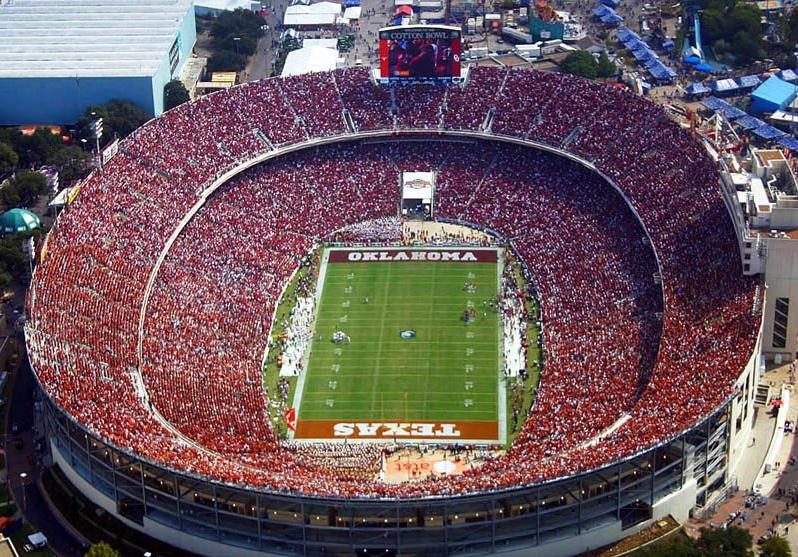
Big draw10 mi Stadium & arenaCotton Bowl
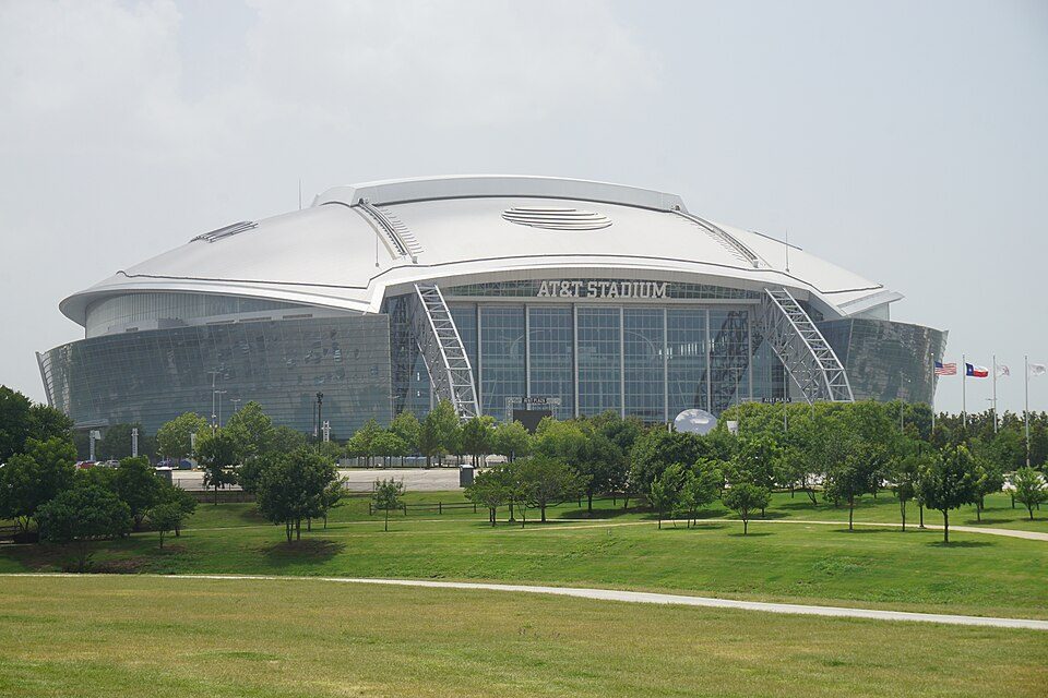
Big draw30 mi Stadium & arenaAT&T Stadium
Big draw20 mi Stadium & arenaTexas Stadium
Big draw29 mi Stadium & arenaGlobe Life Field
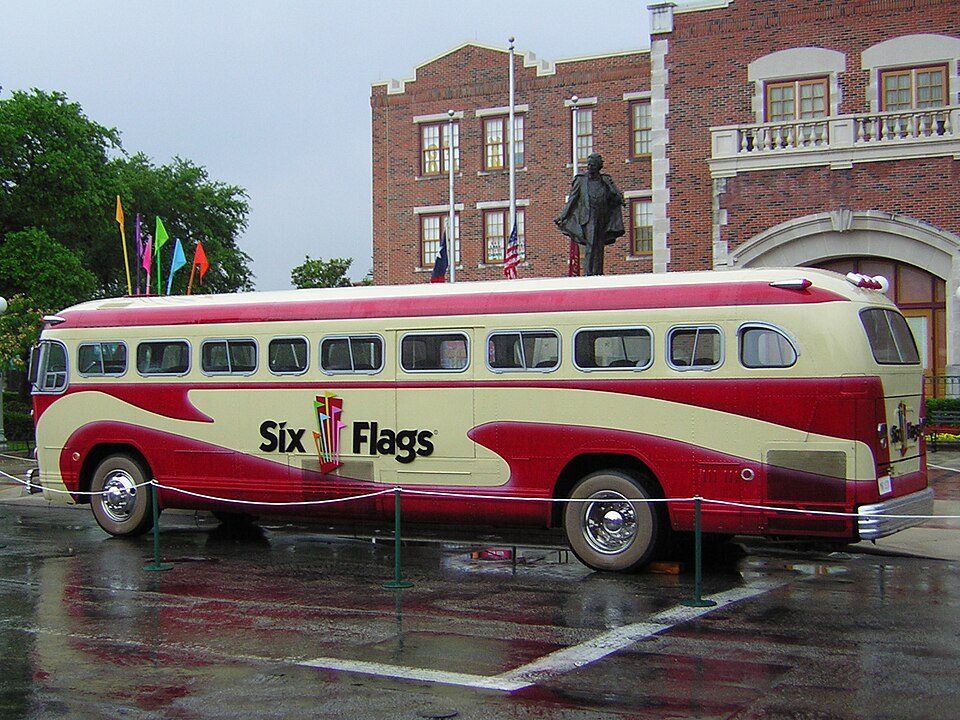
28 mi Theme parkSix Flags Over Texas
13 mi Stadium & arenaGerald J. Ford StadiumCotton Bowl: Robbiewest88, Public domain · AT&T Stadium: Michael Barera, CC BY-SA 4.0 · Texas Stadium: Allspamme, CC BY-SA 4.0 · Globe Life Field: Drone To Fly, CC BY 3.0 · Six Flags Over Texas: Chris Hagerman from New Port Richey, FL, US, CC BY 2.0 · Gerald J. Ford Stadium: Jmcstrav, CC BY-SA 3.0
Who provides power, water and the rest in Mesquite, and how to reach them.
EPA SDWIS (Oct 9, 2026) · HIFLD + EIA-861 2025 · Census 2020 ZCTAs · NCES 2024–25 · registration: vote.gov, updated Nov 18, 2024.
Ordered by what stands out in Mesquite.
Mesquite has more 90° days than nearly all U.S. towns and has homes that are cheap against local pay, but it has a long record of flood insurance claims.
Reported crimes fell from 6,180 to 3,976 over the last three FBI years, a drop beyond ordinary year-to-year swings.
The property crime rate in Mesquite is 21.9 per 1,000 residents. Mesquite reports more crime per resident than most U.S. towns we grade: about 90% report less.
FBI crime data, 2025 · crimes reported to police
Its public schools are run by Mesquite ISD. Three of its 53 schools are below, each with why it’s listed.
| School | Level | Students | Letter |
|---|---|---|---|
| Kimbrough MiddleLargest public middle schoolGrades 6–8 | Grades 6–8 | 1,115 | B |
| Horn H SLargest public high schoolGrades 9–12 | Grades 9–12 | 2,757 | B |
| Poteet H STop results in townGrades 9–12 | Grades 9–12 | 1,523 | A− |
NCES · EDFacts · graded within TX on state tests and graduation
The biggest park or preserve is Valley Creek Park, at 82 acres.
| Mesquite | Texas towns | U.S. towns | |
|---|---|---|---|
| Conserved land | 6% | 1.9% | 4.3% |
| Miles of trail per square mile | 0.4 miles per square mile | 0.3 | 0.4 |
| Biggest places to walk | Trails | Acres |
|---|---|---|
| 1. Vanston Park | 0.9 mi | 19 |
| 2. Paschall Park | 0.5 mi | 51 |
| 3. Florence Park | 0.5 mi | 10 |
Trails & parks © OpenStreetMap contributors · Conserved land: USGS PAD-US
Mesquite beats the Texas average on 1 of 31 CDC measures and trails it on 10. 23% of Mesquite adults 18 to 64 have no health insurance.
| Mesquite | Texas towns | U.S. towns | |
|---|---|---|---|
| No health insurance, 18–64 (CDC PLACES) | 23% | 18% | 8.1% |
| Food insecurity (CDC PLACES) | 25% | 20% | 14% |
| Get no exercise (CDC PLACES) | 33% | 30% | 25% |
| Fair or poor health (CDC PLACES) | 25% | 24% | 19% |
| What stands out | Mesquite | TX |
|---|---|---|
| Fewer adults who have had cancer | 5.3% | 6.1% |
| More adults facing a utility shut-off | 14.2% | 10.7% |
CDC PLACES 2025 · modeled estimates for adults · CMS · HRSA
The Dallas Love Fld weather station, 17 miles away, records that about 108 days a year reach 90°, more than in 96% of U.S. towns. July afternoons average 95.1°, hotter than in 96% of U.S. towns; January nights average 36°.
Mesquite has mild winters and hot summers. Mesquite’s July high is 95°F. About 2 inches of snow falls in a winter.
| Mesquite | Texas towns | U.S. towns | |
|---|---|---|---|
| July high | 95°F | 95°F | 85°F |
| January low | 36°F | 37°F | 22°F |
NOAA U.S. Climate Normals, 1991–2020
Most working residents leave Mesquite for work: only 12% work in town. Since 2013, Mesquite has added 4,277 jobs, to 46,085 in 2023. The top destinations are Dallas (35%), Garland (5%) and Richardson (4%).
| Mesquite | Texas towns | U.S. towns | |
|---|---|---|---|
| Average trip to work | 32 minutes | 25 minutes | 25 minutes |
| Below the poverty line | 13% | 12% | 9.6% |
| Working residents who work in town | 12% | 8.3% | 8% |
Census LEHD 2023 · ACS
At 2.8 years of the Dallas metro’s $90K median household income, the typical home (about $257K) costs less against local pay than in 75% of Texas towns; that ratio is one input to its C for cost of living. The typical value, about $257K, is 10% below its September 2022 peak.
The typical Mesquite home is worth about $257,000, down 2.1% in a year, 13% below the Texas typical home. 61% of renter households spend 30% or more of their income on rent in Mesquite.
| Mesquite | Texas towns | U.S. towns | |
|---|---|---|---|
| Renters paying 30%+ of income on rent | 61% | 50% | 48% |
| Median rent | $1,513 a month | $1,206 a month | $1,185 a month |
| Households that own their home | 63% | 69% | 73% |
Census ACS, 2020–24 · Zillow Home Value Index · Redfin Data Center
98 flood insurance claims have been filed here, and 13 properties have flooded more than once.
Expected storm and flood damage is higher than in 50% of U.S. communities. Since 1979, 98 flood insurance claims have been paid out in Mesquite.
FEMA flood insurance claims · FEMA National Risk Index · OpenFEMA
11 within 15 miles of the center of Mesquite
About 5 of every 100 Mesquite residents are enrolled in college, about the same as Texas.
25 notable people were born in Mesquite.
6 towns share a border with Mesquite.
| Town | TX rank | Overall | Cost | Safety | Schools | Health |
|---|---|---|---|---|---|---|
| Mesquite | #533 | D | C | D | C+ | C |
| Dallas | #567 | D | C− | D | C− | C+ |
| Balch Springs | #517 | D | C+ | D | C− | C |
| Garland | #379 | C− | C− | C | B− | C+ |
| Sunnyvale | #72 | B+ | C− | B | A | A |
| Seagoville | #487 | D | C+ | B− | C− | D |
| Heartland | #488 | D | D− | — | C+ | C+ |
Heartland reports no FBI crime data of its own. Compare Mesquite with a neighbor →
Short answers, built from the data on this page.
Mesquite grades D overall, better than 8% of U.S. towns and #533 of 640 in Texas. It grades C for health, D for safety and C+ for schools. Safety is its weak spot, with a D.
That is 2.8 years of the area's median household income ($90,275 across the Dallas-Fort Worth-Arlington, TX metro area).
25 notable people were born here, including Tara Davis-Woodhall and Alyssa Edwards.