
Book · Wikimedia Commons
2010 Census Urban Cluster Reference Map for
2010from the source
Department of Commerce. Bureau of the Census. Office of the Associate Director for Decennial Census. Geography Division. (1/1987 - 7/15/2011) · Wikimedia Commons · Public domain
What neighbors know
Know something about this?
Lived nearby, know who’s pictured, or remember what it used to be? Add it here.
A memory or a clue…Sign in to add a memory
No memories yet. Know what stands here today, who is pictured, or when it was taken? Be the first.
Same decade
The whole archive →Winchester in the 2010s
 2015DowntownWinchester-US64w-US41An-TN50e2w
 2015Estill-Fite-House-tn1
 2015TN50w-US64-US41AsignsDowntownWinchester
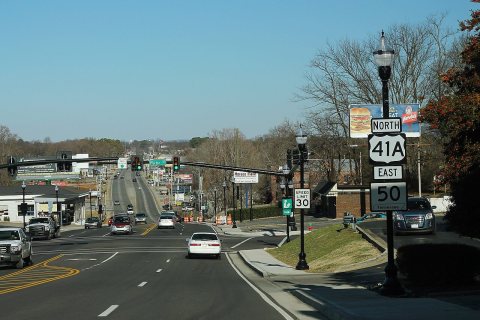 2015US41An TN50e Road Signs
 2015US41AnRoadSign-Winchester
 2015US41AroadAfterSunrise-Winchester
 2015US64BusUS41AnSignsRoad-WinchesterTN
 2016Bank-of-Winchester-building-tn1
 2016Elk-River-Winchester-tn1
 2016Tims-Ford-Lake-Winchester-shore-tn1
 2016Tims-Ford-Lake-Winchester-sunset-tn1
 2016Tims-Ford-SR130-tn1
Archive images are copied here with their credits and licenses. The original at Wikimedia Commons.