132 years in pictures
Census counts: 1,089 in 1900, 17,416 in 2020. The archive holds 12 old photos and papers going back to 1951 and 2 maps from 1972 on.
5 places on the National Register of Historic Places.
- 1894West Columbia is incorporated
Each edition grades its towns against each other only.

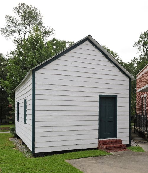
West Columbia grades D overall, 131st among South Carolina's 167 graded towns, mostly because of safety. Its police reported 101 violent crimes reported to the FBI in 2025, a higher rate per resident than 96% of U.S. towns. One bright spot: it is easier to get around on foot or by transit than 73% of U.S. towns. West Columbia’s property crime rate is 39.9 per 1,000 residents, above both the South Carolina town median (21.1) and the median of U.S. towns (9.9). On civic life, just 12 of South Carolina’s 152 towns do better. West Columbia has 5 places on the National Register of Historic Places, among them New Brookland Historic District and Mount Hebron Temperance Hall.
Where West Columbia beats most towns, and one thing worth knowing.
14,988 counted in 2010 and 17,416 in 2020; an estimated 18,489 in 2025.
Growth hasn’t slowed: 5.9% since 2020, after 16.2% in the decade before.
U.S. Census 2010 & 2020 counts · Census Bureau estimate, July 1, 2025
Each subject compared with towns across the country (schools within South Carolina), ordered by how far West Columbia is from typical.
How TownRatings grades towns →
Census counts: 1,089 in 1900, 17,416 in 2020. The archive holds 12 old photos and papers going back to 1951 and 2 maps from 1972 on.
5 places on the National Register of Historic Places.
Who provides power, water and the rest in West Columbia, and how to reach them.
EPA SDWIS (Oct 9, 2026) · HIFLD + EIA-861 2025 · Census 2020 ZCTAs · NCES 2024–25 · registration: vote.gov, updated Sep 12, 2025.
Ordered by what stands out in West Columbia.
West Columbia draws workers from Columbia and beyond and is healthier than towns with similar incomes, but it reports more crime than Columbia and its other graded neighbors.
Each of the 4 graded towns on its borders reports less crime per resident, from Columbia (D) to Lexington (B). Property crime runs at 39.9 per 1,000 residents, about twice the South Carolina rate, most of it theft.
The violent crime rate in West Columbia is 5.4 per 1,000 residents. West Columbia reports more crime per resident than most U.S. towns we grade: about 96% report less. Within South Carolina, it does better than 30% of towns.
FBI crime data, 2025 · crimes reported to police
Two of its 8 schools are below, each with why it’s listed. The largest public high school is South Carolina Virtual Charter School, with 2,180 students.
| School | Level | Students | Letter |
|---|---|---|---|
| Riverbank ElementaryLargest public elementary schoolGrades PK–5 | Grades PK–5 | 996 | C+ |
| Grace Christian School PrivateLargest high schoolGrades PK–12 | Grades PK–12 | 245 | – |
NCES · EDFacts · graded within SC on state tests and graduation
13,527 jobs are based in West Columbia, 1.9 for every working resident, so most of the people who work here commute in. The average commute takes 19.5 minutes, against 25.6 across South Carolina.
Most working residents leave West Columbia for work: only 7% work in town. West Columbia’s average trip to work is 20 minutes. Jobs based in West Columbia grew to 13,527 in 2023, 1,222 more than in 2013.
| West Columbia | South Carolina towns | U.S. towns | |
|---|---|---|---|
| Average trip to work | 20 minutes | 24 minutes | 25 minutes |
| Below the poverty line | 14% | 17% | 9.6% |
| Median household income | $57,000 | $57,000 | $80,000 |
| Work from home | 9.8% | 8.6% | 11% |
Census LEHD 2023 · ACS
The typical West Columbia home is worth about $228,000, up 2.9% in a year, 25% below the South Carolina typical home. 55% of households own their home in West Columbia.
| West Columbia | South Carolina towns | U.S. towns | |
|---|---|---|---|
| Households that own their home | 55% | 65% | 73% |
| Median rent | $1,201 a month | $1,058 a month | $1,185 a month |
Census ACS, 2020–24 · Zillow Home Value Index · Redfin Data Center
West Columbia has mild winters and hot summers. Only 8 of the 169 South Carolina towns we compare have a higher July high than West Columbia.
NOAA U.S. Climate Normals, 1991–2020
Adults 18 to 34 are 28% of residents (22% statewide); children under 18 are 17% of residents (22% statewide). 41% of West Columbia adults 25 and older hold a bachelor’s degree or more. West Columbia has grown 5.9% since 2020, to 18,489 residents in the Census Bureau’s 2025 estimate.
| West Columbia | South Carolina towns | U.S. towns | |
|---|---|---|---|
| Under 18 | 17% | 22% | 22% |
| Bachelor’s degree or more, 25+ | 41% | 23% | 29% |
| Aged 65 or older | 22% | 17% | 18% |
| Median age | 38.6 years | 38.9 years | 40.5 years |
55% women, 45% men
About 82 men for every 100 women (the survey’s margin: ±2.3 points). Across South Carolina, 51.3% of residents are women. Among residents 65 to 74, 57% are men (SC 46%).
| West Columbia | SC | U.S. | |
|---|---|---|---|
| Under 10 | 10.6% | 11.4% | 11.6% |
| 10 to 17 | 6.5% | 10.1% | 10.3% |
| 18 to 24 | 10.8% | 9.1% | 9.1% |
| 25 to 34 | 16.9% | 12.8% | 13.7% |
| 35 to 44 | 12.7% | 12.5% | 13.2% |
| 45 to 54 | 9.5% | 12% | 12.2% |
| 55 to 64 | 11.3% | 13.2% | 12.7% |
| 65 to 74 | 10.7% | 11.4% | 10.2% |
| 75 and older | 11.2% | 7.4% | 7% |
| No diploma | 9.5% | 9.9% | 10.4% |
| High school | 23.1% | 28.2% | 26% |
| Some college | 16.5% | 19.8% | 19.1% |
| Associate’s | 9.9% | 10% | 8.8% |
| Bachelor’s | 24.9% | 19.8% | 21.6% |
| Graduate | 16% | 12.3% | 14.1% |
Census population estimates, 2025 · U.S. Census Bureau · ACS 2020-2024 5-year estimates
1.7 miles of trail in 6 parks and preserves.
| West Columbia | South Carolina towns | U.S. towns | |
|---|---|---|---|
| Conserved land | 1.1% | 1.8% | 4.3% |
| Miles of trail per square mile | 0.2 miles per square mile | 0.3 | 0.4 |
| Biggest places to walk | Trails | Acres |
|---|---|---|
| 1. 3 Rivers Greenway | — | 12 |
| 2. Rosamounda Percell-Butler Park | — | 5 |
| 3. B Avenue Park | — | 4 |
Trails & parks © OpenStreetMap contributors · Conserved land: USGS PAD-US
Expected storm and flood damage is lower than in 53% of U.S. communities. Since 2013, 10 flood insurance claims have been paid out in West Columbia.
FEMA flood insurance claims · FEMA National Risk Index · OpenFEMA
Against the 7,994 U.S. towns with household incomes like West Columbia’s, it is healthier than 78%, so its B− isn’t only a matter of income.
West Columbia tracks South Carolina closely on all 32 CDC measures.
| West Columbia | South Carolina towns | U.S. towns | |
|---|---|---|---|
| Feel lonely (CDC PLACES) | 30% | 33% | 33% |
| Yearly checkup (CDC PLACES) | 82% | 80% | 79% |
| Binge drink (CDC PLACES) | 14% | 15% | 16% |
| Diabetes (CDC PLACES) | 13% | 15% | 12% |
CDC PLACES 2025 · modeled estimates for adults · CMS · HRSA
Museums, parks, gardens and other places to visit around West Columbia. Close and well known come first.
5 mi Stadium & arenaWilliams-Brice Stadium
17 mi National ParkCongaree National Park288K visitors a year10 mi LakeAlcohol and Drug Abuse Lake
14 mi LakeLake Murray
4 mi Stadium & arenaColonial Life Arena
2 mi Zoo & aquariumRiverbanks ZooWilliams-Brice Stadium: SRA MARVIN PRESTON, Public domain · Congaree National Park: Unknown, Public domain · Lake Murray: Greygh0st at English Wikipedia, Public domain · Colonial Life Arena: Dfscgt21, CC BY-SA 3.0 · Riverbanks Zoo: Carlo Giovannetti (Thief12), CC BY-SA 3.0
7 within 15 miles of the center of West Columbia
About 9 of every 100 West Columbia residents are enrolled in college, against 6 across South Carolina.
Where West Columbia’s working residents go each day. Line width shows the share.
Census LEHD 2023
5 places in West Columbia on the National Register of Historic Places.
3 notable people were born in West Columbia.
City in South Carolina, US
West Columbia, formerly Brookland, is a city and commuter town in the suburban eastern sections of Lexington County, South Carolina, United States. As of the 2020 census, West Columbia had a population of 17,416. West Columbia is bordered to the east by Columbia, the state capital, across the Congaree River. It is near Columbia's city center or downtown district as well as the South Carolina State House and the Congaree Vista, known locally as "the Vista". The city is bordered to the south by its sister suburb, Cayce. A small portion of the city borders the town of Lexington to the east. West Columbia is part of the greater Columbia, South Carolina metropolitan area.
From Wikipedia, licensed CC BY-SA 4.0 · facts via Wikidata (CC0)
6 towns share a border with West Columbia.
All 6 graded towns on its borders grade higher than its D; Cayce (D) is closest.
| Town | SC rank | Overall | Cost | Safety | Schools | Health |
|---|---|---|---|---|---|---|
| West Columbia | #131 | D | B− | D− | C | B− |
| Oak Grove | #18 | A− | A− | — | B+ | B |
| Columbia | #124 | C− | C | D | B | B− |
| Springdale | #125 | C− | B− | D | C | C |
| Cayce | #130 | D | B | D | C | B− |
| Lexington | #16 | A− | C | B | A− | A− |
| Seven Oaks | #33 | B | B− | — | A− | B |
Oak Grove and Seven Oaks report no FBI crime data of their own. Compare West Columbia with a neighbor →
Short answers, built from the data on this page.
West Columbia grades D overall, better than 14% of U.S. towns and #131 of 167 in South Carolina. It grades B− for health, D− for safety and C for schools. Safety is its weak spot, with a D−.
Within South Carolina, it does better than 30% of towns.
That is 3.3 years of the area's median household income ($68,359 across the Columbia, SC metro area). Cost of living, which also weighs rents, property taxes and how many households pay 30% or more of their income for housing, grades B−.
3 notable people were born here, including Dakota Dozier and Jake Knotts.