
Burnettown, 2007
Burnettown’s story
Burnettown in pictures
Census counts: 578 in 1950, a low of 359 in 1980, 3,105 in 2020. The archive holds 1 old photo or paper going back to 2007 and 5 maps from 1923 on.
Explore the history →Each edition grades its towns against each other only.

A town of 3,267.
Burnettown gives you more for your money than most places: homes are within reach, about $238K for a typical one, or 3.4 years of the Augusta metro’s $69K median household income. It grades C+ overall, 67th of 167 graded towns in South Carolina. The low prices come with trade-offs. Residents are less healthy than 86% of U.S. towns on CDC estimates, and the median household income is $50K, and 20% of residents live below the poverty line. On the plus side, 8% of its land is conserved. Only 4 of South Carolina’s 107 towns score higher on safety. Most errands need a car: it is less walkable than 87% of U.S. towns. Burnettown's civic life (library use, community groups, volunteering) trails 96% of U.S. towns.
Where Burnettown beats most towns.
2,673 counted in 2010 and 3,105 in 2020; an estimated 3,267 in 2025.
Growth hasn’t slowed: 6.7% since 2020, after 16.2% in the decade before.
U.S. Census 2010 & 2020 counts · Census Bureau estimate, July 1, 2025
Each subject compared with towns across the country (schools within South Carolina), ordered by how far Burnettown is from typical.
How TownRatings grades towns →
Census counts: 578 in 1950, a low of 359 in 1980, 3,105 in 2020. The archive holds 1 old photo or paper going back to 2007 and 5 maps from 1923 on.
Explore the history →Who provides power, water and the rest in Burnettown, and how to reach them.
EPA SDWIS (Oct 9, 2026) · HIFLD + EIA-861 2025 · Census 2020 ZCTAs · NCES 2024–25 · registration: vote.gov, updated Sep 12, 2025.
Ordered by what stands out in Burnettown.
Burnettown fares better on crime within South Carolina than nationally, is healthier than towns with similar incomes and sends most of its workers to Augusta and beyond.
The biggest place to walk is Langley Pond Park, 149 acres with 3.9 miles of trail. In 2 parks and preserves, walkers have 4.3 miles of trail. Burnettown’s concentration of trails stands at 0.7 miles per square mile, where South Carolina’s towns sit at 0.3 and U.S. towns at 0.4.
| Biggest places to walk | Trails | Acres |
|---|---|---|
| 1. Langley Pond Park | 3.9 mi | 149 |
| 2. Fun Valley Sassafras Park | — | 2 |
Trails & parks © OpenStreetMap contributors · Conserved land: USGS PAD-US
The public schools here belong to the Aiken 01 school district. The largest public high school is Midland Valley High, with 1,558 students. Two of its 5 schools are below, each with the reason it’s listed.
| School | Level | Students | Letter |
|---|---|---|---|
| Jefferson ElementaryLargest public elementary schoolGrades PK–5 | Grades PK–5 | 572 | C+ |
| Midland Valley HighLargest public high schoolGrades 9–12 | Grades 9–12 | 1,558 | A− |
NCES · EDFacts · graded within SC on state tests and graduation
Against the 5,917 U.S. towns with household incomes like Burnettown’s, it is less healthy than 65%, so that grade isn’t only a matter of income.
18% of adults in Burnettown smoke cigarettes; 26% say their health is fair or poor. Among adults 18 to 64 in the town, 15% have no health insurance, above both South Carolina’s towns (13%) and U.S. towns (8.1%). The share of adults in Burnettown who report frequent physical distress: 17%.
| Burnettown | South Carolina towns | U.S. towns | |
|---|---|---|---|
| Frequent physical distress (CDC PLACES) | 17% | 15% | 14% |
| Smoke cigarettes (CDC PLACES) | 18% | 15% | 14% |
| Fair or poor health (CDC PLACES) | 26% | 22% | 19% |
| Diabetes (CDC PLACES) | 16% | 15% | 12% |
| What stands out | Burnettown | SC |
|---|---|---|
| More older adults who have lost all their teeth | 21.2% | 13.9% |
| More smokers | 18.3% | 13.3% |
| More adults with COPD | 10.1% | 7.5% |
CDC PLACES 2025 · modeled estimates for adults · CMS · HRSA
Burnettown has 228 jobs for its 1,231 working residents: even if every job went to a resident, most would still commute out.
Among working residents in Burnettown, 0.8% work locally. Employers in Burnettown added 48 jobs between 2013 and 2023, to 228. The top destinations are Augusta (19%), Aiken (12%) and North Augusta (6%). Its average commute stands at 22 minutes.
| Burnettown | South Carolina towns | U.S. towns | |
|---|---|---|---|
| Working residents who work in town | 0.8% | 6.3% | 8% |
| Median household income | $50,000 | $57,000 | $80,000 |
| Average trip to work | 22 minutes | 24 minutes | 25 minutes |
Census LEHD 2023 · ACS
At 11.3 crimes per 1,000 residents a year, it reports less crime than 98% of South Carolina’s graded towns. Reported crimes fell from 46 to 23 over the last three FBI years, a drop beyond ordinary year-to-year swings.
Only 5 of the 90 South Carolina towns we compare have a lower rate of thefts and burglaries than Burnettown. The town reports less crime per resident than 70% of the U.S. towns and cities we grade.
| Burnettown | South Carolina towns | U.S. towns | |
|---|---|---|---|
| Violent crimes per 1,000 (2025) | 0.3 per 1,000 residents | 4.3 | 1.6 |
| Property crimes per 1,000 (2025) | 6.7 per 1,000 residents | 21.7 | 9.9 |
FBI crime data, 2025 · crimes reported to police
At about $238K, home values are down 5% in five years, against a rise of 24% across South Carolina.
In Burnettown, just over four in five households live in a home they own. The typical home value in the town is about $238,000, up 1.8% in a year, 22% below the South Carolina typical home. A home in Burnettown typically sold within 147 days of listing.
| Burnettown | South Carolina towns | U.S. towns | |
|---|---|---|---|
| Households that own their home | 81% | 65% | 73% |
| Median rent | $932 a month | $1,062 a month | $1,185 a month |
Zillow Home Value Index · Redfin Data Center
NOAA U.S. Climate Normals, 1991–2020
Households in Burnettown have drawn federal disaster aid once, in 2024. On expected storm and flood damage, Burnettown sits below two thirds of U.S. communities. Of the losses FEMA expects here, 55% come from inland flooding and 12% from hurricanes.
FEMA disaster declarations and aid · FEMA National Risk Index · OpenFEMA
Museums, parks, gardens and other places to visit around Burnettown. Close and well known come first.
 17 mi LandmarkFort Gordon
 7 mi Stadium & arenaJames Brown Arena
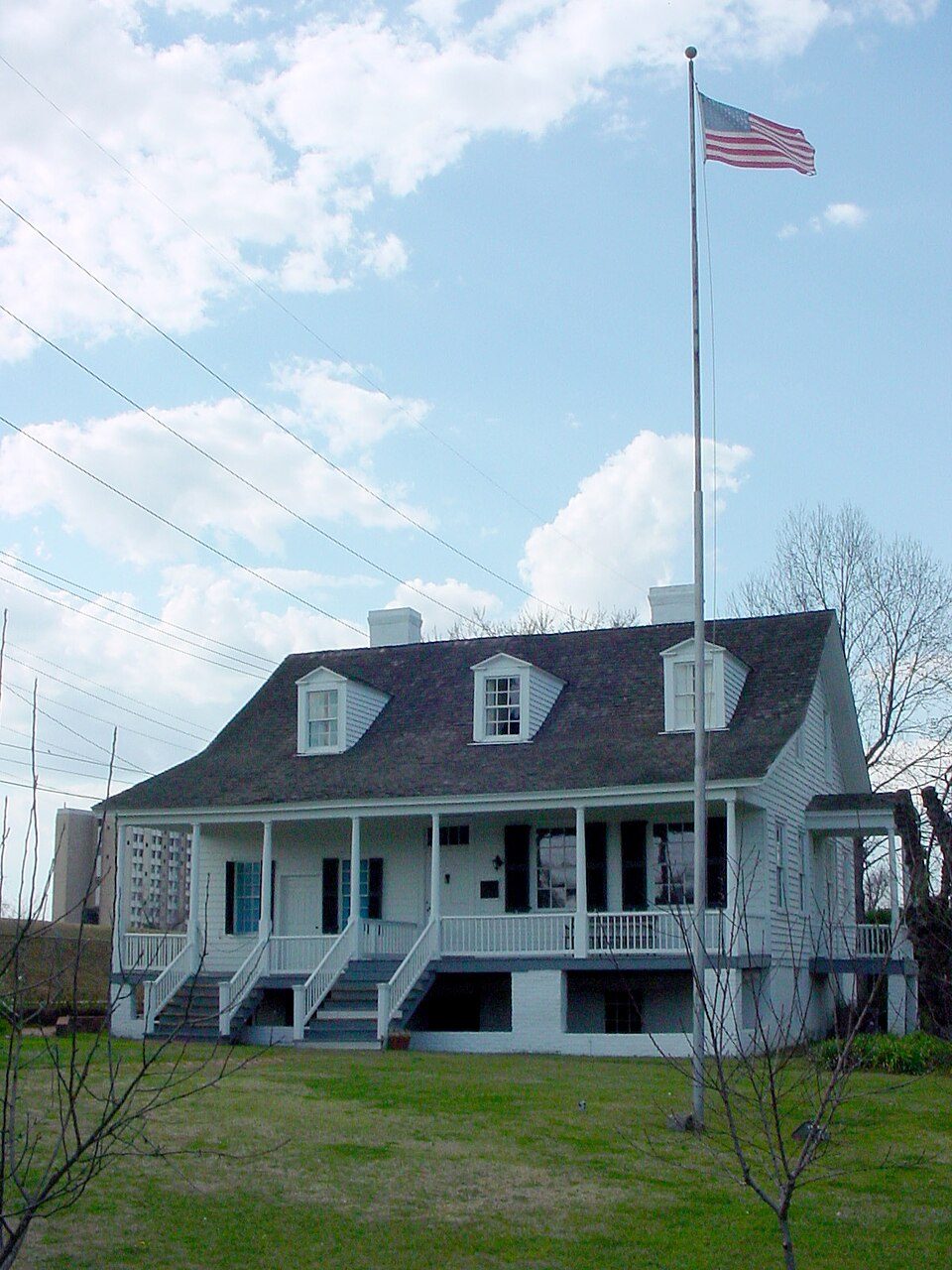 7 mi MuseumMeadow Garden
 7 mi MuseumMorris Museum of Art120K visitors a year7 mi MuseumBeech Island Historical Society
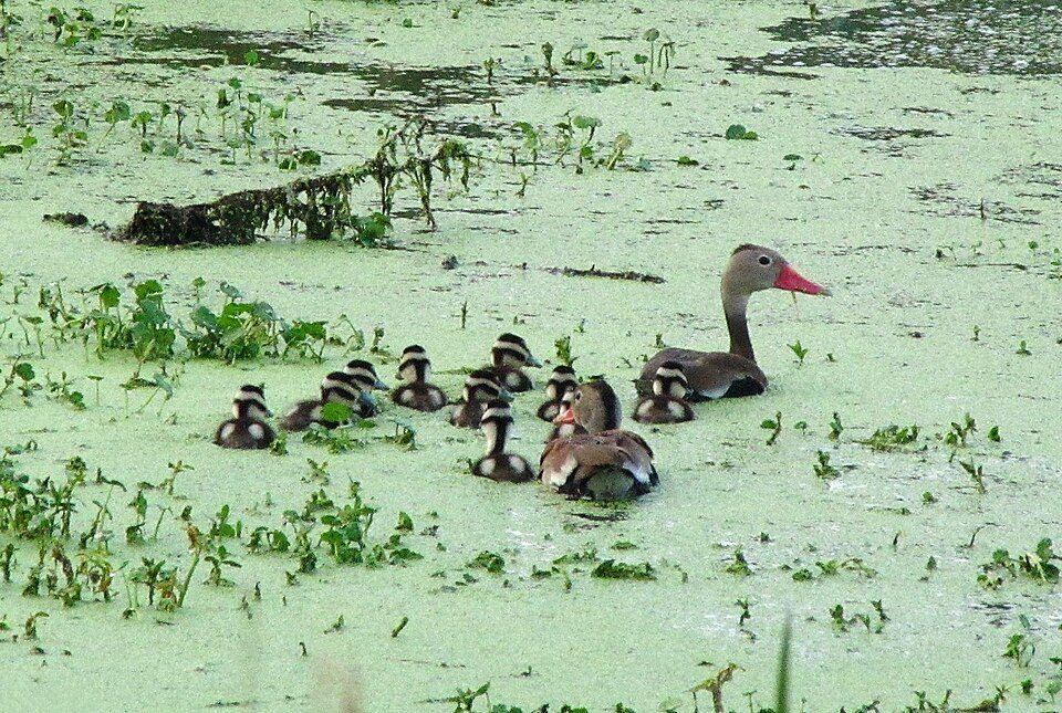 7 mi GardenAugusta Botanical Gardens
Fort Gordon: U.S. Army Cyber Command, Public domain · James Brown Arena: Thomson200, CC0 · Meadow Garden: Flickr user Sir Mildred Pierce, CC BY 2.0 · Morris Museum of Art: Thomson200, CC0 · Augusta Botanical Gardens: Liam Wolff (Ospr3yy at en.wikipedia), FAL
6 within 15 miles of the center of Burnettown
About 6 of every 100 Burnettown residents are enrolled in college, about the same as South Carolina.
Where Burnettown’s working residents go each day. Line width shows the share.
Census LEHD 2023
Town in South Carolina, United States
Burnettown is a town in Aiken County, South Carolina, United States. The population was 3,105 at the 2020 census. It is part of the Augusta, Georgia metropolitan area. Burnettown is located in historic Horse Creek Valley.
From Wikipedia, licensed CC BY-SA 4.0 · facts via Wikidata (CC0)
3 towns share a border with Burnettown.
| Town | SC rank | Overall | Cost | Safety | Schools | Health |
|---|---|---|---|---|---|---|
| Burnettown | #67 | C+ | A− | B+ | B | D |
| Clearwater | #68 | C+ | A | — | B | D |
| Langley | — | — | A+ | — | B | D |
| North Augusta | #14 | A− | B | — | B | B+ |
Langley has fewer than 2,500 residents, so it gets subject grades but no overall grade. Clearwater, Langley and North Augusta report no FBI crime data of their own. Compare Burnettown with a neighbor →
Short answers, built from the data on this page.
Burnettown grades C+ overall, better than 45% of U.S. towns and #67 of 167 in South Carolina. It grades D for health, B+ for safety and B for schools. Walkability is its weak spot, with a D.
Not for the area. Cost of living, which also weighs rents, property taxes and how many households pay 30% or more of their income for housing, grades A−.


