West Bethlehem Township in pictures
Census counts: 1,432 in 2000, 1,292 in 2020. The archive holds 4 maps from 1901 on.
2 places on the National Register of Historic Places.
Explore the history →Each edition grades its towns against each other only.

A town of 1,284. Home to 2 places on the National Register of Historic Places.
The best of West Bethlehem Township’s subject grades are an A− for cost of living and an A for history; the weakest is a D for walkability. West Bethlehem Township’s median age is 50.8 years, above both the Pennsylvania town median (43.2 years) and the median of U.S. towns (40.5 years). On the outdoors, just 111 of Pennsylvania’s 1,751 towns do worse. Its National Register listings include Ulery Mill. West Bethlehem Township has fewer than 2,500 residents, so it gets subject grades but no overall grade.
Where West Bethlehem Township beats most towns.
In a town this size, neighbors are the best guide. Ask them anything.
Each subject compared with towns across the country (schools within Pennsylvania), ordered by how far West Bethlehem Township is from typical.
How TownRatings grades towns →
Census counts: 1,432 in 2000, 1,292 in 2020. The archive holds 4 maps from 1901 on.
2 places on the National Register of Historic Places.
Explore the history →Who provides power, water and the rest in West Bethlehem Township, and how to reach them.
EPA SDWIS (Oct 9, 2026) · HIFLD + EIA-861 2025 · Census 2020 ZCTAs · NCES 2024–25 · registration: vote.gov, updated Nov 18, 2024.
Ordered by what stands out in West Bethlehem Township.
Most working residents leave West Bethlehem Township for work: only 6% work in town. Jobs based in West Bethlehem Township grew to 232 in 2023, 173 more than in 2013. 4.4% of West Bethlehem Township residents live below the poverty line, where Pennsylvania’s towns sit at 7.6% and U.S. towns at 9.6%.
| West Bethlehem Township | Pennsylvania towns | U.S. towns | |
|---|---|---|---|
| Below the poverty line | 4.4% | 7.6% | 9.6% |
| Average trip to work | 28 minutes | 26 minutes | 25 minutes |
| Work from home | 8.4% | 12% | 11% |
| Median household income | $65,000 | $81,000 | $80,000 |
Census LEHD 2023 · ACS
Expected storm and flood damage is higher than in 70% of U.S. communities. Since 2003, 4 flood insurance claims have been paid out in West Bethlehem Township.
FEMA flood insurance claims · FEMA National Risk Index · OpenFEMA
West Bethlehem Township has chilly, snowy winters and pleasant summers. July afternoons reach 84°, January nights drop to 21° and about 30 inches of snow falls in a winter.
NOAA U.S. Climate Normals, 1991–2020
Adults 18 to 34 are 14% of residents (22% statewide); adults 35 to 64 are 43% of residents (38% statewide). 23% of West Bethlehem Township residents are 65 or older. 33% of adults 25 and older have a bachelor’s degree or more, vs 35% across Pennsylvania.
| West Bethlehem Township | Pennsylvania towns | U.S. towns | |
|---|---|---|---|
| Aged 65 or older | 23% | 21% | 18% |
| Bachelor’s degree or more, 25+ | 33% | 29% | 29% |
| Under 18 | 21% | 20% | 22% |
45% women, 55% men
About 121 men for every 100 women (the survey’s margin: ±3.3 points). Across Pennsylvania, 50.7% of residents are women.
| West Bethlehem Township | PA | U.S. | |
|---|---|---|---|
| Under 10 | 10.8% | 10.8% | 11.6% |
| 10 to 17 | 9.9% | 9.7% | 10.3% |
| 18 to 24 | 7.4% | 9% | 9.1% |
| 25 to 34 | 6.7% | 13% | 13.7% |
| 35 to 44 | 10.6% | 12.6% | 13.2% |
| 45 to 54 | 10.7% | 11.9% | 12.2% |
| 55 to 64 | 21.4% | 13.6% | 12.7% |
| 65 to 74 | 12.1% | 11.4% | 10.2% |
| 75 and older | 10.3% | 8.1% | 7% |
| No diploma | 6.6% | 7.9% | 10.4% |
| High school | 39.8% | 32.9% | 26% |
| Some college | 9.9% | 15.1% | 19.1% |
| Associate’s | 10.3% | 8.9% | 8.8% |
| Bachelor’s | 17.8% | 20.9% | 21.6% |
| Graduate | 15.6% | 14.3% | 14.1% |
U.S. Census Bureau · ACS 2020-2024 5-year estimates · in a town of 1,300, single groups can be off by several points
West Bethlehem Township beats the Pennsylvania average on 1 of 26 CDC measures and trails it on 4. 38% of adults have high blood pressure in West Bethlehem Township.
| West Bethlehem Township | Pennsylvania towns | U.S. towns | |
|---|---|---|---|
| High blood pressure (CDC PLACES) | 38% | 34% | 35% |
| Binge drink (CDC PLACES) | 19% | 18% | 16% |
| Obesity (CDC PLACES) | 38% | 35% | 35% |
| Yearly checkup (CDC PLACES) | 80% | 79% | 79% |
| What stands out | West Bethlehem Township | PA |
|---|---|---|
| More adults seeing a dentist | 67.7% | 64.4% |
| More adults with arthritis | 36% | 30.4% |
CDC PLACES 2025 · modeled estimates for adults · CMS · HRSA
0.5 miles of trail in 2 parks and preserves. The biggest park or preserve is State Game Lands Number 297, at 20 acres.
| Biggest places to walk | Trails | Acres |
|---|---|---|
| 1. State Game Lands Number 297 | — | 20 |
| 2. West Bethlehem Township Community Park | — | 3 |
Trails & parks © OpenStreetMap contributors · Conserved land: USGS PAD-US
Museums, parks, gardens and other places to visit around West Bethlehem Township. Close and well known come first.
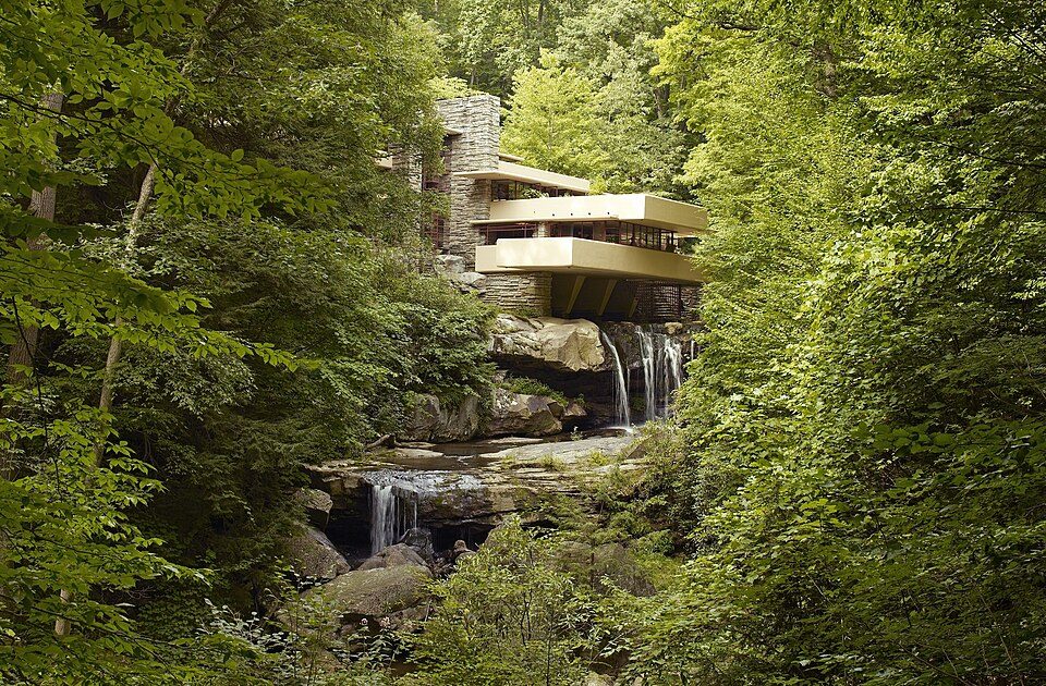
Big draw35 mi MuseumFallingwater
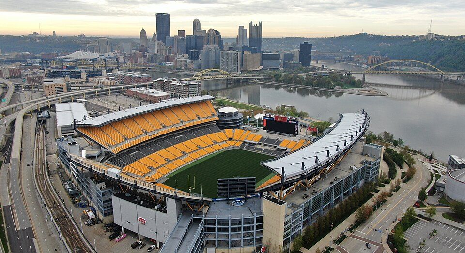
Big draw29 mi Stadium & arenaAcrisure Stadium
28 mi Theme parkKennywood
29 mi LandmarkFort Duquesne
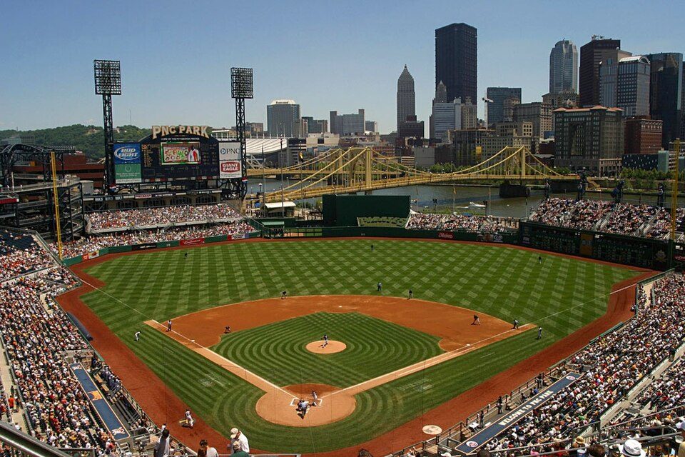
29 mi Stadium & arenaPNC Park
29 mi Stadium & arenaPPG Paints ArenaFallingwater: Carol M. Highsmith, Public domain · Acrisure Stadium: Fo2grfr, CC BY-SA 4.0 · Kennywood: Ski2007 of English Wikipedia, Public domain · Fort Duquesne: Sébastien Paquin, CC BY-SA 3.0 · PNC Park: alpineinc, CC BY 2.0 · PPG Paints Arena: Jleedev, CC BY-SA 4.0
3 within 15 miles of the center of West Bethlehem Township
About 1 of every 100 West Bethlehem Township residents are enrolled in college, against 6 across Pennsylvania.
1,460 counted in 2010 and 1,291 in 2020; an estimated 1,284 in 2025.
U.S. Census 2010 & 2020 counts · Census Bureau estimate, July 1, 2025
2 places in West Bethlehem Township on the National Register of Historic Places.
Township in Pennsylvania, US
West Bethlehem Township is a township in Washington County, Pennsylvania, United States established in 1781. In 1790, it was split into East and West Bethlehem Townships. The Martin's Mill Covered Bridge, Horn Davis Overholtzer Bridge, and Ulery Mill are listed on the National Register of Historic Places. According to the United States Census Bureau, the township has a total area of 22.2 square miles (57.5 km2), all of it land.
From Wikipedia, licensed CC BY-SA 4.0 · facts via Wikidata (CC0)
Short answers, built from the data on this page.
Home to 2 places on the National Register of Historic Places.
Not for the area. Cost of living, which also weighs rents, property taxes and how many households pay 30% or more of their income for housing, grades A−.