144 years in pictures
Census counts: 2,204 in 1900, a peak of 8,027 in 1930, 4,065 in 2020. The archive holds 4 old photos and papers going back to 2011 and 7 maps from 1889 on.
- 1882Throop is settled
Each edition grades its towns against each other only.
A town of 4,113, settled in 1882.
Throop gives you more for your money than most places: a typical home costs about $165K, 2.5 years of the Scranton metro’s $65K median household income. It grades B− overall, ranked 734th of 1032 in Pennsylvania. The low prices come with trade-offs. Residents are less healthy than 78% of U.S. towns on CDC estimates. On the plus side, it reports less crime per resident than 81% of U.S. towns. Throop’s trail density is 1.8 miles per square mile, above both the Pennsylvania town median (0.4) and the median of U.S. towns (0.4). Most errands need a car: it is less walkable than 73% of U.S. towns.
Where Throop beats most towns.
1.3% of the town is conserved land, across 3 parks and preserves.
Each subject compared with towns across the country (schools within Pennsylvania), ordered by how far Throop is from typical.
How TownRatings grades towns →
Census counts: 2,204 in 1900, a peak of 8,027 in 1930, 4,065 in 2020. The archive holds 4 old photos and papers going back to 2011 and 7 maps from 1889 on.
Museums, parks, gardens and other places to visit around Throop. Close and well known come first.
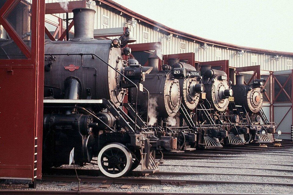
4 mi National Historic SiteSteamtown National Historic Site61K visitors a year
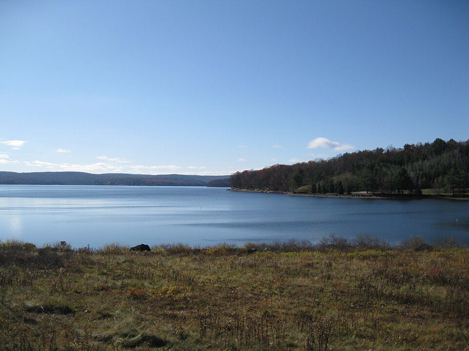
18 mi LakeLake Wallenpaupack
35 mi State parkRicketts Glen State Park
4 mi GardenNay Aug Park8 mi Theme parkRocky Glen Park
7 mi Ski areaMontage Mountain Ski Area25 runs · 998 ft verticalSteamtown National Historic Site: National Park Service, Public domain · Lake Wallenpaupack: Doug Kerr from Albany, NY, United States, CC BY-SA 2.0 · Ricketts Glen State Park: en:User:Msitler, Public domain · Nay Aug Park: The Mebane Greeting Card Co., Wilkes-Barre, PA., Public domain · Montage Mountain Ski Area: Montage Mountain Resorts, CC BY-SA 4.0
Who provides power, water and the rest in Throop, and how to reach them.
EPA SDWIS (Oct 9, 2026) · HIFLD + EIA-861 2025 · Census 2020 ZCTAs · NCES 2024–25 · registration: vote.gov, updated Nov 18, 2024.
Ordered by what stands out in Throop.
Throop is healthier than towns with similar incomes, has homes that are cheap against local pay and is safe by national standards but not by Pennsylvania’s.
On this, Throop is below both Pennsylvania’s towns (8.2%) and U.S. towns (4.3%). 9.0 miles of trail in 3 parks and preserves.
| Biggest places to walk | Trails | Acres |
|---|---|---|
| 1. Washington Street Park | — | 6 |
| 2. Bellman Street Park | — | 1 |
| 3. Olendike Street Park | — | 1 |
Trails & parks © OpenStreetMap contributors · Conserved land: USGS PAD-US
Its public schools are run by Mid Valley SD. Its two schools are below. The largest public high school is Mid Valley Secondary Center, with 898 students.
| School | Level | Students | Letter |
|---|---|---|---|
| Mid Valley El CtrLargest public elementary schoolGrades K–6 | Grades K–6 | 1,027 | C+ |
| Mid Valley Secondary CenterLargest public high schoolGrades 7–12 | Grades 7–12 | 898 | C− |
NCES · EDFacts · graded within PA on state tests and graduation
At 8.1 crimes per 1,000 residents a year, it reports less crime than 63% of Pennsylvania’s graded towns.
The property crime rate in Throop is 2.4 per 1,000 residents.
| Throop | Pennsylvania towns | U.S. towns | |
|---|---|---|---|
| Property crimes per 1,000 (2025) | 2.4 per 1,000 residents | 5.7 | 9.9 |
| Violent crimes per 1,000 (2025) | 1.2 per 1,000 residents | 0.7 | 1.6 |
FBI crime data, 2025 · crimes reported to police
Against the 8,158 U.S. towns with household incomes like Throop’s, it is less healthy than 62%, so its C− isn’t only a matter of income. All 3 graded neighbors score healthier than its C−, from Olyphant (C+) to Dunmore (A−).
22% of Throop adults smoke cigarettes. Throop beats the Pennsylvania average on 0 of 26 CDC measures and trails it on 11. 42% of Throop adults sleep under 7 hours.
| Throop | Pennsylvania towns | U.S. towns | |
|---|---|---|---|
| Smoke cigarettes (CDC PLACES) | 22% | 16% | 14% |
| Sleep under 7 hours (CDC PLACES) | 42% | 38% | 36% |
| Frequent physical distress (CDC PLACES) | 17% | 14% | 14% |
| Frequent mental distress (CDC PLACES) | 19% | 16% | 17% |
| What stands out | Throop | PA |
|---|---|---|
| More uninsured adults | 8.3% | 5.8% |
| More smokers | 21.8% | 15.8% |
| More adults with COPD | 10.6% | 7.7% |
CDC PLACES 2025 · modeled estimates for adults · CMS · HRSA
The average commute for its 1,839 working residents takes 15.8 minutes, against 26.3 across Pennsylvania.
Most working residents leave Throop for work: only 5% work in town. Throop’s average trip to work is 16 minutes. Jobs based in Throop grew to 1,013 in 2023, 179 more than in 2013.
| Throop | Pennsylvania towns | U.S. towns | |
|---|---|---|---|
| Average trip to work | 16 minutes | 26 minutes | 25 minutes |
| Below the poverty line | 15% | 7.6% | 9.6% |
| Median household income | $57,000 | $81,000 | $80,000 |
| Working residents who work in town | 5.1% | 6.3% | 8% |
Census LEHD 2023 · ACS
Throop has chilly, snowy winters and pleasant summers. July afternoons reach 83°, January nights drop to 17° and about 45 inches of snow falls in a winter.
NOAA U.S. Climate Normals, 1991–2020
Expected storm and flood damage is lower than in 67% of U.S. communities. Since 1996, 2 flood insurance claims have been paid out in Throop.
FEMA flood insurance claims · FEMA National Risk Index · OpenFEMA
At 2.5 years of the Scranton metro’s $65K median household income, the typical home costs less against local pay than in 81% of Pennsylvania towns; that ratio is one input to its B+ for cost of living.
Zillow Home Value Index · Redfin Data Center
8 within 15 miles of the center of Throop
About 3 of every 100 Throop residents are enrolled in college, against 6 across Pennsylvania.
Where Throop’s working residents go each day. Line width shows the share.
Census LEHD 2023
3 notable people were born in Throop.
Borough in Pennsylvania, US
Throop ( TROOP) is a borough in Lackawanna County, Pennsylvania, United States, adjoining Scranton. Formerly, coal mining and silk manufacturing provided employment for the people of Throop, who numbered 2,204 in 1900 and 5,133 in 1910. In 1940, 7,382 people lived in Throop. The population was 4,078 at the 2020 census.
From Wikipedia, licensed CC BY-SA 4.0 · facts via Wikidata (CC0)
3 towns share a border with Throop.
| Town | PA rank | Overall | Cost | Safety | Schools | Health |
|---|---|---|---|---|---|---|
| Throop | #734 | B− | B+ | A− | C+ | C− |
| Dickson City | #955 | C− | B− | C− | C+ | C+ |
| Olyphant | #539 | B | B− | A | C+ | C+ |
| Dunmore | #464 | B+ | C+ | — | B− | A− |
Dunmore reports no FBI crime data of its own. Compare Throop with a neighbor →
Short answers, built from the data on this page.
Throop grades B− overall, better than 47% of U.S. towns and #734 of 1032 in Pennsylvania. It grades C− for health, A− for safety and C+ for schools. Health is its weak spot, with a C−.
Not for the area. The typical home is worth about $165,000, 42% below the Pennsylvania typical home. Cost of living, which also weighs rents, property taxes and how many households pay 30% or more of their income for housing, grades B+.
3 notable people were born here, including Joseph Minish and John McDonald.