Is Lower Paxton Township a good place to live?
Lower Paxton Township grades B overall, 532nd among Pennsylvania's 1032 graded towns, with clear strengths and some subjects that lag. The median household earns $92K and it is healthier than 79% of U.S. towns. Its lowest everyday mark is in cost of living: homes are expensive, about $285K for a typical one and 3.5 times the Harrisburg metro’s $81K median household income. Abraham Bomberger Farmhouse is on the National Register of Historic Places. Lower Paxton Township’s average trip to work is 21 minutes, where Pennsylvania’s towns sit at 26 minutes and U.S. towns at 25 minutes. The biggest place to walk is Boyd Big Tree Preserve Conservation Area, 338 acres with 3.1 miles of trail.
What makes Lower Paxton Township stand out
Where Lower Paxton Township beats most towns.
Lower Paxton Township has grown 17% since 2010
47,360 counted in 2010 and 53,501 in 2020; an estimated 55,564 in 2025.
U.S. Census 2010 & 2020 counts · Census Bureau estimate, July 1, 2025
How Lower Paxton Township grades
Each subject compared with towns across the country (schools within Pennsylvania), ordered by how far Lower Paxton Township is from typical.
How TownRatings grades towns →
Hersheypark and 31 more within 40 miles
Museums, parks, gardens and other places to visit around Lower Paxton Township. Close and well known come first.
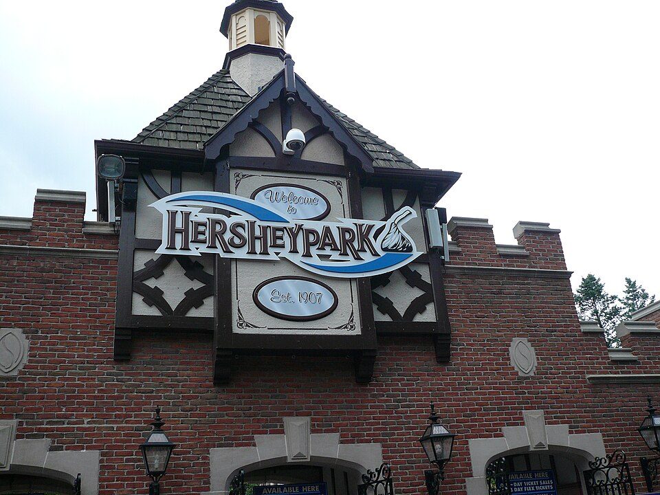 8 mi Theme parkHersheypark3.0M visitors a year
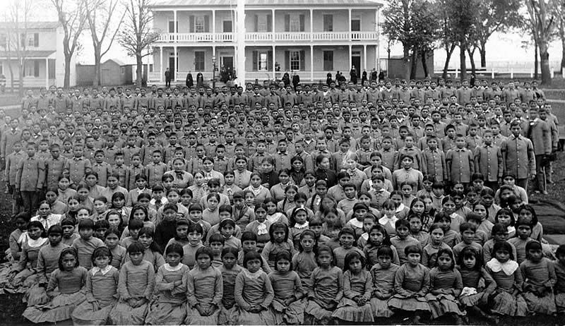 21 mi National MonumentCarlisle Federal Indian Boarding School National Monument
 8 mi Stadium & arenaHersheypark Stadium
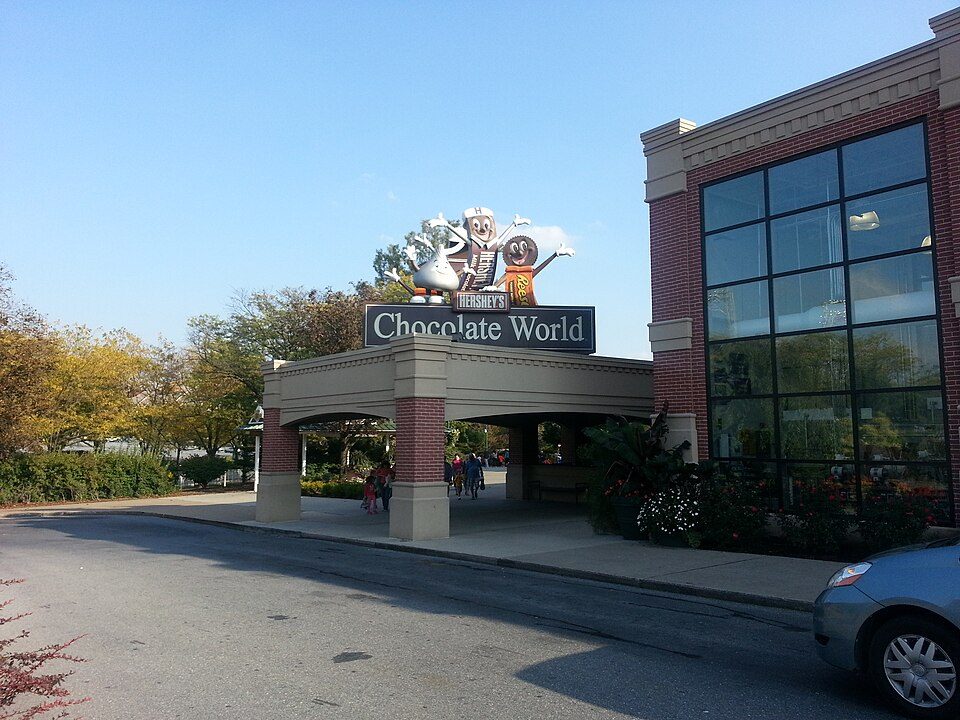 8 mi MuseumHershey's Chocolate World
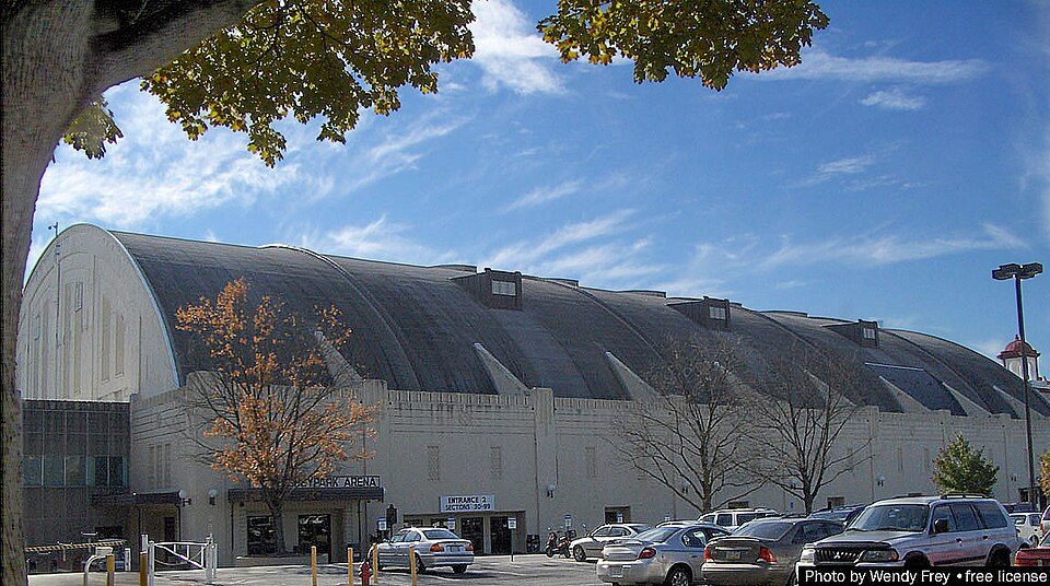 8 mi Stadium & arenaHersheypark Arena
 6 mi Stadium & arenaFNB Field
Photo credits
Hersheypark: Michael Gray, CC BY-SA 2.0 · Carlisle Federal Indian Boarding School National Monument: Unknown authorUnknown author, Public domain · Hersheypark Stadium: 45BearsFan, CC BY-SA 4.0 · Hershey's Chocolate World: Phillyfan0419, CC BY-SA 3.0 · Hersheypark Arena: Hersheyarena4ever at English Wikipedia, Public domain · FNB Field: Whammies Were Here, Public domain


Moving to Lower Paxton Township: who provides what
Who provides power, water and the rest in Lower Paxton Township, and how to reach them.
EPA SDWIS (Oct 9, 2026) · HIFLD + EIA-861 2025 · Census 2020 ZCTAs · NCES 2024–25 · registration: vote.gov, updated Nov 18, 2024.
The data
Ordered by what stands out in Lower Paxton Township.
5.3% of Lower Paxton Township is conserved land
16 miles of trail in 13 parks and preserves.
| Lower Paxton Township | Pennsylvania towns | U.S. towns | |
|---|---|---|---|
| Miles of trail per square mile | 0.6 miles per square mile | 0.4 | 0.4 |
| Conserved land | 5.3% | 8.2% | 4.3% |
| Biggest places to walk | Trails | Acres |
|---|---|---|
| 1. Boyd Big Tree Preserve Conservation Area | 3.1 mi | 338 |
| 2. Brightbill Park | 0.9 mi | 28 |
| 3. Koon's Park | 0.6 mi | 26 |
Trails & parks © OpenStreetMap contributors · Conserved land: USGS PAD-US
On state tests, Lower Paxton Township’s schools trail 61% of Pennsylvania districts
Its public schools are run by Central Dauphin SD. Three of its 18 schools are below, each with why it’s listed.
| School | Level | Students | Letter |
|---|---|---|---|
| Linglestown MSLargest public middle schoolGrades 6–8 | Grades 6–8 | 841 | C+ |
| Central Dauphin East SHSLargest public high schoolGrades 9–12 | Grades 9–12 | 1,573 | C |
| Infinity CSTop results in townGrades K–8 | Grades K–8 | 256 | A |
NCES · EDFacts · graded within PA on state tests and graduation
Lower Paxton Township’s grade for health is an A−
12% of adults report frequent physical distress in Lower Paxton Township. Lower Paxton Township beats the Pennsylvania average on 5 of 26 CDC measures and trails it on 0. 15% of adults report frequent mental distress in Lower Paxton Township.
| Lower Paxton Township | Pennsylvania towns | U.S. towns | |
|---|---|---|---|
| Frequent physical distress (CDC PLACES) | 12% | 14% | 14% |
| Frequent mental distress (CDC PLACES) | 15% | 16% | 17% |
| Obesity (CDC PLACES) | 31% | 35% | 35% |
| Sleep under 7 hours (CDC PLACES) | 39% | 38% | 36% |
| What stands out | Lower Paxton Township | PA |
|---|---|---|
| Fewer older adults who have lost all their teeth | 10% | 14.5% |
| Fewer adults with COPD | 6.6% | 7.7% |
CDC PLACES 2025 · modeled estimates for adults · CMS · HRSA
Four seasons and pleasant summers in Lower Paxton Township
Lower Paxton Township has chilly winters and warm summers. July afternoons reach 85°, January nights drop to 22° and about 24 inches of snow falls in a winter.
Typical low → high °F
NOAA U.S. Climate Normals, 1991–2020
Lower Paxton Township faces a low natural-hazard risk, led by inland flooding
Expected storm and flood damage is lower than in 67% of U.S. communities. Since 1978, 35 flood insurance claims have been paid out in Lower Paxton Township.
FEMA flood insurance claims · FEMA National Risk Index · OpenFEMA
About one in seven working residents works right in Lower Paxton Township
Lower Paxton Township has about as many jobs (24,935) as working residents, but only 3,481 people both live and work here.
Most working residents leave Lower Paxton Township for work: only 14% work in town. 19% of Lower Paxton Township workers work from home. The top destinations are Harrisburg (14%), Derry Township (8%) and Susquehanna Township (7%).
| Lower Paxton Township | Pennsylvania towns | U.S. towns | |
|---|---|---|---|
| Work from home | 19% | 12% | 11% |
| Working residents who work in town | 14% | 6.3% | 8% |
| Below the poverty line | 6.1% | 7.6% | 9.6% |
| Median household income | $92,000 | $81,000 | $80,000 |
Where working residents work
Census LEHD 2023 · ACS
Crime reported in Lower Paxton Township
Lower Paxton Township's reported crime rate is below Pennsylvania's. Most reported incidents are property crimes, mainly thefts. 74 violent crimes were reported in 2025.
| Lower Paxton Township | Pennsylvania towns | U.S. towns | |
|---|---|---|---|
| Property crimes per 1,000 (2025) | 9.9 per 1,000 residents | 5.7 | 9.9 |
| Violent crimes per 1,000 (2025) | 1.3 per 1,000 residents | 0.7 | 1.6 |
Violent crime per 1,000 residents
Property crime per 1,000 residents
FBI crime data, 2025 · crimes reported to police
An age mix much like Pennsylvania’s
No broad age group is more than 4 points off the Pennsylvania average. Lower Paxton Township has grown 3.7% since 2020, to 55,564 residents in the Census Bureau’s 2025 estimate. 39% of adults 25 and older have a bachelor’s degree or more, vs 35% across Pennsylvania.
| Lower Paxton Township | Pennsylvania towns | U.S. towns | |
|---|---|---|---|
| Bachelor’s degree or more, 25+ | 39% | 29% | 29% |
| Under 18 | 23% | 20% | 22% |
| Median age | 40.8 years | 43.2 years | 40.5 years |
| Aged 65 or older | 19% | 21% | 18% |
Ages · share of residents
Education · adults 25 and older
Women and men · all residents
52% women, 48% men
About 92 men for every 100 women (the survey’s margin: ±1.4 points). Across Pennsylvania, 50.7% of residents are women. Median age: women 41.9, men 38.8.
| Lower Paxton Township | PA | U.S. | |
|---|---|---|---|
| Under 10 | 12.3% | 10.8% | 11.6% |
| 10 to 17 | 10.9% | 9.7% | 10.3% |
| 18 to 24 | 6.9% | 9% | 9.1% |
| 25 to 34 | 12.3% | 13% | 13.7% |
| 35 to 44 | 13.1% | 12.6% | 13.2% |
| 45 to 54 | 12.5% | 11.9% | 12.2% |
| 55 to 64 | 13% | 13.6% | 12.7% |
| 65 to 74 | 11.6% | 11.4% | 10.2% |
| 75 and older | 7.4% | 8.1% | 7% |
| No diploma | 7.9% | 7.9% | 10.4% |
| High school | 25.9% | 32.9% | 26% |
| Some college | 15.8% | 15.1% | 19.1% |
| Associate’s | 11.7% | 8.9% | 8.8% |
| Bachelor’s | 24.7% | 20.9% | 21.6% |
| Graduate | 14.1% | 14.3% | 14.1% |
Census population estimates, 2025 · U.S. Census Bureau · ACS 2020-2024 5-year estimates
Everything we know about Lower Paxton Township
Colleges nearby
5 within 15 miles of the center of Lower Paxton Township
About 4 of every 100 Lower Paxton Township residents are enrolled in college, against 6 across Pennsylvania.
About Lower Paxton Township
Township in Pennsylvania, US
Lower Paxton is a township in Dauphin County, Pennsylvania, United States. The population was 53,514 at the 2020 census. It is the most populous municipality in Dauphin County and the 17th-most populated municipality in the state. Lower Paxton Township is located 76.6 miles (123.3 km) southwest of Allentown, 9.4 miles (15.1 km) northeast of Harrisburg, and 107.3 miles (172.7 km) northwest of Philadelphia. The township was incorporated in 1767 from Paxton Township.
From Wikipedia, licensed CC BY-SA 4.0 · facts via Wikidata (CC0)
- Area
- 28 sq mi
Lower Paxton Township’s neighbors
5 towns share a border with Lower Paxton Township.
South Hanover Township next door grades higher for schools (B+ to Lower Paxton Township’s C+) and lower for cost of living (D to C).
| Town | PA rank | Overall | Cost | Safety | Schools | Health |
|---|---|---|---|---|---|---|
| Lower Paxton Township | #532 | B | C | — | C+ | A− |
| West Hanover Township | #489 | B+ | C | — | C+ | A |
| South Hanover Township | #438 | B+ | D | — | B+ | A |
| Swatara Township | #769 | C+ | B− | C | C+ | B |
| Rutherford | — | — | — | — | — | — |
| Middle Paxton Township | #502 | B+ | B+ | — | C+ | A |
Lower Paxton Township, West Hanover Township, South Hanover Township and Middle Paxton Township report no FBI crime data of their own. Rutherford isn’t graded (fewer than 1,000 residents, or not enough data). Compare Lower Paxton Township with a neighbor →
Questions about Lower Paxton Township
Short answers, built from the data on this page.
Is Lower Paxton Township, PA a good place to live?
By most measures, yes. Lower Paxton Township grades B overall, better than 64% of U.S. towns and #532 of 1032 in Pennsylvania. It grades A− for health and C+ for schools.
Is Lower Paxton Township, PA expensive?
Cost of living, which also weighs rents, property taxes and how many households pay 30% or more of their income for housing, grades C.