Lower Macungie Township in pictures
Census counts: 8,814 in 1970, 32,426 in 2020. The archive holds 7 maps from 1902 on.
1 place on the National Register of Historic Places.
Explore the history →Each edition grades its towns against each other only.
For most people who can afford it, yes. Lower Macungie Township grades A− overall, 353rd of 1032 graded towns in Pennsylvania. The median household earns $125K. CDC estimates put its residents' health ahead of 83% of the country and its schools outperform 76% of the state's. The trade-off is money: the typical home is worth about $406K, 4.8 years of the Allentown metro’s $85K median household income. 15% of the land in Lower Macungie Township is conserved, against 8.2% in Pennsylvania’s towns and 4.3% across U.S. towns. Rodale Organic Gardening Experimental Farm is on the National Register of Historic Places.
Where Lower Macungie Township beats most towns.
Each subject compared with towns across the country (schools within Pennsylvania), ordered by how far Lower Macungie Township is from typical.
Its grades run from A+ for jobs and income (better than 95% of comparable towns) to D for cost of living (better than 15%), so the A− overall blends very different results.
How TownRatings grades towns →
Census counts: 8,814 in 1970, 32,426 in 2020. The archive holds 7 maps from 1902 on.
1 place on the National Register of Historic Places.
Explore the history →Museums, parks, gardens and other places to visit around Lower Macungie Township. Close and well known come first.
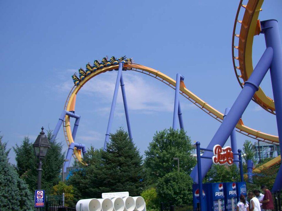
4 mi Theme parkDorney Park & Wildwater Kingdom
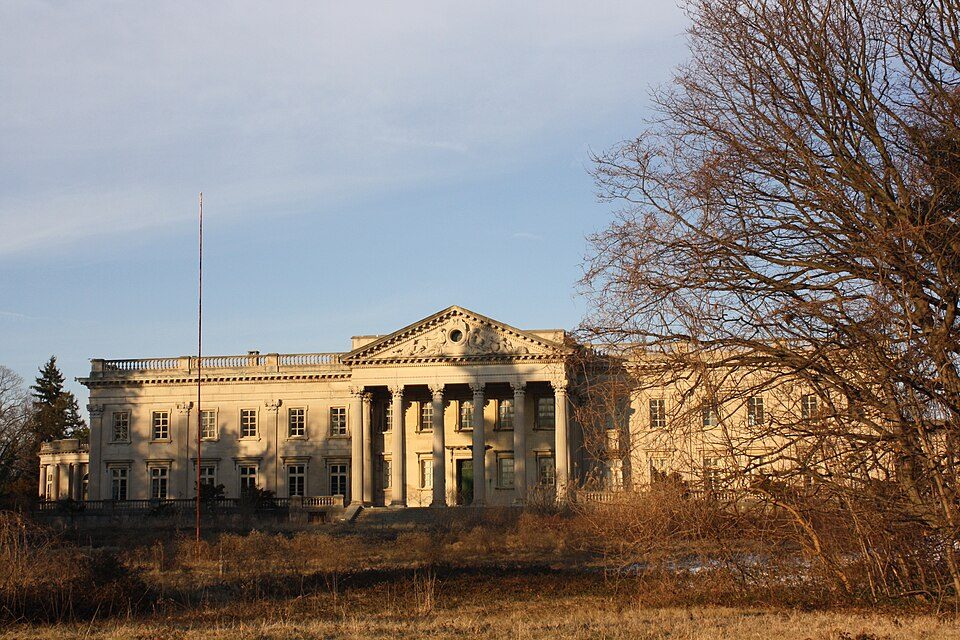
Big draw39 mi MuseumLynnewood Hall
7 mi Stadium & arenaPPL Center
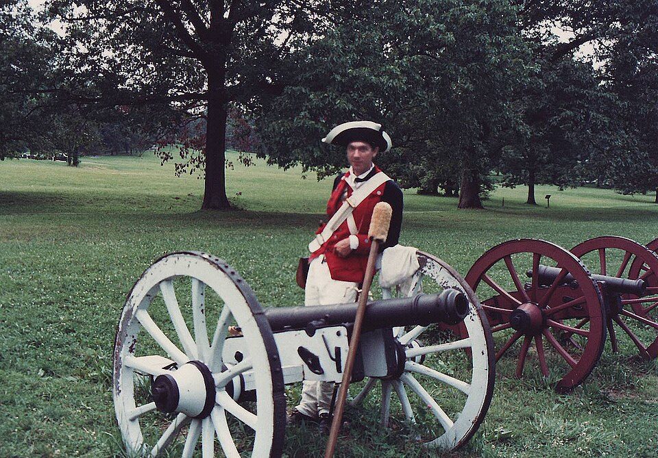
29 mi National Historical ParkValley Forge National Historical Park1.8M visitors a year
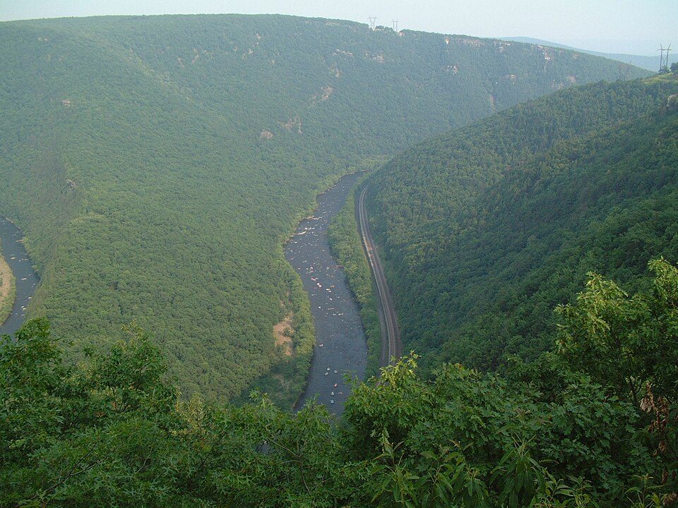
22 mi Park & preserveLehigh River23 mi Stadium & arenaSovereign CenterDorney Park & Wildwater Kingdom: Coasterman1234 at en.wikipedia, CC BY-SA 3.0 · Lynnewood Hall: Shuvaev, CC BY-SA 3.0 · PPL Center: Hunter Kahn, CC BY-SA 3.0 · Valley Forge National Historical Park: The original uploader was JGHowes at English Wikipedia. (Original text: en:User, Attribution · Lehigh River: The original uploader was Malepheasant at English Wikipedia., CC BY-SA 2.0
Who provides power, water and the rest in Lower Macungie Township, and how to reach them.
EPA SDWIS (Oct 9, 2026) · HIFLD + EIA-861 2025 · Census 2020 ZCTAs · NCES 2024–25 · registration: vote.gov, updated Nov 18, 2024.
Ordered by what stands out in Lower Macungie Township.
Lower Macungie Township trades workers with Allentown and other neighbors and has less tooth loss than most of Pennsylvania, but it has a long record of flood insurance claims.
Its widest gap with Pennsylvania is tooth loss: 8.9% of those 65+ have lost all their teeth, against 14.5% statewide. Against the 5,035 U.S. towns with household incomes like Lower Macungie Township’s, it is healthier than 56%, a smaller edge than it has nationally: part of it comes with its incomes.
14% of adults report frequent mental distress in Lower Macungie Township, below both Pennsylvania’s towns (16%) and U.S. towns (17%). 12% of Lower Macungie Township adults report frequent physical distress. Lower Macungie Township beats the Pennsylvania average on 9 of 26 CDC measures and trails it on 0.
| Lower Macungie Township | Pennsylvania towns | U.S. towns | |
|---|---|---|---|
| Frequent mental distress (CDC PLACES) | 14% | 16% | 17% |
| Frequent physical distress (CDC PLACES) | 12% | 14% | 14% |
| Sleep under 7 hours (CDC PLACES) | 34% | 38% | 36% |
| Obesity (CDC PLACES) | 31% | 35% | 35% |
| What stands out | Lower Macungie Township | PA |
|---|---|---|
| Fewer older adults who have lost all their teeth | 8.9% | 14.5% |
| Fewer smokers | 13.1% | 15.8% |
CDC PLACES 2025 · modeled estimates for adults · CMS · HRSA
Its public schools are run by East Penn SD. Two of its 7 schools are below, each with why it’s listed.
| School | Level | Students | Letter |
|---|---|---|---|
| Lower Macungie MSLargest public middle schoolGrades 6–8 | Grades 6–8 | 1,041 | C+ |
| Shoemaker El SchTop results in townGrades K–5 | Grades K–5 | 537 | A− |
NCES · EDFacts · graded within PA on state tests and graduation
9.8 miles of trail in 34 parks and preserves. The biggest park or preserve is Camp Olympic Park, at 109 acres.
| Biggest places to walk | Trails | Acres |
|---|---|---|
| 1. Dorothy Rider Pool Wildlife Sanctuary | 2.7 mi | 72 |
| 2. Brenner-Penfield Macungie Mountain Preserve | 1 mi | 42 |
| 3. Reimert Memorial Bird Haven | 0.6 mi | 12 |
Trails & parks © OpenStreetMap contributors · Conserved land: USGS PAD-US
Lower Macungie Township has chilly, snowy winters and warm summers, with plenty of rain. July afternoons reach 86°, January nights drop to 21° and about 33 inches of snow falls in a winter.
NOAA U.S. Climate Normals, 1991–2020
Lower Macungie Township has about as many jobs (13,503) as working residents, but only 1,257 people both live and work here. Jobs based here grew from 7,404 in 2013 to 13,503.
Most working residents leave Lower Macungie Township for work: only 8% work in town. 2.7% of residents live below the poverty line in Lower Macungie Township. Jobs based in Lower Macungie Township grew to 13,503 in 2023, 6,099 more than in 2013.
| Lower Macungie Township | Pennsylvania towns | U.S. towns | |
|---|---|---|---|
| Median household income | $125,000 | $81,000 | $80,000 |
| Work from home | 18% | 12% | 11% |
| Below the poverty line | 2.7% | 7.6% | 9.6% |
| Average trip to work | 27 minutes | 26 minutes | 25 minutes |
Census LEHD 2023 · ACS
150 flood insurance claims have been filed here, and 25 properties have flooded more than once.
Expected storm and flood damage is lower than in 64% of U.S. communities. Since 1978, 150 flood insurance claims have been paid out in Lower Macungie Township.
FEMA flood insurance claims · FEMA National Risk Index · OpenFEMA
8 within 15 miles of the center of Lower Macungie Township
About 5 of every 100 Lower Macungie Township residents are enrolled in college, about the same as Pennsylvania.
Township in Pennsylvania, US
Lower Macungie Township is a township in Lehigh County, Pennsylvania, United States. The township's population was 32,426 as of the 2020 census, making it the second-largest population center in Lehigh County after Allentown and the third-largest population center in the Lehigh Valley metropolitan area after Allentown and Bethlehem. Lower Macungie Township is located 7.1 miles (11.4 km) southwest of Allentown 60.8 miles (97.8 km) northwest of Philadelphia, and 95.5 miles (153.7 km) west of New York City. The township is part of the Lehigh Valley, which had a population of 861,899 and was the third-largest populated metropolitan region in Pennsylvania and 68th-most populous metropolitan area…
From Wikipedia, licensed CC BY-SA 4.0 · facts via Wikidata (CC0)
10 towns share a border with Lower Macungie Township.
All 5 graded towns on its borders grade higher than its A−; Macungie (A−) is closest.
| Town | PA rank | Overall | Cost | Safety | Schools | Health |
|---|---|---|---|---|---|---|
| Lower Macungie Township | #353 | A− | D | — | A− | A− |
| Macungie | #348 | A− | D | A+ | A− | B+ |
| Emmaus | #319 | A− | C | B | A− | A− |
| Upper Milford Township | #217 | A | C | — | A− | A− |
| Upper Macungie Township | #125 | A | D | A | A | A |
| Wescosville | — | — | — | — | — | — |
| South Whitehall Township | #336 | A− | D | — | A | A− |
| Trexlertown | — | — | — | — | — | — |
Lower Macungie Township, Upper Milford Township and South Whitehall Township report no FBI crime data of their own. Wescosville and Trexlertown aren’t graded (fewer than 1,000 residents, or not enough data). Compare Lower Macungie Township with a neighbor →
Short answers, built from the data on this page.
For most people who can afford it, yes. Lower Macungie Township grades A− overall, better than 79% of U.S. towns and #353 of 1032 in Pennsylvania. It grades A− for health and A− for schools. Cost of living is its weak spot, with a D.
Yes. Cost of living, which also weighs rents, property taxes and how many households pay 30% or more of their income for housing, grades D.