Gettysburg dates to 1780, and 48% of its homes were built before 1940
More historic than 98% of U.S. towns · #68 of 1,035 in Pennsylvania. What drives it
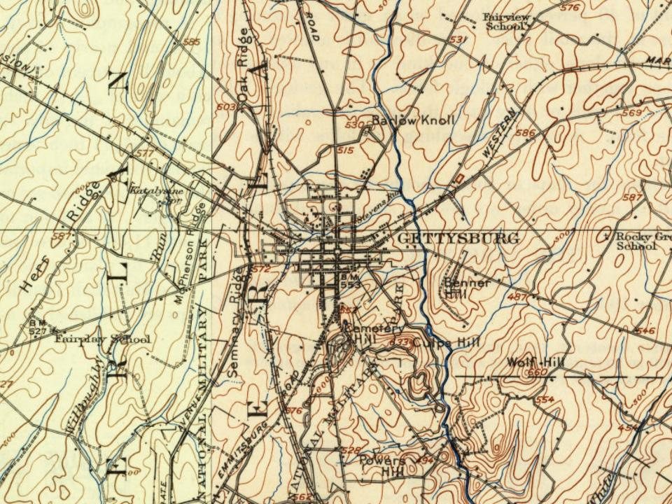
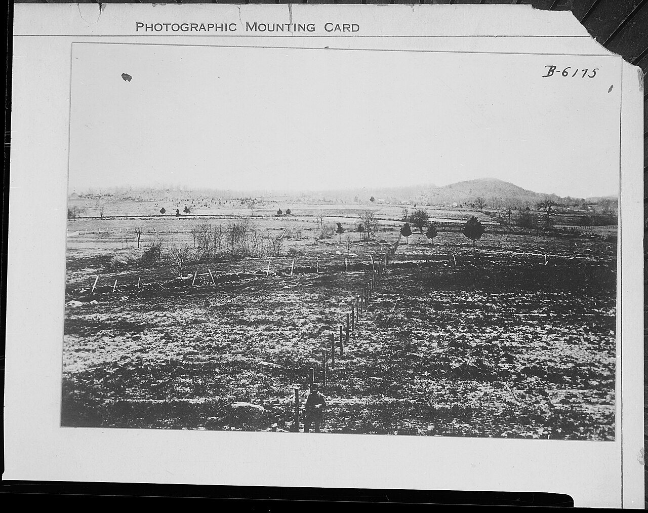
8 places in town are on the National Register, among them a historic district with 315 buildings. Below: 5 old photos and papers, maps from 1886 on, and the census since 1830.
Founding year: Wikidata. First post office: 1796.The full story ↓
History grade
What drives Gettysburg’s History grade
On its age, its old homes and the National Register, Gettysburg is more historic than 98% of U.S. towns, #68 of 1,035 in Pennsylvania. All 3 inputs are above most U.S. towns; its share of homes from before 1940 ranks highest and its age lowest.
A+
HistoryA character grade: shown, never part of Gettysburg’s overall grade.
Pennsylvania towns list about as much on the Register as the country (a typical Pennsylvania town has 2.1 per 10,000 residents, the U.S. 2.4), so Gettysburg’s 389 sits above most of its state (94% of Pennsylvania towns have fewer) while its 321 historic buildings outnumber those of 95% of U.S. towns.
NoteThe founding year comes from Wikidata alone; no second source gives 1780.
How sure. Graded on any two of the three inputs instead, the letter would range from A to A+. The pre-1940 share is a Census survey estimate (±6.3 points).
Founding year: Wikidata (other dates in Quick answers). Homes: Census ACS 2020–24. National Register: National Park Service, May 2026 list; each listing counted once (boundary changes and added documentation belong to their listing), and a historic district counts its contributing buildings. How TownRatings grades history →
What stands out about Gettysburg’s past
Read from the archive, the National Register and the record. The page puts what stands out first.
National Park Service, National Register of Historic Places. Photos from Wikimedia Commons, credited on each place’s page.
Every building
Gettysburg, building by building, 1886–1924
Fire insurance maps drew every building, what it was made of and what it was used for, so insurers could price the risk of fire. Pick a year, then a sheet.
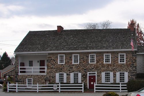
In 1760, Irishman Samuel Gettys settled at the Shippensburg-Baltimore and Philadelphia-Pittsburgh crossroads, in what was then western York County, and established a tavern frequented by soldiers and traders. In 1786, his son James purchased 116 acres of his land, divided it up into 220 lots and sold them, and is thus considered the founder of Gettysburg. The borough boundary was established, with the Dobbin House tavern (established in 1776) sitting in the southwest.
Visiting the Field Those who visit Gettysburg for the semi-centennial and at other times will find In the following paragraphs concise directions for reaching the principal sections of the battlefield from the center of Gettysburg, where are located the leading hotels and railroad stations.
Text read by machine from the scan; it may contain errors.
behind Steinwehr's entrenchments on Cemetery Hill, that the victorious Confederates ceased the pursuit and formed a new line for the night, centering on the town of Gettysburg. By this time, General Hancock, sent by General Meade from Taneytown, had arrived to take command of the forces in and around Gettysburg.
Text read by machine from the scan; it may contain errors.
spent. Thev offered but feeble resistance when the I'nion troops closed in around them. The assault was over quickly, thousands were among the dead, wounded and prisoners, and the grandest charge in historv ended. The battle of Gettysburg was won. for with the exception of a spirited and desperate cavalry contest between the forces of Gregg and Stuart, the lighting at Gettysburg was finished.
Text read by machine from the scan; it may contain errors.
A brief history of the Fourth Pennsylvania Veteran Cavalry, embracing organization, reunions, dedication of monument at Gettysburg and address of General W. E. Doster, Venango County Battalion, reminiscences, etc1891Read the page →
Read the text
The third reunion was held at Gettysburg, on Pennsylvania Da>', September iith, 1SS9, upon the occasion of the dedication of the Monuments of the Pennsylvania organizations who participated in the battle of Gettysburg, the Fourth Cavalry being of the number. Transportation was furnished to its members entitled to the same, under the provisions of the Act approved May 8th, 1889. A business meeting was held in the Court House at 10 A. M., on September 11th, and
Text read by machine from the scan; it may contain errors.
Scans and text from the Internet Archive. Books published in 1930 or earlier, which are in the public domain.
Timeline
Gettysburg, 1771 to 1952
Woven from the archive, old maps, post office records, the National Register and the people born here.
In 1780, according to Wikidata. Gettysburg’s post office opened in 1796, and the census of 1830 counted 1,473 people here.
How does Gettysburg rank for history?
Gettysburg is more historic than 98% of U.S. towns, #68 of 1,035 in Pennsylvania. The History grade combines the town’s founding era, the share of homes built before 1940 and its National Register listings. It’s a character grade, so it isn’t part of the overall grade. How it works.
What is on the National Register in Gettysburg?
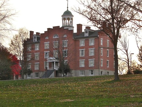
8 listings: 6 buildings, among them the Pennsylvania Hall, Gettysburg College (listed 1972, the first), 1 historic district, the Gettysburg Battlefield Historic District, with 315 contributing buildings, and 1 site. 321 historic buildings in all.
How old are the homes in Gettysburg?
48% of Gettysburg’s homes were built before 1940 (Census estimate, ±6.3 points), against a typical 18% for a Pennsylvania town; the median home was built in 1942.
Founding dates: Wikidata, Wikipedia, the U.S. post office records of Blevins & Helbock (CC0) and the Census. Homes by year built: Census ACS 2020–24. National Register of Historic Places: National Park Service (list of May 22, 2026). Old photos, postcards and papers: Wikimedia Commons, the Library of Congress and other public archives, credited on each item’s page. Maps: U.S. Geological Survey historical topographic maps (via Esri) and Sanborn fire-insurance maps (Library of Congress). History text and census tables: Wikipedia (CC BY-SA 4.0). Places that used to be: USGS Geographic Names Information System (2021).
From Wikimedia Commons (5), Wikidata (1), the National Register of Historic Places (8), Wikipedia, Wikidata and Wikipedia for famous people, U.S. Geological Survey historical maps, U.S. Census counts (via Wikipedia), the US Post Offices dataset (Blevins & Helbock), the USGS Geographic Names Information System, Sanborn fire insurance maps (Library of Congress) and old county and town histories (Internet Archive). Archive images are copied here with their credits and licenses, shown on each photo’s page. Refreshed monthly.







 1850
 1861
 1863