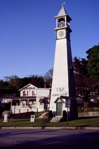
Gap was named for its location at a low pass through Mine Ridge. Gap has a history which can be dated as far back as William Penn's first visits to the area. Isaac Taylor erected the first house in what would become Gap in 1747. The area around Gap had a copper mine and what at the time were the only nickel mines in the United States.
Passages that mention Gap, cut from the printed page as they were published.
Locust Gap, Northumberland County, Pennsylvania1929Read the page →
Read the text
Among the schools decided upon was “one at Locust Gap.” This I find was erected near Locust Gav Junction, of today, which at that date was Locust Gap, and was completed in 1841, but I have been unable to ecure any detailed description of the building. This seems to have sufficed for the needs of the community for six years, when a larger building was erected on the Reading Turnpike about mid-way between the Red Bridge and the present village of Dooleyville and was in-tended to serve the entire section, including the present Mount Carmel.
Text read by machine from the scan; it may contain errors.
Locust Gap, Northumberland County, Pennsylvania1929Read the page →
Read the text
1832—The first industry in the town, a saw-mill, was erected by Samuel, William and Joseph Casper, of Sunbury, on Big Shamokin Creek, about three hundred yards north of the present ‘Locust Gap Junction station on the Pennsylvania Railroad. 1834—-On Monday, March 3, the lumber for the first house built in the present borough fo Shamokin, was prepared at this Locust Gap mill by Ziba Bird, who had purchasde the mill. This house was erected by and for Mr. Bird and his family.
Text read by machine from the scan; it may contain errors.
Scans and text from the Internet Archive. Books published in 1930 or earlier, which are in the public domain.
By decade
Gap, decade by decade
5 decades in the archive, from the 1850s to the 1980s. Scroll each row; tap a photo for its story.
Nothing in the archives for these yearsWeddings on Main Street, storms, parades, school pictures, the old store. If it’s in your family album, it belongs here.
Nothing in the archives for these yearsWeddings on Main Street, storms, parades, school pictures, the old store. If it’s in your family album, it belongs here.
Founding dates: Wikidata, Wikipedia, the U.S. post office records of Blevins & Helbock (CC0) and the Census. Homes by year built: Census ACS 2020–24. National Register of Historic Places: National Park Service (list of May 22, 2026). Old photos, postcards and papers: Wikimedia Commons, the Library of Congress and other public archives, credited on each item’s page. Maps: U.S. Geological Survey historical topographic maps (via Esri) and Sanborn fire-insurance maps (Library of Congress). History text and census tables: Wikipedia (CC BY-SA 4.0). Places that used to be: USGS Geographic Names Information System (2021). How TownRatings grades history →
From Wikimedia Commons (6), Wikipedia, Wikidata and Wikipedia for famous people and old county and town histories (Internet Archive). Archive images are copied here with their credits and licenses, shown on each photo’s page. Refreshed monthly.




 2015