Chestnut HillPA
A town of 7,086.
Is Chestnut Hill a good place to live?
52% of adults 25 and older hold a bachelor’s degree or more in Chestnut Hill, where Pennsylvania’s towns sit at 29% and U.S. towns at 29%. Chestnut Hill’s trail density is 2.4 miles per square mile, above both Pennsylvania’s towns (0.4) and U.S. towns (0.4). The biggest park or preserve is Meco Fields, at 27 acres. We don’t grade Chestnut Hill yet; the figures below are still real.
98% of working residents leave Chestnut Hill for work
Where Chestnut Hill’s working residents go each day. Line width shows the share.
Census LEHD 2023
Dorney Park & Wildwater Kingdom and 78 more within 40 miles
Museums, parks, gardens and other places to visit around Chestnut Hill. Close and well known come first.
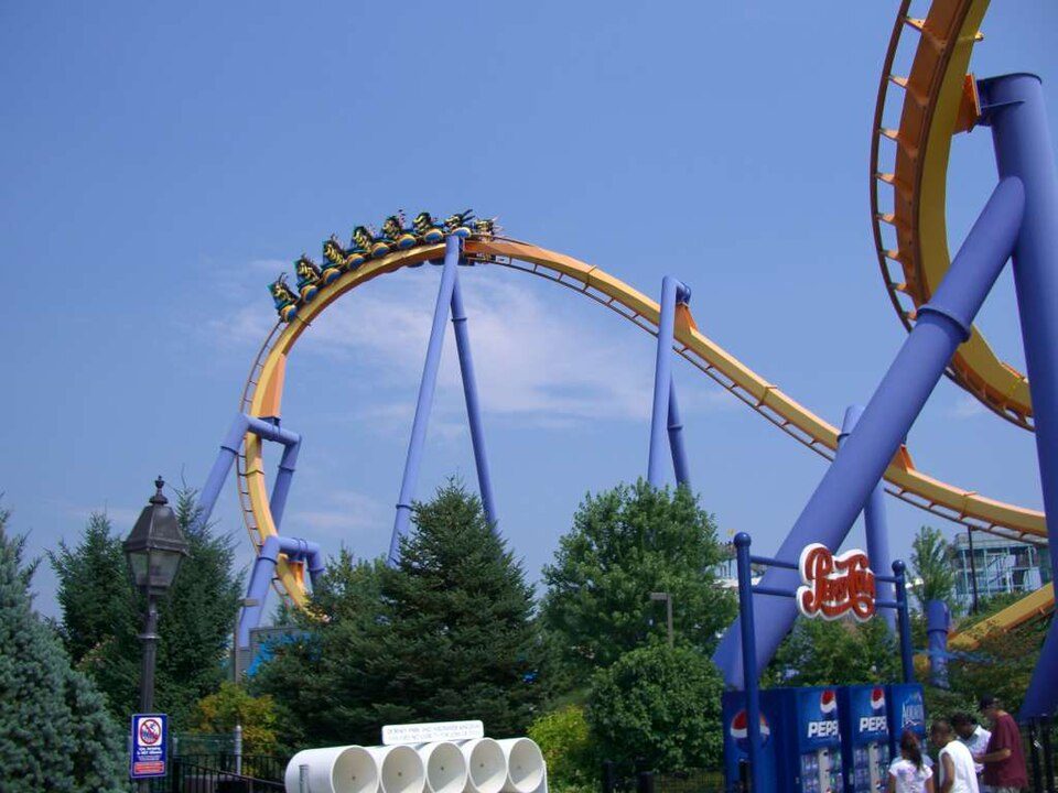 20 mi Theme parkDorney Park & Wildwater Kingdom
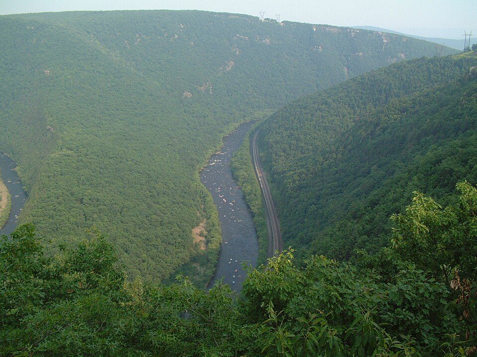 2 mi Park & preserveLehigh River
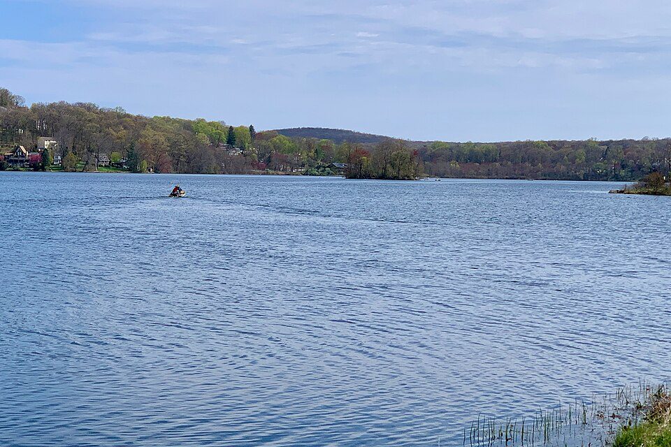 30 mi LakeLake Musconetcong
 16 mi Stadium & arenaPPL Center
 33 mi Park & preserveDuke Farms
 3 mi Theme parkBushkill Park
Photo credits
Dorney Park & Wildwater Kingdom: Coasterman1234 at en.wikipedia, CC BY-SA 3.0 · Lehigh River: The original uploader was Malepheasant at English Wikipedia., CC BY-SA 2.0 · Lake Musconetcong: Zeete, CC BY-SA 4.0 · PPL Center: Hunter Kahn, CC BY-SA 3.0 · Duke Farms: Ekem, CC BY-SA 3.0 · Bushkill Park: Mr6507, CC BY-SA 4.0


Moving to Chestnut Hill: who provides what
Chestnut Hill is unincorporated, so Northampton County and regional agencies provide most services.
EPA SDWIS (Oct 9, 2026) · HIFLD + EIA-861 2025 · Census 2020 ZCTAs · NCES 2024–25 · registration: vote.gov, updated Nov 18, 2024.
The data
Ordered by what stands out in Chestnut Hill.
Most of Chestnut Hill’s workers commute out: the town has 0.2 jobs for each of them
Most working residents leave Chestnut Hill for work: only 2% work in town. Chestnut Hill’s median household income is $124,000. Since 2013, Chestnut Hill has lost 1,163 jobs, to 671 in 2023.
| Chestnut Hill | Pennsylvania towns | U.S. towns | |
|---|---|---|---|
| Median household income | $124,000 | $81,000 | $80,000 |
| Average trip to work | 29 minutes | 26 minutes | 25 minutes |
| Working residents who work in town | 1.7% | 6.3% | 8% |
| Below the poverty line | 6.5% | 7.6% | 9.6% |
Where working residents work
Census LEHD 2023 · ACS
Chestnut Hill has four seasons and pleasant summers
Chestnut Hill has chilly winters and warm summers, with plenty of rain. July afternoons reach 85°, January nights drop to 19° and about 23 inches of snow falls in a winter.
Typical low → high °F
NOAA U.S. Climate Normals, 1991–2020
Chestnut Hill faces a high natural-hazard risk, led by inland flooding
Expected storm and flood damage is higher than in 66% of U.S. communities. Since 2005, 7 flood insurance claims have been paid out in Chestnut Hill.
FEMA flood insurance claims · FEMA National Risk Index · OpenFEMA
How healthy Chestnut Hill is
Chestnut Hill beats the Pennsylvania average on 9 of 26 CDC measures and trails it on 0. 14% of Chestnut Hill adults report frequent mental distress.
| Chestnut Hill | Pennsylvania towns | U.S. towns | |
|---|---|---|---|
| Frequent mental distress (CDC PLACES) | 14% | 16% | 17% |
| Binge drink (CDC PLACES) | 19% | 18% | 16% |
| Frequent physical distress (CDC PLACES) | 12% | 14% | 14% |
| Get no exercise (CDC PLACES) | 20% | 24% | 25% |
| What stands out | Chestnut Hill | PA |
|---|---|---|
| Fewer older adults who have lost all their teeth | 11.6% | 14.5% |
| Fewer smokers | 12.9% | 15.8% |
CDC PLACES 2025 · modeled estimates for adults · CMS · HRSA
Chestnut Hill has set aside 7.1% of its land for conservation
7.3 miles of trail in 6 parks and preserves.
| Biggest places to walk | Trails | Acres |
|---|---|---|
| 1. Gollub Park | 0.5 mi | 26 |
| 2. Meco Fields | — | 27 |
| 3. Forks Township Elementary School Grounds | — | 8 |
Trails & parks © OpenStreetMap contributors · Conserved land: USGS PAD-US
A home in Chestnut Hill sells for about $550K at the median
88% of households own their home in Chestnut Hill.
Census ACS, 2020–24 · Zillow Home Value Index · Redfin Data Center
Everything we know about Chestnut Hill
Colleges nearby
5 within 15 miles of the center of Chestnut Hill
About 5 of every 100 Chestnut Hill residents are enrolled in college, about the same as Pennsylvania.
About Chestnut Hill
Community in Pennsylvania, US
Chestnut Hill is an unincorporated community and census-designated place (CDP) in Northampton County, Pennsylvania, United States. It was first listed as a CDP prior to the 2020 census. Its population as of the 2020 census was 6,689. It is part of the Lehigh Valley metropolitan area, which had a population of 861,899 and was the 68th-most populous metropolitan area in the U.S. as of 2020. Chestnut Hill is on the eastern edge of Northampton County, in the southeastern quadrant of Forks Township. It is bordered to the south by the city of Easton and to the east by the Delaware River, which forms the Pennsylvania–New Jersey border. It is bordered to the west by Sullivan Trail (old Pennsylvania…
From Wikipedia, licensed CC BY-SA 4.0 · facts via Wikidata (CC0)
- Area
- 3.1 sq mi
- Elevation
- 295 ft
Chestnut Hill’s neighbors
3 towns share a border with Chestnut Hill.
| Town | PA rank | Overall | Cost | Safety | Schools | Health |
|---|---|---|---|---|---|---|
| Chestnut Hill | — | — | — | — | — | — |
| Forks Township | #569 | B | C− | A | C | A− |
| Easton | #841 | C | C+ | B | C | C+ |
Chestnut Hill isn’t graded (fewer than 1,000 residents, or not enough data). Compare Chestnut Hill with a neighbor →
Questions about Chestnut Hill
Short answers, built from the data on this page.
Is Chestnut Hill, PA a good place to live?
We don’t grade Chestnut Hill yet; the figures below are still real.