
Lehigh county, 2014
Cetronia’s story
138 years in pictures
The archive holds 2 old photos and papers going back to 2014.
- 1888Cetronia is settled
Each edition grades its towns against each other only.

A town of 2,120, settled in 1888.
Cetronia’s average trip to work is 19 minutes, where Pennsylvania’s towns sit at 26 minutes and U.S. towns at 25 minutes. 28% of the land in Cetronia is conserved, where Pennsylvania’s towns sit at 8.2% and U.S. towns at 4.3%. The biggest park or preserve is Cedar Creek Parkway West, at 110 acres. We don’t grade Cetronia yet; the figures below are still real.
Where Cetronia’s working residents go each day. Line width shows the share.
Census LEHD 2023
The archive holds 2 old photos and papers going back to 2014.
Museums, parks, gardens and other places to visit around Cetronia. Close and well known come first.
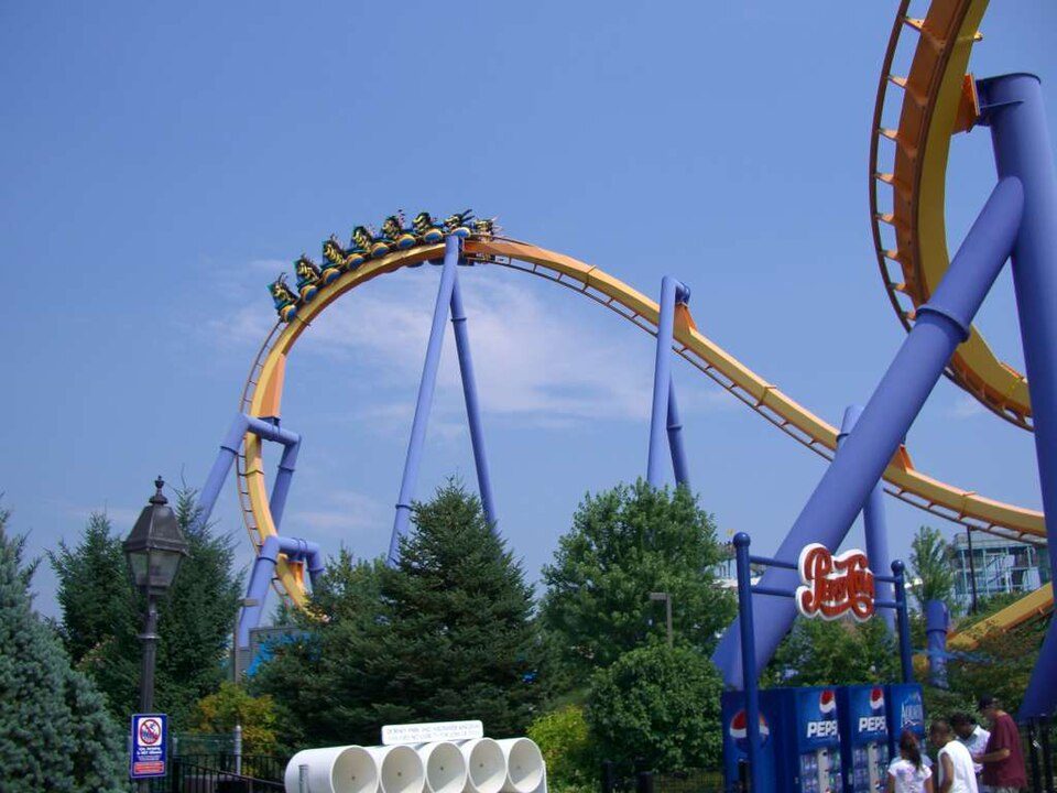 in town Theme parkDorney Park & Wildwater Kingdom
 4 mi Stadium & arenaPPL Center
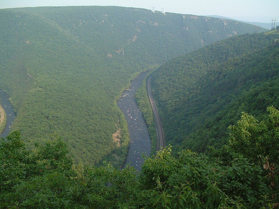 19 mi Park & preserveLehigh River
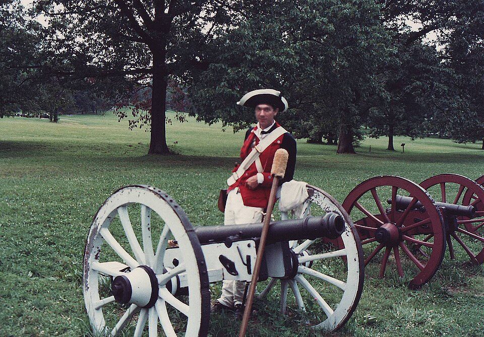 33 mi National Historical ParkValley Forge National Historical Park1.8M visitors a year
 31 mi Park & preserveRoadside America16 mi Ski areaBlue Mountain Resort44 runs · 1,077 ft vertical
Dorney Park & Wildwater Kingdom: Coasterman1234 at en.wikipedia, CC BY-SA 3.0 · PPL Center: Hunter Kahn, CC BY-SA 3.0 · Lehigh River: The original uploader was Malepheasant at English Wikipedia., CC BY-SA 2.0 · Valley Forge National Historical Park: The original uploader was JGHowes at English Wikipedia. (Original text: en:User, Attribution · Roadside America: Mark Fleisher, President and CEO of Aim Advertising in Lewisburg, PA,, Public domain
Cetronia is unincorporated, so Lehigh County and regional agencies provide most services.
EPA SDWIS (Oct 9, 2026) · HIFLD + EIA-861 2025 · Census 2020 ZCTAs · NCES 2024–25 · registration: vote.gov, updated Nov 18, 2024.
Ordered by what stands out in Cetronia.
Most working residents leave Cetronia for work: only 2% work in town. Since 2013, Cetronia has added 843 jobs, to 1,604 in 2023. The top destinations are Allentown (17%), Upper Macungie Township (10%) and South Whitehall Township (8%).
| Cetronia | Pennsylvania towns | U.S. towns | |
|---|---|---|---|
| Working residents who work in town | 1.6% | 6.3% | 8% |
| Below the poverty line | 8.6% | 7.6% | 9.6% |
Census LEHD 2023 · ACS
| Biggest places to walk | Trails | Acres |
|---|---|---|
| 1. Cedar Creek Parkway West | — | 110 |
| 2. Cedar Creek Parkway East | 0.1 mi | 10 |
| 3. Wedgewood Open Space | — | 2 |
Trails & parks © OpenStreetMap contributors · Conserved land: USGS PAD-US
Expected storm and flood damage is lower than in 76% of U.S. communities. Since 1978, 40 flood insurance claims have been paid out in Cetronia.
FEMA flood insurance claims · FEMA National Risk Index · OpenFEMA
Adults 35 to 64 are 47% of residents (38% statewide); adults 18 to 34 are 17% of residents (22% statewide). 44% of adults 25 and older hold a bachelor’s degree or more in Cetronia.
| Cetronia | Pennsylvania towns | U.S. towns | |
|---|---|---|---|
| Median age | 49.1 years | 43.2 years | 40.5 years |
| Bachelor’s degree or more, 25+ | 44% | 29% | 29% |
| Aged 65 or older | 18% | 21% | 18% |
Somewhere between 33% and 62% women
The Census survey reached too few of Cetronia’s residents to say more: its margin here is ±14.6 points. Across Pennsylvania, 50.7% of residents are women.
| Cetronia | PA | U.S. | |
|---|---|---|---|
| Under 10 | 10.7% | 10.8% | 11.6% |
| 10 to 17 | 8% | 9.7% | 10.3% |
| 18 to 24 | 6.7% | 9% | 9.1% |
| 25 to 34 | 9.9% | 13% | 13.7% |
| 35 to 44 | 10.8% | 12.6% | 13.2% |
| 45 to 54 | 21.4% | 11.9% | 12.2% |
| 55 to 64 | 14.7% | 13.6% | 12.7% |
| 65 to 74 | 10% | 11.4% | 10.2% |
| 75 and older | 8% | 8.1% | 7% |
| No diploma | 1.5% | 7.9% | 10.4% |
| High school | 27.9% | 32.9% | 26% |
| Some college | 16.2% | 15.1% | 19.1% |
| Associate’s | 10.2% | 8.9% | 8.8% |
| Bachelor’s | 34.7% | 20.9% | 21.6% |
| Graduate | 9.5% | 14.3% | 14.1% |
U.S. Census Bureau · ACS 2020-2024 5-year estimates · in a town of 2,100, single groups can be off by several points
Cetronia has chilly, snowy winters and warm summers, with plenty of rain. July afternoons reach 87°, January nights drop to 20° and about 33 inches of snow falls in a winter.
NOAA U.S. Climate Normals, 1991–2020
Cetronia beats the Pennsylvania average on 5 of 26 CDC measures and trails it on 2. 14% of Cetronia adults report frequent mental distress.
| Cetronia | Pennsylvania towns | U.S. towns | |
|---|---|---|---|
| Frequent mental distress (CDC PLACES) | 14% | 16% | 17% |
| Sleep under 7 hours (CDC PLACES) | 33% | 38% | 36% |
| Obesity (CDC PLACES) | 31% | 35% | 35% |
| Smoke cigarettes (CDC PLACES) | 14% | 17% | 14% |
| What stands out | Cetronia | PA |
|---|---|---|
| Fewer older adults who have lost all their teeth | 10.1% | 14.5% |
| Fewer smokers | 13.5% | 15.8% |
| More adults who have had cancer | 9.9% | 8.8% |
CDC PLACES 2025 · modeled estimates for adults · CMS · HRSA
Zillow Home Value Index · Redfin Data Center
9 within 15 miles of the center of Cetronia
About 6 of every 100 Cetronia residents are enrolled in college, about the same as Pennsylvania.
Unincorporated community in Pennsylvania, US
Cetronia is a census-designated place (CDP) in South Whitehall Township, Pennsylvania, located near Allentown. As of the 2020 census, its population was 2,421. Cetronia is part of the Lehigh Valley metropolitan area, which had a population of 861,899 and was the 68th-most populous metropolitan area in the U.S. as of the 2020 census.
From Wikipedia, licensed CC BY-SA 4.0 · facts via Wikidata (CC0)
3 towns share a border with Cetronia.
| Town | PA rank | Overall | Cost | Safety | Schools | Health |
|---|---|---|---|---|---|---|
| Cetronia | — | — | — | — | — | — |
| South Whitehall Township | #336 | A− | D | — | A | A− |
| Allentown | #1021 | D | C | C | D | D |
| Dorneyville | — | — | — | — | — | — |
South Whitehall Township reports no FBI crime data of its own. Cetronia and Dorneyville aren’t graded (fewer than 1,000 residents, or not enough data). Compare Cetronia with a neighbor →
Short answers, built from the data on this page.
We don’t grade Cetronia yet; the figures below are still real.


