Beaver dates to 1792, and 57% of its homes were built before 1940
Among the most historic 1% of U.S. towns · #41 of 1,035 in Pennsylvania. What drives it
2 places in town are on the National Register, among them the Matthew S. Quay House, a National Historic Landmark, and a historic district with 1,254 buildings. 2 places in town are on the National Register, among them the Matthew S. Quay House, a National Historic Landmark, and a historic district with 1,254 buildings. Below: 5 old photos and papers, maps from 1886 on, and the census since 1820.
Founding year: Wikidata; Wikipedia’s history section gives the same year. First post office: 1801.The full story ↓
History grade
What drives Beaver’s History grade
On its age, its old homes and the National Register, Beaver is among the most historic 1% of U.S. towns, #41 of 1,035 in Pennsylvania. All 3 inputs are above most U.S. towns; its National Register listings ranks highest and its age lowest.
A+
HistoryA character grade: shown, never part of Beaver’s overall grade.
Pennsylvania towns list about as much on the Register as the country (a typical Pennsylvania town has 2.1 per 10,000 residents, the U.S. 2.4), so Beaver’s 2,869 sits above most of its state (100% of Pennsylvania towns have fewer) while its 1,255 historic buildings outnumber those of 99% of U.S. towns.
How sure. Graded on any two of the three inputs instead, the letter would still be A+. The pre-1940 share is a Census survey estimate (±5.7 points). Two sources give 1792.
Founding year: Wikidata (other dates in Quick answers). Homes: Census ACS 2020–24. National Register: National Park Service, May 2026 list; each listing counted once (boundary changes and added documentation belong to their listing), and a historic district counts its contributing buildings. How TownRatings grades history →
What stands out about Beaver’s past
Read from the archive, the National Register and the record. The page puts what stands out first.
National Park Service, National Register of Historic Places. Photos from Wikimedia Commons, credited on each place’s page.
People over time
Beaver, census by census
Lost half of its people between 1850 and 1860, then grew 5-fold.
21 censuses, 1820–2020.
U.S. Census Bureau decennial counts, from the census table on Beaver’s Wikipedia page.
Every building
Beaver, building by building, 1886–1912
Fire insurance maps drew every building, what it was made of and what it was used for, so insurers could price the risk of fire. Pick a year, then a sheet.
1886Sheet 1 of 1
Edition
Sheets
BrickWoodStone
Sanborn Map Company, via the Library of Congress. Editions published in 1930 or earlier, which are in the public domain.
The area around Beaver was once home to Shawnee Indians, who were later displaced by groups such as the Mingoes and the Lenape. It was part of the Ohio Country that was in dispute during the French and Indian War.
Beaver became the site of Fort McIntosh, a Revolutionary War era Patriot frontier fort. After the war, the fort was the home of the First American Regiment, the oldest active unit in the US Army. The fort was abandoned in 1788 and razed a short time later. By then, the frontier had moved westward and there was no further need for a permanent garrison to protect the area.
Passages that mention Beaver, cut from the printed page as they were published.
History of Beaver County, Pennsylvania1888 · page 504Read the page →
Read the text
A very important portion of this tract on the west side of Big Beaver was known first as " Beaver Point," but subsequently as " Stone's Point." Stephen Stone sold a large number of town lots at this site on the 18th of October, 1831, one range fronting on the bayou that cuts across from Big Beaver to the Ohio river, and another fronting on the alley running parallel with Beaver river. He announced that "all the islandf which lies immediately at the junction of Ohio and Big Beaver will also be laid out in small lots and sold."
Text read by machine from the scan; it may contain errors.
History of Beaver County, Pennsylvania1888 · page 506Read the page →
Read the text
A very important portion of this tract on the west side of Big Beaver was known first as " Beaver Point," but subsequently as " Stone's Point." Stephen Stone sold a large number of town lots at this site on the 18th of October, 1831, one range fronting on the bayou that cuts across from Big Beaver to the Ohio river, and another fronting on the alley running parallel with Beaver river. He announced that "all the islandf which lies immediately at the junction of Ohio and Big Beaver will also be laid out in small lots and sold."
Text read by machine from the scan; it may contain errors.
History of Beaver County, Pennsylvania1888 · page 283Read the page →
Read the text
Whisler and L. W. Keed, after which Mr. Kennedy resumed sole control and published the Star alone until September, ISST, when he sold it to John A. Mellon, of Beaver Falls, who consolidated the Star with the Beaver Falls Glohe, and now continues the publication in Beaver as The Globe and Star. Thus the celestial and the terrestrial have been brought into close union; and the future historian will chronicle the results upon the destiny of Beaver county.
Text read by machine from the scan; it may contain errors.
History of Beaver County, Pennsylvania1888 · page 402Read the page →
Read the text
THIS thriftv borough, which the editor of " Hazartrs Register " for September, 1831, predicted would be, in a few years, the Manchester q/" ^»imc«, is comparatively new as a corporation. Its superior location on the west bank of Big Beaver, about four miles from its mouth; its superior water-power and railroad facilities; and, withal, the active impulse given to its enterprises by its first settlers — which has not been sacrificed by their worthy successors — have made it the metrojiolis of Beaver county, and the mercantile emporium of Beaver valley.
Text read by machine from the scan; it may contain errors.
Scans and text from the Internet Archive. Books published in 1930 or earlier, which are in the public domain.
Timeline
Beaver, 1792 to 1993
Woven from the archive, old maps, post office records, the National Register and the people born here.
Nothing in the archives for these yearsWeddings on Main Street, storms, parades, school pictures, the old store. If it’s in your family album, it belongs here.
Nothing in the archives for these yearsWeddings on Main Street, storms, parades, school pictures, the old store. If it’s in your family album, it belongs here.
In 1792, according to Wikidata and Wikipedia’s history of the town. Beaver’s post office opened in 1801, and the census of 1820 counted 361 people here.
How does Beaver rank for history?
Beaver is among the most historic 1% of U.S. towns, #41 of 1,035 in Pennsylvania. The History grade combines the town’s founding era, the share of homes built before 1940 and its National Register listings. It’s a character grade, so it isn’t part of the overall grade. How it works.
What is on the National Register in Beaver?
Two places: the Matthew S. Quay House (listed 1975) and the Beaver Historic District (1996).
How old are the homes in Beaver?
57% of Beaver’s homes were built before 1940 (Census estimate, ±5.7 points), against a typical 18% for a Pennsylvania town; the median home was built in 1938.
Founding dates: Wikidata, Wikipedia, the U.S. post office records of Blevins & Helbock (CC0) and the Census. Homes by year built: Census ACS 2020–24. National Register of Historic Places: National Park Service (list of May 22, 2026). Old photos, postcards and papers: Wikimedia Commons, the Library of Congress and other public archives, credited on each item’s page. Maps: U.S. Geological Survey historical topographic maps (via Esri) and Sanborn fire-insurance maps (Library of Congress). History text and census tables: Wikipedia (CC BY-SA 4.0). Places that used to be: USGS Geographic Names Information System (2021).
From Wikimedia Commons (11), Wikidata (3), the National Register of Historic Places (2), Wikipedia, Wikidata and Wikipedia for famous people, U.S. Geological Survey historical maps, U.S. Census counts (via Wikipedia), the US Post Offices dataset (Blevins & Helbock), the USGS Geographic Names Information System, Sanborn fire insurance maps (Library of Congress) and old county and town histories (Internet Archive). Archive images are copied here with their credits and licenses, shown on each photo’s page. Refreshed monthly.


 ★ Landmark


 1900
 1973
 1973
 2013
 2009
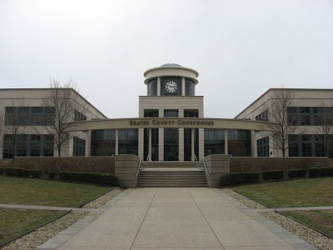 2009
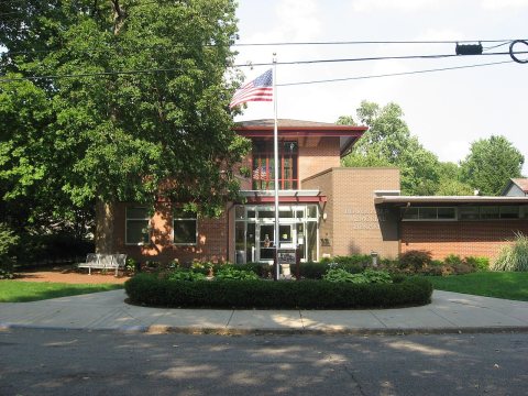 2009
 2006
 2006


