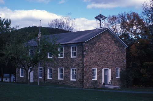
The Beale Township post office opened in 1883, the earliest record of the town by name. Five smaller post offices, Walnut (1833), Academia (1847) and Doyles Mills (1863), opened inside today’s town and later closed.
First census: 744 in 18502020 census: 768143 years
Founding year: the first Beale Township post office (Blevins & Helbock, CC0).The full story ↓
What stands out about Beale Township’s past
Read from the archive, the National Register and the record. The page puts what stands out first.
Beale Township is the location of the Book Site, an archaeological site dating from the Woodland period. It is listed on the National Register of Historic Places. The Academia Pomeroy Covered Bridge and Tuscarora Academy are also listed. The Academia Pomeroy Covered Bridge at 278 feet (85 m) (portal to portal) is the longest remaining covered bridge in Pennsylvania, crossing Tuscarora Creek between Spruce Hill and Beale Townships. It has been owned by the Juniata County Historical Society of Mifflintown since 1962.
Every edition of the U.S. Geological Survey’s map of Beale Township. Tap a year, or press play to watch the town change.
1966Lewistown sheet · 1:24,000
U.S. Geological Survey historical topographic maps (public domain), via Esri’s collection of the scans. The red ring marks the center of Beale Township.
On the National Register
1 historic place in Beale Township
The country’s official list of buildings and places worth saving.
Founding dates: Wikidata, Wikipedia, the U.S. post office records of Blevins & Helbock (CC0) and the Census. Homes by year built: Census ACS 2020–24. National Register of Historic Places: National Park Service (list of May 22, 2026). Old photos, postcards and papers: Wikimedia Commons, the Library of Congress and other public archives, credited on each item’s page. Maps: U.S. Geological Survey historical topographic maps (via Esri) and Sanborn fire-insurance maps (Library of Congress). History text and census tables: Wikipedia (CC BY-SA 4.0). Places that used to be: USGS Geographic Names Information System (2021). How TownRatings grades history →
From Wikidata (1), the National Register of Historic Places (1), Wikipedia, U.S. Geological Survey historical maps, U.S. Census counts (via Wikipedia), the US Post Offices dataset (Blevins & Helbock) and the USGS Geographic Names Information System. Archive images are copied here with their credits and licenses, shown on each photo’s page. Refreshed monthly.