137 years in pictures
Census counts: 332 in 1900, 6,277 in 2020. The archive holds 7 old photos and papers going back to 1913 and 6 maps from 1927 on.
2 places on the National Register of Historic Places.
- 1889Warrenton is platted
Each edition grades its towns against each other only.

Warrenton earns a D, 117th of 142 graded towns in Oregon, mostly because of safety and schools. It reports more crime per resident than 93% of U.S. towns, including 19 violent crimes reported to the FBI in 2025. Its schools rank behind 75% of the state's. What it does well: it has 32 miles of trail. Warrenton’s property crime rate is 36.8 per 1,000 residents, where Oregon’s towns sit at 15.2 and U.S. towns at 9.9. On hazard risk, just 2 of Oregon’s 228 towns do worse. Warrenton is more walkable than 90% of U.S. towns.
Where Warrenton beats most towns, and one thing worth knowing.
4,989 counted in 2010 and 6,277 in 2020; an estimated 6,312 in 2025.
Growth has leveled off: within 1% of 2020, after 25.8% in the decade before.
U.S. Census 2010 & 2020 counts · Census Bureau estimate, July 1, 2025
Each subject compared with towns across the country (schools within Oregon), ordered by how far Warrenton is from typical.
How TownRatings grades towns →
Census counts: 332 in 1900, 6,277 in 2020. The archive holds 7 old photos and papers going back to 1913 and 6 maps from 1927 on.
2 places on the National Register of Historic Places.
Museums, parks, gardens and other places to visit around Warrenton. Close and well known come first.
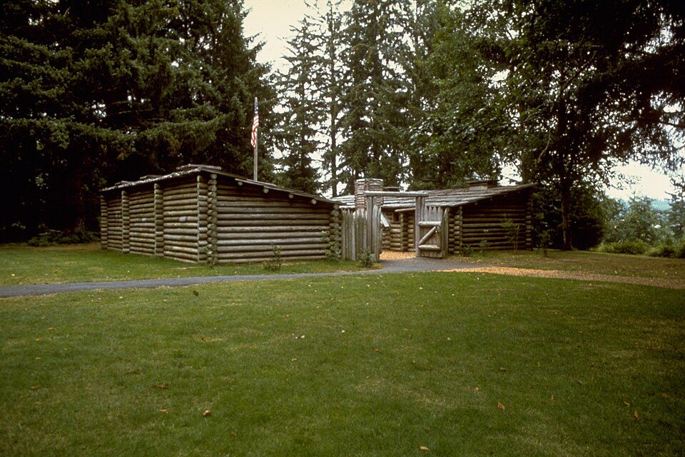
4 mi LandmarkFort Clatsop
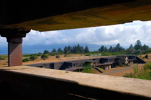
3 mi LandmarkFort Stevens
5 mi LandmarkAstoria Column
17 mi LighthouseTillamook Rock Light
3 mi National Historical ParkLewis and Clark National Historical Park244K visitors a year
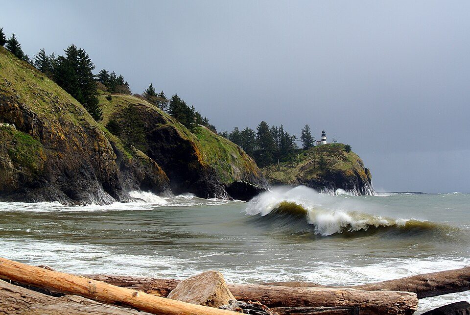
11 mi State parkCape Disappointment State ParkFort Clatsop: Glenn Scofield Williams from USA, CC BY 2.0 · Fort Stevens: Gary Halvorson, Oregon State Archives, Attribution · Astoria Column: The original uploader was Decumanus at English Wikipedia., CC BY-SA 3.0 · Tillamook Rock Light: Jwyoung, CC BY-SA 4.0 · Lewis and Clark National Historical Park: National Park Service Digital Image Archives, Public domain · Cape Disappointment State Park: Adbar, CC BY-SA 3.0
Who provides power, water and the rest in Warrenton, and how to reach them.
EPA SDWIS (Oct 9, 2026) · HIFLD + EIA-861 2025 · Census 2020 ZCTAs · NCES 2024–25 · registration: vote.gov, updated Oct 2, 2026.
Ordered by what stands out in Warrenton.
Warrenton has cooler summers than nearly all U.S. towns, but it carries more natural-hazard risk than most of Oregon (mostly tsunamis) and has homes that cost more against local pay than most of Oregon.
33 miles of trail in 4 parks and preserves. Warrenton’s trail density is 1.9 miles per square mile. Fort Stevens State Park, at 1,667 acres with 14.9 miles of trail, is the biggest park or preserve.
| Biggest places to walk | Trails | Acres |
|---|---|---|
| 1. Fort Stevens State Park | 14.9 mi | 1,667 |
| 2. Skipanon River Park | 0.3 mi | 6 |
| 3. Carruthers Memorial Park | — | 14 |
Trails & parks © OpenStreetMap contributors · Conserved land: USGS PAD-US
Its public schools are run by Warrenton-Hammond SD 30. Two of its 6 schools are below, each with why it’s listed.
| School | Level | Students | Letter |
|---|---|---|---|
| Warrenton Grade SchoolLargest public elementary schoolGrades K–5 | Grades K–5 | 405 | D− |
| Warrenton High SchoolLargest public high schoolGrades 9–12 | Grades 9–12 | 279 | – |
NCES · EDFacts · graded within OR on state tests and graduation
Reported crimes fell from 342 to 252 over the last three FBI years, a drop beyond ordinary year-to-year swings.
The violent crime rate in Warrenton is 3 per 1,000 residents. Warrenton reports more crime per resident than most U.S. towns we grade: about 93% report less.
FBI crime data, 2025 · crimes reported to police
FEMA rates its natural-hazard risk higher than 99% of Oregon towns, with expected losses of about $3,403 per resident a year; that rating is what its D− for hazard risk is built on.
Only 1 of the 142 Oregon towns we compare have a higher FEMA risk score than Warrenton. Since 1979, 2 flood insurance claims have been paid out in Warrenton.
FEMA flood insurance claims · FEMA National Risk Index · OpenFEMA
July afternoons average 66.8°, cooler than in 100% of U.S. towns; January nights average 37.3°.
Warrenton has mild winters and cool summers, with plenty of rain. Among 142 Oregon towns, just 7 have a lower July high than Warrenton. Snow is almost unheard of.
| Warrenton | Oregon towns | U.S. towns | |
|---|---|---|---|
| July high | 67°F | 82°F | 85°F |
| January low | 37°F | 36°F | 22°F |
NOAA U.S. Climate Normals, 1991–2020
Warrenton has about as many jobs (3,041) as working residents, but only 659 people both live and work here. Jobs based here grew from 2,180 in 2013 to 3,041.
About one in 4 of Warrenton’s working residents works in town. Jobs based in Warrenton grew to 3,041 in 2023, 861 more than in 2013. 7% of Warrenton residents live below the poverty line.
| Warrenton | Oregon towns | U.S. towns | |
|---|---|---|---|
| Working residents who work in town | 23% | 9.5% | 8% |
| Average trip to work | 18 minutes | 23 minutes | 25 minutes |
| Below the poverty line | 7% | 11% | 9.6% |
| Median household income | $71,000 | $81,000 | $80,000 |
Census LEHD 2023 · ACS
Warrenton tracks Oregon closely on all 26 CDC measures. 28% of adults have been diagnosed with depression in Warrenton.
| Warrenton | Oregon towns | U.S. towns | |
|---|---|---|---|
| Depression (CDC PLACES) | 28% | 27% | 23% |
| Yearly checkup (CDC PLACES) | 73% | 72% | 79% |
| Sleep under 7 hours (CDC PLACES) | 31% | 32% | 36% |
| Frequent mental distress (CDC PLACES) | 19% | 18% | 17% |
CDC PLACES 2025 · modeled estimates for adults · CMS · HRSA
At 7 years of the Astoria area’s $72K median household income, the typical home (about $503K) costs more against local pay than in 84% of Oregon towns; that ratio is one input to its C− for cost of living.
The typical Warrenton home is worth about $503,000, down 0.6% in a year, close to the Oregon typical home.
| Warrenton | Oregon towns | U.S. towns | |
|---|---|---|---|
| Households that own their home | 60% | 65% | 73% |
| Median rent | $1,305 a month | $1,415 a month | $1,185 a month |
Zillow Home Value Index · Redfin Data Center
1 within 15 miles of the center of Warrenton
About 7 of every 100 Warrenton residents are enrolled in college, about the same as Oregon.
Coastal flooding makes up 12% of the storm damage FEMA expects here.
FEMA National Risk Index · OpenFEMA · OpenStreetMap
City in Oregon, United States
Warrenton is a small, coastal city in Clatsop County, Oregon, United States. Named for D.K. (Daniel Knight) Warren, an early settler, the town is primarily a fishing and logging community. The population was 6,277 according to the 2020 US Census. Warrenton is a less urbanized area close to the Clatsop County seat, Astoria.
From Wikipedia, licensed CC BY-SA 4.0 · facts via Wikidata (CC0)
Short answers, built from the data on this page.
Warrenton grades D overall, better than 7% of U.S. towns and #117 of 142 in Oregon. It grades B for health, D for safety and C for schools. Hazard risk is its weak spot, with a D−.
Yes. Cost of living, which also weighs rents, property taxes and how many households pay 30% or more of their income for housing, grades C−.