98 years in pictures
Census counts: 723 in 1980, 1,515 in 2020. The archive holds 12 old photos and papers going back to 1927 and 3 maps from 1941 on.
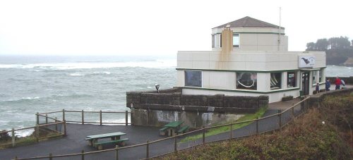
2 places on the National Register of Historic Places.
- 1928Depoe Bay is settled
Each edition grades its towns against each other only.

The best of Depoe Bay’s subject grades is an A for walkability; the weakest is a D for cost of living. Depoe Bay’s July high is 65°F, where Oregon’s towns sit at 82°F and U.S. towns at 85°F. Among 143 Oregon towns, just 8 have a higher January low than Depoe Bay. Depoe Bay’s trail density is 2.6 miles per square mile, above both the Oregon town median (0.8) and the median of U.S. towns (0.4). Depoe Bay has 2 places on the National Register of Historic Places, among them Depoe Bay Ocean Wayside. Depoe Bay has fewer than 2,500 residents, so it gets subject grades but no overall grade.
Where Depoe Bay beats most towns.
Where Depoe Bay’s working residents go each day. Line width shows the share.
Census LEHD 2023
Each subject compared with towns across the country (schools within Oregon), ordered by how far Depoe Bay is from typical.
How TownRatings grades towns →
Census counts: 723 in 1980, 1,515 in 2020. The archive holds 12 old photos and papers going back to 1927 and 3 maps from 1941 on.
2 places on the National Register of Historic Places.
Who provides power, water and the rest in Depoe Bay, and how to reach them.
EPA SDWIS (Oct 9, 2026) · HIFLD + EIA-861 2025 · Census 2020 ZCTAs · NCES 2024–25 · registration: vote.gov, updated Oct 2, 2026.
Ordered by what stands out in Depoe Bay.
People 65 and older are 36% of residents (19% statewide); children under 18 are 9% of residents (20% statewide). The median age in Depoe Bay is 56.1 years. 43% of adults 25 and older have a bachelor’s degree or more, vs 37% across Oregon.
| Depoe Bay | Oregon towns | U.S. towns | |
|---|---|---|---|
| Median age | 56.1 years | 39.4 years | 40.5 years |
| Bachelor’s degree or more, 25+ | 43% | 27% | 29% |
55% women, 45% men
That’s an even split within the survey’s margin of ±7.1 points. Across Oregon, 50.1% of residents are women.
| Depoe Bay | OR | U.S. | |
|---|---|---|---|
| Under 10 | 7.3% | 10.3% | 11.6% |
| 10 to 17 | 1.7% | 9.6% | 10.3% |
| 18 to 24 | 5.4% | 8.5% | 9.1% |
| 25 to 34 | 10.6% | 14% | 13.7% |
| 35 to 44 | 11% | 14.1% | 13.2% |
| 45 to 54 | 9.9% | 12.3% | 12.2% |
| 55 to 64 | 18.5% | 12.2% | 12.7% |
| 65 to 74 | 19.9% | 11.5% | 10.2% |
| 75 and older | 15.6% | 7.6% | 7% |
| No diploma | 1.3% | 8.2% | 10.4% |
| High school | 21.5% | 22.4% | 26% |
| Some college | 24.5% | 23.5% | 19.1% |
| Associate’s | 9.2% | 9.1% | 8.8% |
| Bachelor’s | 19.9% | 22.7% | 21.6% |
| Graduate | 23.5% | 14.1% | 14.1% |
U.S. Census Bureau · ACS 2020-2024 5-year estimates · in a town of 1,500, single groups can be off by several points
Most working residents leave Depoe Bay for work: only 12% work in town. The top destinations are Lincoln City (14%), Newport (11%) and Portland (10%). Half commute less than 42 miles.
| Depoe Bay | Oregon towns | U.S. towns | |
|---|---|---|---|
| Below the poverty line | 8% | 11% | 9.6% |
| Working residents who work in town | 12% | 9.8% | 8% |
| Median household income | $85,000 | $81,000 | $80,000 |
| Average trip to work | 24 minutes | 23 minutes | 25 minutes |
Census LEHD 2023 · ACS
Expected storm and flood damage is higher than in 77% of U.S. communities. Since 1979, 2 flood insurance claims have been paid out in Depoe Bay.
FEMA flood insurance claims · FEMA National Risk Index · OpenFEMA
Depoe Bay has mild winters and cool summers, with plenty of rain. July afternoons reach 65°, January nights drop to 40° and snow is almost unheard of.
NOAA U.S. Climate Normals, 1991–2020
5.6% of adults 18 to 64 have no health insurance in Depoe Bay. Among 143 Oregon towns, just 4 have a higher share of adults who had a checkup this year than Depoe Bay. 42% of adults have high blood pressure in Depoe Bay.
| Depoe Bay | Oregon towns | U.S. towns | |
|---|---|---|---|
| High blood pressure (CDC PLACES) | 42% | 33% | 35% |
| Binge drink (CDC PLACES) | 12% | 15% | 16% |
| Frequent mental distress (CDC PLACES) | 15% | 18% | 17% |
| Yearly checkup (CDC PLACES) | 80% | 72% | 79% |
| What stands out | Depoe Bay | OR |
|---|---|---|
| Fewer uninsured adults | 5.6% | 8.5% |
| Fewer binge drinkers | 12.4% | 15.4% |
| More adults who have had cancer | 13.9% | 8.9% |
CDC PLACES 2025 · modeled estimates for adults · CMS · HRSA
The typical Depoe Bay home is worth about $553,000, down 0.8% in a year, 12% above the Oregon typical home. Depoe Bay’s median rent is $1,622 a month.
| Depoe Bay | Oregon towns | U.S. towns | |
|---|---|---|---|
| Households that own their home | 81% | 65% | 73% |
| Median rent | $1,622 a month | $1,414 a month | $1,185 a month |
Census ACS, 2020–24 · Zillow Home Value Index · Redfin Data Center
| Biggest places to walk | Trails | Acres |
|---|---|---|
| 1. Oregon Islands National Wildlife Refuge | — | 12 |
| 2. Depoe Bay City Park | 0.1 mi | 4 |
| 3. Whale Cove Marine Conservation Area | — | 4 |
Trails & parks © OpenStreetMap contributors · Conserved land: USGS PAD-US
1 within 15 miles of the center of Depoe Bay
About 3 of every 100 Depoe Bay residents are enrolled in college, against 6 across Oregon.
2 places in Depoe Bay on the National Register of Historic Places.
City in Oregon, United States
Depoe Bay is a city in Lincoln County, Oregon, United States, located on U.S. Route 101 on the Pacific Ocean. As of the 2020 census, Depoe Bay had a population of 1,515. The bay of the same name is a 6-acre (2.4 ha) harbor that the city promotes as the world's smallest navigable harbor.
From Wikipedia, licensed CC BY-SA 4.0 · facts via Wikidata (CC0)
Short answers, built from the data on this page.
Yes. That is 8.8 years of the area's median household income ($63,165 across the Newport, OR area). Cost of living, which also weighs rents, property taxes and how many households pay 30% or more of their income for housing, grades D.