
Crooked River Ranch - DPLA - 0a831f6a0df56635c571d63fe408d493, 2019
Crooked River Ranch’s story
Crooked River Ranch in pictures
The archive holds 6 old photos and papers going back to 2019 and 3 maps from 1962 on.
Explore the history →Each edition grades its towns against each other only.
A town of 5,160.
Most errands need a car: it is less walkable than 97% of U.S. towns. Overall it grades C−, ranked 88th of 142 in Oregon. Its weakest subject is hazard risk: FEMA rates its natural-hazard risk higher than 74% of U.S. communities, with wildfire at the top. 33% of residents are 65 or older in Crooked River Ranch, above both Oregon’s towns (18%) and U.S. towns (18%). Only 6 of Oregon’s 228 towns score lower on history. The biggest place to walk is Deschutes Canyon-Steelhead Falls Wilderness Study Area, 1,099 acres with 4.4 miles of trail.
Where Crooked River Ranch’s working residents go each day. Line width shows the share.
Census LEHD 2023
Each subject compared with towns across the country (schools within Oregon), ordered by how far Crooked River Ranch is from typical.
How TownRatings grades towns →
The archive holds 6 old photos and papers going back to 2019 and 3 maps from 1962 on.
Explore the history →Crooked River Ranch is unincorporated, so Deschutes County and regional agencies provide most services.
EPA SDWIS (Oct 9, 2026) · HIFLD + EIA-861 2025 · Census 2020 ZCTAs · NCES 2024–25 · registration: vote.gov, updated Oct 2, 2026.
Ordered by what stands out in Crooked River Ranch.
Crooked River Ranch has a shorter frost-free season than nearly all U.S. towns and sends most of its workers to Redmond and beyond.
Walkers can cover 23 miles of trail in 2 parks and preserves. Crooked River Ranch’s concentration of trails stands at 1.1 miles per square mile.
| Biggest places to walk | Trails | Acres |
|---|---|---|
| 1. Deschutes Canyon-Steelhead Falls Wilderness Study Area | 4.4 mi | 1,099 |
| 2. Panorama Park | 1.6 mi | 87 |
Trails & parks © OpenStreetMap contributors · Conserved land: USGS PAD-US
Crooked River Ranch has 211 jobs for its 1,868 working residents: even if every job went to a resident, most would still commute out. The average commute takes 32.1 minutes, against 23 across Oregon.
Employers in Crooked River Ranch added 89 jobs between 2013 and 2023, to 211. Most working residents leave Crooked River Ranch for work: only 6% work in town. Also worth knowing: the average commute locally is 32 minutes. The median commute is under 24 miles.
| Crooked River Ranch | Oregon towns | U.S. towns | |
|---|---|---|---|
| Average trip to work | 32 minutes | 23 minutes | 25 minutes |
| Working residents who work in town | 5.5% | 10% | 8% |
| Median household income | $86,000 | $81,000 | $80,000 |
Census LEHD 2023 · ACS
Of the losses FEMA expects in Crooked River Ranch, 49% come from wildfires and 36% from inland flooding.
FEMA National Risk Index · OpenFEMA
The Madras 2 N weather station, 18 miles away, records that the frost-free season runs about 136 days, shorter than in 99% of U.S. towns. January nights average 25.7°: milder than most of the country, but colder than 79% of Oregon places with climate records; July afternoons average 86.5°.
For Crooked River Ranch, the January low is 26°F. About 14 inches of snow falls in a winter.
| Crooked River Ranch | Oregon towns | U.S. towns | |
|---|---|---|---|
| July high | 87°F | 82°F | 85°F |
| January low | 26°F | 36°F | 22°F |
NOAA U.S. Climate Normals, 1991–2020
Just over two fifths of Crooked River Ranch adults have high blood pressure. On the CDC’s 26 measures, Crooked River Ranch is ahead of Oregon on 7 and behind on 8. Among adults locally, 13% binge drink and 30% sleep under 7 hours. Only 8 of the 142 Oregon towns we compare have a higher share of adults who had a checkup this year than Crooked River Ranch.
| Crooked River Ranch | Oregon towns | U.S. towns | |
|---|---|---|---|
| High blood pressure (CDC PLACES) | 41% | 33% | 35% |
| Binge drink (CDC PLACES) | 13% | 15% | 16% |
| Sleep under 7 hours (CDC PLACES) | 30% | 32% | 36% |
| Frequent mental distress (CDC PLACES) | 15% | 18% | 17% |
| What stands out | Crooked River Ranch | OR |
|---|---|---|
| Fewer uninsured adults | 6.3% | 8.5% |
| More adults screened for colon cancer | 73.4% | 63.4% |
| More adults who have had cancer | 13.3% | 8.9% |
CDC PLACES 2025 · modeled estimates for adults · CMS · HRSA
Museums, parks, gardens and other places to visit around Crooked River Ranch. Close and well known come first.
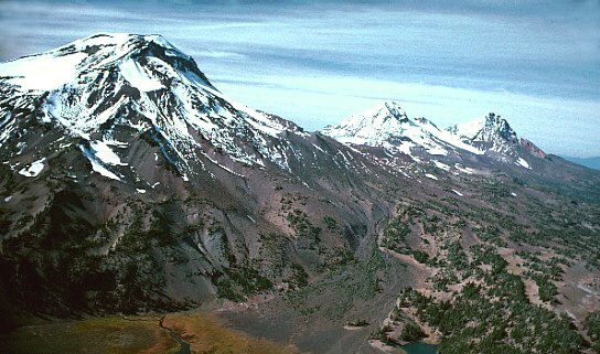 33 mi MountainThree Sisters
 8 mi State parkSmith Rock State Park36 mi Ski areaMt. Bachelor128 runs · 3,233 ft vertical
 18 mi MuseumErickson Aircraft Collection
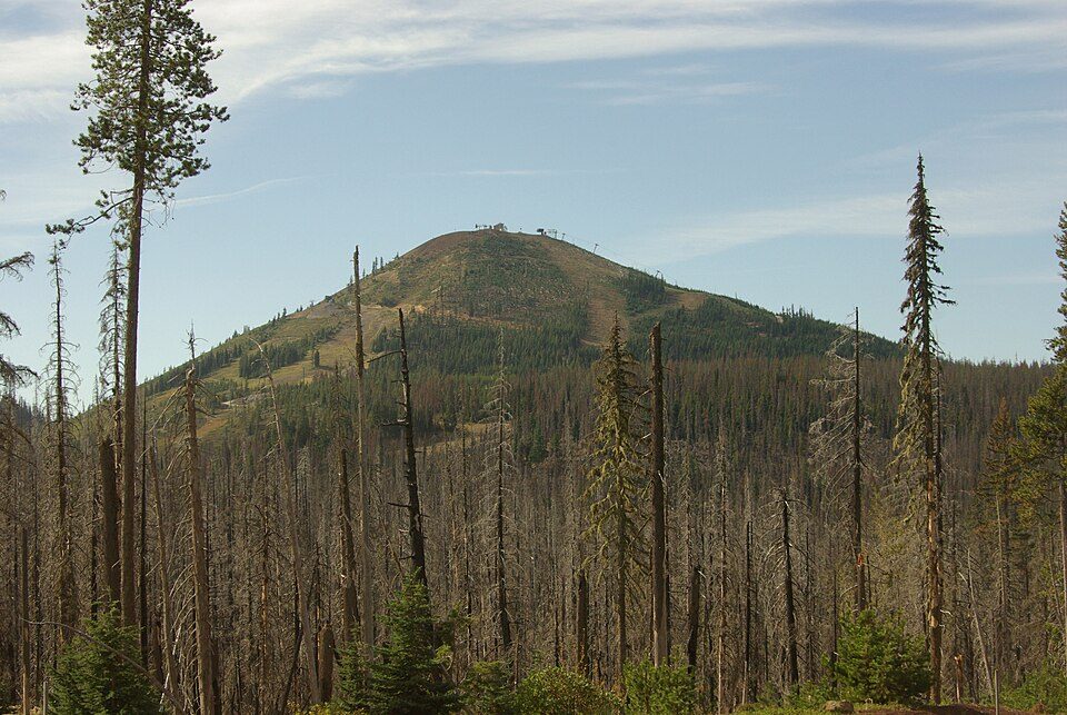 30 mi Ski areaHoodoo Ski Area47 runs · 1,002 ft vertical
 15 mi MuseumPetersen Rock Garden
Three Sisters: USGS photo by Lyn Topinka, Public domain · Smith Rock State Park: Max Schwarz, CC BY-SA 2.5 · Erickson Aircraft Collection: Orygun, CC BY 4.0 · Hoodoo Ski Area: Rvannatta, CC BY-SA 3.0 · Petersen Rock Garden: Another Believer, CC BY-SA 3.0
None within 15 miles of Crooked River Ranch; the nearest are
About 2 of every 100 Crooked River Ranch residents are enrolled in college, against 6 across Oregon.
Unincorporated community in the state of Oregon, United States
Crooked River Ranch is an unincorporated community and census-designated place (CDP) in southern Jefferson County, Oregon, United States. A small portion of the ranch is also in north Deschutes County. The Ranch is located between the Deschutes River and the Crooked River near the south end of Lake Billy Chinook. It is west of U.S. Route 97 between Culver and Terrebonne. Amenities in the community include a golf course, swimming pool, tennis courts, saloon, disc golf course, horse riding arena and general store. The ranch is approximately 12,000 acres, and as of the 2020 census had a population of 4,912. It is the largest homeowner association in Oregon. Crooked River Ranch has a Terrebonne…
From Wikipedia, licensed CC BY-SA 4.0 · facts via Wikidata (CC0)
Short answers, built from the data on this page.
Crooked River Ranch grades C− overall, better than 18% of U.S. towns and #88 of 142 in Oregon. It grades B for health and B+ for schools. Walkability is its weak spot, with a D−.
Yes. Cost of living, which also weighs rents, property taxes and how many households pay 30% or more of their income for housing, grades C−.


