Bayside GardensOR
A town of 1,128.
Is Bayside Gardens a good place to live?
The best of Bayside Gardens’ subject grades are a B+ for the outdoors and schools; the weakest is a D for hazard risk. Bayside Gardens’ typical July afternoon high is 67°F, against 82°F in Oregon’s towns and 85°F across U.S. towns. Only 21 of Oregon’s 228 towns score higher on cost of living. Most errands need a car: it is less walkable than 68% of U.S. towns. The biggest park or preserve is Sitka Wetlands, at 23 acres. Bayside Gardens has fewer than 2,500 residents, so it gets subject grades but no overall grade.
1,128 people, and everyone knows the way
In a town this size, neighbors are the best guide. Ask them anything.
How Bayside Gardens grades
Each subject compared with towns across the country (schools within Oregon), ordered by how far Bayside Gardens is from typical.
How TownRatings grades towns →
Moving to Bayside Gardens: who provides what
Bayside Gardens is unincorporated, so Tillamook County and regional agencies provide most services.
EPA SDWIS (Oct 9, 2026) · HIFLD + EIA-861 2025 · Census 2020 ZCTAs · NCES 2024–25 · registration: vote.gov, updated Oct 2, 2026.
The data
Ordered by what stands out in Bayside Gardens.
Bayside Gardens has 0.1 jobs per working resident, so most workers leave town for work
The share of residents in Bayside Gardens who live below the poverty line is 15%, above both the Oregon town median (11%) and the median of U.S. towns (9.6%). Commuting out is the norm locally: 1% of working residents work locally. Bayside Gardens’ mean commuting time is 18 minutes. The top destinations are Portland (13%), Manzanita (12%) and Nehalem (6%).
| Bayside Gardens | Oregon towns | U.S. towns | |
|---|---|---|---|
| Average trip to work | 18 minutes | 23 minutes | 25 minutes |
| Below the poverty line | 15% | 11% | 9.6% |
| Working residents who work in town | 1.4% | 9.8% | 8% |
Where working residents work
Census LEHD 2023 · ACS
Natural hazards: high risk in Bayside Gardens, mostly earthquakes
Compared with 78% of U.S. communities, expected storm and flood damage in Bayside Gardens is higher. Of the losses FEMA expects locally, 46% come from earthquakes and 42% from inland flooding.
FEMA National Risk Index · OpenFEMA
Bayside Gardens stands out in Oregon and nationally: a smaller share of its adults sleep under 7 hours
Among adults in Bayside Gardens, 24% have been diagnosed with depression. Only 10 of the 143 Oregon towns we compare have a lower share of adults who binge drink than Bayside Gardens. On the CDC’s 26 measures, Bayside Gardens is ahead of Oregon on 8 and behind on 8.
| Bayside Gardens | Oregon towns | U.S. towns | |
|---|---|---|---|
| Sleep under 7 hours (CDC PLACES) | 26% | 32% | 36% |
| Binge drink (CDC PLACES) | 13% | 15% | 16% |
| Frequent mental distress (CDC PLACES) | 15% | 18% | 17% |
| High blood pressure (CDC PLACES) | 40% | 33% | 35% |
| What stands out | Bayside Gardens | OR |
|---|---|---|
| Fewer older adults who have lost all their teeth | 8.4% | 12.5% |
| Fewer binge drinkers | 12.6% | 15.4% |
| More adults who have had cancer | 13.2% | 8.9% |
CDC PLACES 2025 · modeled estimates for adults · CMS · HRSA
Mild winters and pleasant summers in Bayside Gardens
Among 143 Oregon towns, just 10 have a higher January low than Bayside Gardens. July afternoons reach 67°, January nights drop to 38° and about 1 inches of snow falls in a winter.
Typical low → high °F
NOAA U.S. Climate Normals, 1991–2020
Open space protected for good: 5.9% of Bayside Gardens
Across 5 parks and preserves: 1.1 miles of trail. Parks and preserves in Bayside Gardens: 5, covering 46 acres.
| Bayside Gardens | Oregon towns | U.S. towns | |
|---|---|---|---|
| Miles of trail per square mile | 1.1 miles per square mile | 0.8 | 0.4 |
| Conserved land | 5.9% | 4.4% | 4.3% |
| Biggest places to walk | Trails | Acres |
|---|---|---|
| 1. Sitka Wetlands | 0.1 mi | 23 |
| 2. Tohl Meadows | 0.1 mi | 9 |
| 3. Elk Meadows Park | 0.1 mi | 6 |
Trails & parks © OpenStreetMap contributors · Conserved land: USGS PAD-US
Tillamook Rock Light and 12 more within 40 miles
Museums, parks, gardens and other places to visit around Bayside Gardens. Close and well known come first.
 16 mi LighthouseTillamook Rock Light
 29 mi LandmarkFort Clatsop
 21 mi MuseumTillamook Air Museum
 15 mi State parkEcola State Park
 10 mi Scenic railwayOregon Coast Scenic Railroad
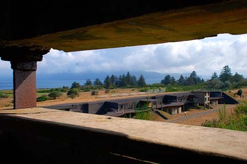 34 mi LandmarkFort Stevens
Photo credits
Tillamook Rock Light: Jwyoung, CC BY-SA 4.0 · Fort Clatsop: Glenn Scofield Williams from USA, CC BY 2.0 · Tillamook Air Museum: Semifamous at English Wikipedia, Public domain · Ecola State Park: Brmuchim (talk), CC BY-SA 3.0 · Oregon Coast Scenic Railroad: Rich gitsch, CC BY-SA 4.0 · Fort Stevens: Gary Halvorson, Oregon State Archives, Attribution


Everything we know about Bayside Gardens
Colleges nearby
None within 15 miles of Bayside Gardens; the nearest are
About 0 of every 100 Bayside Gardens residents are enrolled in college, against 6 across Oregon.
99% of working residents leave Bayside Gardens for work
Where Bayside Gardens’s working residents go each day. Line width shows the share.
Census LEHD 2023
About Bayside Gardens
Unincorporated community in the state of Oregon, United States
Bayside Gardens is an unincorporated community in Tillamook County, Oregon, United States. It lies along Route 101 between Manzanita and Nehalem and borders Nehalem Bay. For statistical purposes, the United States Census Bureau has defined Bayside Gardens as a census-designated place (CDP). The census definition of the area may not precisely correspond to local understanding of the area with the same name. As of the 2020 census, Bayside Gardens had a population of 1,214.
From Wikipedia, licensed CC BY-SA 4.0 · facts via Wikidata (CC0)
- Area
- 0.6 sq mi
- Elevation
- 72 ft
- Area code
- 503
Questions about Bayside Gardens
Short answers, built from the data on this page.
Is Bayside Gardens, OR expensive?
Cost of living, which also weighs rents, property taxes and how many households pay 30% or more of their income for housing, grades B−.