Cameron’s post office opened in 1888, and 1 of its places is on the National Register
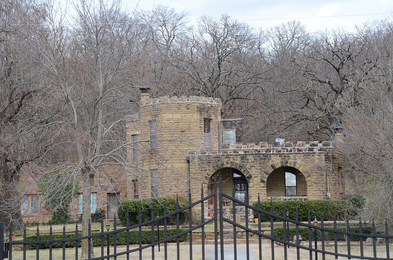
Most of Cameron was built recently: 5% of its homes predate 1940 and the median home dates from 1980. Its Register listing is the James E. Reynolds House. Its Register listing is the James E. Reynolds House. Below: maps from 1899 on and the census since 1900.
Every edition of the U.S. Geological Survey’s map of Cameron. Tap a year, or press play to watch the town change.
1900Sallisaw sheet · 1:125,000
U.S. Geological Survey historical topographic maps (public domain), via Esri’s collection of the scans. The red ring marks the center of Cameron.
Every building
Cameron, building by building, 1899–1913
Fire insurance maps drew every building, what it was made of and what it was used for, so insurers could price the risk of fire. Pick a year, then a sheet.
1899Sheet 1 of 1
Edition
Sheets
BrickWoodStone
Sanborn Map Company, via the Library of Congress. Editions published in 1930 or earlier, which are in the public domain.
When the Fort Smith and Southern Railway laid tracks in the area of the present day town of Cameron in 1886–87, there was already a settlement of about 40 people. At the time of its founding, Cameron was located in Skullyville County, a part of the Moshulatubbee District of the Choctaw Nation. The U. S. Post Office Department established a post office that it named Cameron, Indian Territory in 1888.
According to Encyclopedia of Oklahoma History and Culture, the post office and town may have been named for either of two persons. One was William Cameron, a former Mine Inspector for Indian Territory. The other was James Cameron, an employee of the Fort Smith and Southern Railway.
Founding dates: Wikidata, Wikipedia, the U.S. post office records of Blevins & Helbock (CC0) and the Census. Homes by year built: Census ACS 2020–24. National Register of Historic Places: National Park Service (list of May 22, 2026). Old photos, postcards and papers: Wikimedia Commons, the Library of Congress and other public archives, credited on each item’s page. Maps: U.S. Geological Survey historical topographic maps (via Esri) and Sanborn fire-insurance maps (Library of Congress). History text and census tables: Wikipedia (CC BY-SA 4.0). Places that used to be: USGS Geographic Names Information System (2021). How TownRatings grades history →
From Wikimedia Commons (4), the National Register of Historic Places (1), Wikipedia, U.S. Geological Survey historical maps, U.S. Census counts (via Wikipedia), the US Post Offices dataset (Blevins & Helbock), the USGS Geographic Names Information System and Sanborn fire insurance maps (Library of Congress). Archive images are copied here with their credits and licenses, shown on each photo’s page. Refreshed monthly.



 2024
 2024
 2018
 2004