Van Wert’s post office opened in 1838, and 33% of its homes were built before 1940
More historic than 96% of U.S. towns · #49 of 993 in Ohio. What drives it
5 places in town are on the National Register, among them a historic district with 72 buildings. Below: 17 old photos and papers, maps from 1884 on, and the census since 1850.
Founding year: the first Van Wert post office (Blevins & Helbock, CC0). Wikidata: 1848.The full story ↓
History grade
What drives Van Wert’s History grade
On its age, its old homes and the National Register, Van Wert is more historic than 96% of U.S. towns, #49 of 993 in Ohio. All 3 inputs are above most U.S. towns; its National Register listings ranks highest and its age lowest.
A+
HistoryA character grade: shown, never part of Van Wert’s overall grade.
Ohio towns list about as much on the Register as the country (a typical Ohio town has 2.9 per 10,000 residents, the U.S. 2.4), so Van Wert’s 88.0 sits above most of its state (92% of Ohio towns have fewer) while its 95 historic buildings outnumber those of 89% of U.S. towns.
How sure. Graded on any two of the three inputs instead, the letter would range from A to A+. The pre-1940 share is a Census survey estimate (±3.8 points). The founding year is the first post office, not a stated founding date; Wikidata’s 1848 falls in the same era, so the grade doesn’t depend on which one is used.
Founding year: the first post office (other dates in Quick answers). Homes: Census ACS 2020–24. National Register: National Park Service, May 2026 list; each listing counted once (boundary changes and added documentation belong to their listing), and a historic district counts its contributing buildings. How TownRatings grades history →
What stands out about Van Wert’s past
Read from the archive, the National Register and the record. The page puts what stands out first.
Nothing in the archives for these yearsWeddings on Main Street, storms, parades, school pictures, the old store. If it’s in your family album, it belongs here.
Van Wert was surveyed in 1824 by Captain James Riley, who was contracted by the government to survey lands purchased from Native Americans under a treaty in 1818. It was incorporated as a town in 1848 and was chartered as a city in 1903.
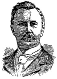
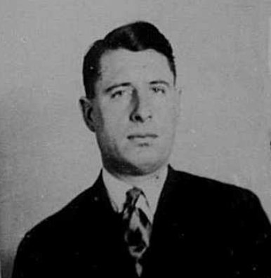
The town is located in an area originally known as the Black Swamp. Early pioneers had to deal with swampy ground, mud, and malaria. They persevered, draining the swamp for agriculture and eventually reclaiming enough dry land to establish the town. Van Wert was the birthplace of aviation pioneer Walter Hinton and the famous baritone Charles W. Clark.
Passages that mention Van Wert, cut from the printed page as they were published.
HISTORY OF VAN WERT AND MERCER COUNTIES, OHIO SUTTON 18821882 · page 188Read the page →
Read the text
In the spring of 1853 he moved his family to this county, and located on a farm one and a half miles south of Van Wert. He again turned his attention to farming, which he followed one year. In 1854 he moved to Van Wert and was employed by the Ohio and Indiana Railroad, but now called the Pittsburgh, Fort Wayne and Chicago Railroad, as road master.’ He had charge of the road from Van Wert to Lima, but afterwards from Van Wert to Fort Wayne, for four years, and then resigned.
Text read by machine from the scan; it may contain errors.
HISTORY OF VAN WERT AND MERCER COUNTIES, OHIO SUTTON 18821882 · page 163Read the page →
Read the text
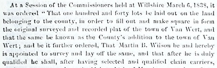
At a Session of the Commissioners held at Willshire March 6, 1838, it was ordered “ That one hundred and forty lots be laid out on the land belonging to the county, in order to fill out and make square in form the original surveyed and recorded plat of the town of Van Wert, and that the same be known as the County’s addition to the town of Van Wert; and be it further ordered, That Martin B. Wilson be and hereby is appointed to survey and lay off the same, and that after he is duly qualified he shall, after having selected and qualified chain carriers,
Text read by machine from the scan; it may contain errors.
History of Van Wert and Mercer counties, Ohio, with illustrations and biographical sketches of some of its prominent men and pioneers1882Read the page →
Read the text
Ata Session of the Commissioners held at Willshire March 6.1838, it was ordered “ Vhat one hundred and forty lots be laid out on the land belonging to the county, in order to fill out and make square in form the original surveyed and recorded plat of the town of Van Wert, and that the same be known as the Connty’s addition to the town of Van Wert; and be it further ordered, That’ Martin B. Wiison be and hereby is appointed to survey und lay off the same, and that after he is duly qualified be shall, after having selected and qualified chain carriers,
Text read by machine from the scan; it may contain errors.
History of Van Wert and Mercer counties, Ohio, with illustrations and biographical sketches of some of its prominent men and pioneers1882Read the page →
Read the text
Revs. Nicbolai and Fox Iubored unsuecessfully, but their successors, Revs. Kronemiller and Strickler, succecded in boo ta oresuizine a Chass. ; Jn ISTE. several members having moved into the town of Van Wert, Revo BP. Beth organized a eluss of erolit persons. About Psa the class north of Van Wert, ia the Mohr setthement, buikt a chavel whieh cost S600, Tn US72 the elass tn Van Wert bolt a charel which cost 82100, and the class in the Tlertel settlement. south of Van Wert. lilt oa
Text read by machine from the scan; it may contain errors.
Scans and text from the Internet Archive. Books published in 1930 or earlier, which are in the public domain.
Timeline
Van Wert, 1838 to 1985
Woven from the archive, old maps, post office records, the National Register and the people born here.
Every edition of the U.S. Geological Survey’s map of Van Wert. Tap a year, or press play to watch the town change.
1914Van Wert sheet · 1:62,500
U.S. Geological Survey historical topographic maps (public domain), via Esri’s collection of the scans. The red ring marks the center of Van Wert.
Every building
Van Wert, building by building, 1884–1914
Fire insurance maps drew every building, what it was made of and what it was used for, so insurers could price the risk of fire. Pick a year, then a sheet.
The Van Wert post office opened in 1838, the earliest record of the town by name (U.S. post office records). Wikidata gives 1848.
How does Van Wert rank for history?
Van Wert is more historic than 96% of U.S. towns, #49 of 993 in Ohio. The History grade combines the town’s founding era, the share of homes built before 1940 and its National Register listings. It’s a character grade, so it isn’t part of the overall grade. How it works.
What is on the National Register in Van Wert?
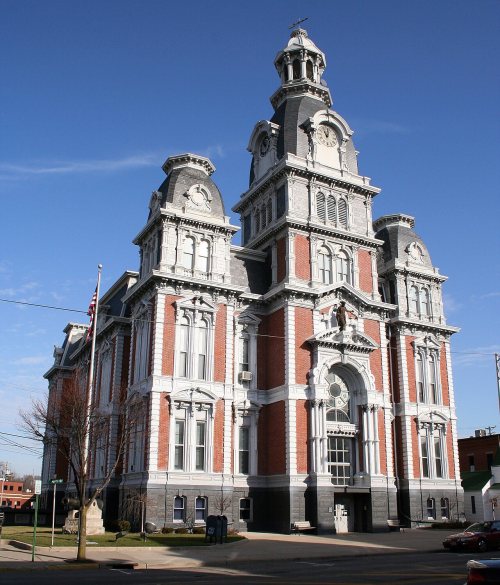
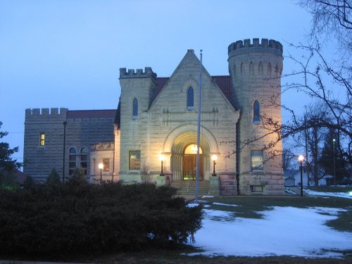
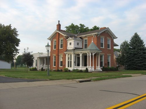
5 listings: 3 buildings, among them the Van Wert County Courthouse (listed 1974, the first), 1 historic district, the Downtown Van Wert Historic District, with 72 contributing buildings, and 1 structure. 95 historic buildings in all.
How old are the homes in Van Wert?
33% of Van Wert’s homes were built before 1940 (Census estimate, ±3.8 points), against a typical 15% for an Ohio town; the median home was built in 1956.
Founding dates: Wikidata, Wikipedia, the U.S. post office records of Blevins & Helbock (CC0) and the Census. Homes by year built: Census ACS 2020–24. National Register of Historic Places: National Park Service (list of May 22, 2026). Old photos, postcards and papers: Wikimedia Commons, the Library of Congress and other public archives, credited on each item’s page. Maps: U.S. Geological Survey historical topographic maps (via Esri) and Sanborn fire-insurance maps (Library of Congress). History text and census tables: Wikipedia (CC BY-SA 4.0). Places that used to be: USGS Geographic Names Information System (2021).
From Wikimedia Commons (17), Wikidata (1), the National Register of Historic Places (5), Wikipedia, Wikidata and Wikipedia for famous people, U.S. Geological Survey historical maps, U.S. Census counts (via Wikipedia), the US Post Offices dataset (Blevins & Helbock), the USGS Geographic Names Information System, Sanborn fire insurance maps (Library of Congress) and old county and town histories (Internet Archive). Archive images are copied here with their credits and licenses, shown on each photo’s page. Refreshed monthly.



 1868
 1907
 1907
 1909
 1909
 1909
 1909
 1909
 1910
 1910
 1910
 1910
 1912
 1912
 1914
 1917
 1917