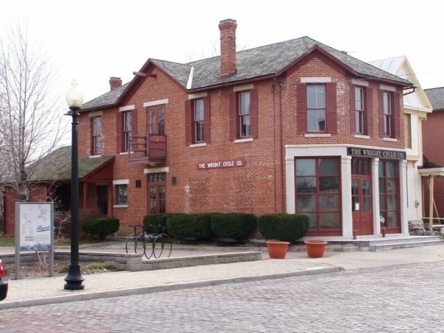
160 years in pictures
Census counts: 42 in 1870, 23,070 in 2020. The archive holds 1 old photo or paper and 6 maps from 1905 on.
2 places on the National Register of Historic Places.
- 1866Trotwood is settled

Each edition grades its towns against each other only.

A town of 23,190, settled in 1866.
Trotwood earns a D, 971st among Ohio's 987 graded towns, mostly because of health and safety. CDC estimates put its residents' health behind 94% of the country. Its police reported 154 violent crimes reported to the FBI in 2025, a higher rate per resident than 92% of U.S. towns. One bright spot: it has 27 miles of trail. Trotwood’s violent crime rate is 6.7 per 1,000 residents, against 1.2 in Ohio’s towns and 1.6 across U.S. towns. On walkability, just 64 of Ohio’s 1,718 towns do better. Trotwood is home to United Theological Seminary.
Where Trotwood beats most towns, and one thing worth knowing.
| Widest gap | Trotwood | OH |
|---|---|---|
| More adults facing a utility shut-off | 17% | 8.3% |
14.1% of the town is conserved land, across 4 parks and preserves.
Each subject compared with towns across the country (schools within Ohio), ordered by how far Trotwood is from typical.
How TownRatings grades towns →
Census counts: 42 in 1870, 23,070 in 2020. The archive holds 1 old photo or paper and 6 maps from 1905 on.
2 places on the National Register of Historic Places.
Museums, parks, gardens and other places to visit around Trotwood. Close and well known come first.
11 mi MuseumNational Museum of the United States Air Force1.0M visitors a year
Big draw31 mi Theme parkKings Island3.5M visitors a year11 mi MuseumNational Aviation Hall of Fame300K visitors a year
5 mi National Historical ParkDayton Aviation Heritage National Historical Park80K visitors a year
7 mi MuseumDayton Art Institute304K visitors a year
8 mi GardenWoodland Cemetery and ArboretumNational Museum of the United States Air Force: No machine-readable author provided. Rogerd assumed (based on copyright claims)., CC BY-SA 3.0 · Kings Island: Eli Duke from Portland, OR, USA, CC BY-SA 2.0 · Dayton Aviation Heritage National Historical Park: Chris Light (talk), CC BY-SA 3.0 · Dayton Art Institute: Warren LeMay, CC BY-SA 2.0 · Woodland Cemetery and Arboretum: Dcb1995 at en.wikipedia, Public domain
Who provides power, water and the rest in Trotwood, and how to reach them.
EPA SDWIS (Oct 9, 2026) · HIFLD + EIA-861 2025 · Census 2020 ZCTAs · NCES 2024–25 · registration: vote.gov, updated Aug 3, 2026.
Ordered by what stands out in Trotwood.
Trotwood has more 90° days than almost anywhere else in Ohio and has homes that are cheap against local pay, but it reports violent crime at about twice the Ohio rate.
Trotwood’s trail density is 0.9 miles per square mile. Spring Run Conservation Area, at 532 acres with 5.2 miles of trail, is the biggest park or preserve.
| Biggest places to walk | Trails | Acres |
|---|---|---|
| 1. Spring Run Conservation Area | 5.2 mi | 532 |
| 2. Madison Lakes Park | 1 mi | 41 |
| 3. Trotwood Community Park | 0.9 mi | 38 |
Trails & parks © OpenStreetMap contributors · Conserved land: USGS PAD-US
Its public schools are run by the Trotwood-Madison City school district. Two of its 8 schools are below, each with why it’s listed.
| School | Level | Students | Letter |
|---|---|---|---|
| Trotwood-Madison Middle SchoolLargest public middle schoolGrades 6–8 | Grades 6–8 | 548 | D |
| Trotwood-Madison High SchoolLargest public high schoolGrades 9–12 | Grades 9–12 | 840 | D |
NCES · EDFacts · graded within OH on state tests and graduation
22% of adults have diabetes in Trotwood. Among 993 Ohio towns, just 6 have a higher share of adults who have high blood pressure than Trotwood. 45% of adults have obesity in Trotwood.
| Trotwood | Ohio towns | U.S. towns | |
|---|---|---|---|
| Diabetes (CDC PLACES) | 22% | 13% | 12% |
| Binge drink (CDC PLACES) | 11% | 17% | 16% |
| Sleep under 7 hours (CDC PLACES) | 46% | 38% | 36% |
| High blood pressure (CDC PLACES) | 48% | 38% | 35% |
| What stands out | Trotwood | OH |
|---|---|---|
| Fewer binge drinkers | 11.3% | 16.6% |
| Fewer adults who have had cancer | 7.2% | 8.7% |
| More adults facing a utility shut-off | 17% | 8.3% |
CDC PLACES 2025 · modeled estimates for adults · CMS · HRSA
Violent crime runs at 6.7 per 1,000 residents, about twice the Ohio rate; the Safety Grade counts each violent crime four times, so this weighs most on its D.
The property crime rate in Trotwood is 25.5 per 1,000 residents. Trotwood reports more crime per resident than most U.S. towns we grade: about 92% report less.
FBI crime data, 2025 · crimes reported to police
At 1.9 years of the Dayton metro’s $72K median household income, the typical home (about $138K) costs less against local pay than in 95% of Ohio towns; that ratio is one input to its B for cost of living. Home values rose 52% in five years, to about $138K, against 30% across Ohio.
The typical Trotwood home is worth about $138,000, up 7.5% in a year, 44% below the Ohio typical home. 58% of Trotwood households own their home.
| Trotwood | Ohio towns | U.S. towns | |
|---|---|---|---|
| Households that own their home | 58% | 77% | 73% |
| Median rent | $1,031 a month | $943 a month | $1,185 a month |
Census ACS, 2020–24 · Zillow Home Value Index · Redfin Data Center
Most working residents leave Trotwood for work: only 4% work in town. Jobs based in Trotwood fell to 4,113 in 2023, 421 fewer than in 2013. The top destinations are Dayton (27%), Moraine (4%) and Kettering (4%).
| Trotwood | Ohio towns | U.S. towns | |
|---|---|---|---|
| Below the poverty line | 22% | 9.1% | 9.6% |
| Median household income | $50,000 | $75,000 | $80,000 |
| Work from home | 8.6% | 9.7% | 11% |
| Working residents who work in town | 4.5% | 6.9% | 8% |
Census LEHD 2023 · ACS
The Dayton Mcd weather station, 7 miles away, records that about 39 days a year reach 90°, the highest of 2,573 Ohio places with climate records.
Trotwood has chilly winters and warm summers. July afternoons reach 85°, January nights drop to 21° and about 12 inches of snow falls in a winter.
NOAA U.S. Climate Normals, 1991–2020
Expected storm and flood damage is lower than in 65% of U.S. communities. Since 1979, 10 flood insurance claims have been paid out in Trotwood.
FEMA flood insurance claims · FEMA National Risk Index · OpenFEMA
8 within 15 miles of the center of Trotwood
About 4 of every 100 Trotwood residents are enrolled in college, against 6 across Ohio.
3 notable people were born in Trotwood.
City in Ohio, United States
Trotwood is a city in Montgomery County, Ohio, United States. The population was 23,070 at the 2020 census. A suburb of Dayton, it is part of the Dayton metropolitan area. The city is served by the Trotwood-Madison City School District.
From Wikipedia, licensed CC BY-SA 4.0 · facts via Wikidata (CC0)
6 towns share a border with Trotwood.
| Town | OH rank | Overall | Cost | Safety | Schools | Health |
|---|---|---|---|---|---|---|
| Trotwood | #971 | D | B | D | C− | D |
| Dayton | #974 | D | B+ | D− | C− | D− |
| Clayton | #260 | A− | C+ | B | B+ | B |
| Harrison Township | #876 | C− | B+ | — | C− | D |
| Fort McKinley | #928 | C− | B | — | C− | D− |
| Shiloh | #948 | D | B | — | C− | D |
| Perry Township | #645 | B− | C+ | — | B+ | C+ |
Harrison Township, Fort McKinley, Shiloh and Perry Township report no FBI crime data of their own. Compare Trotwood with a neighbor →
Short answers, built from the data on this page.
Trotwood grades D overall, better than 7% of U.S. towns and #971 of 987 in Ohio. It grades D for health, D for safety and C− for schools. Health is its weak spot, with a D.
That is 1.9 years of the area's median household income ($71,739 across the Dayton-Kettering-Beavercreek, OH metro area). Cost of living, which also weighs rents, property taxes and how many households pay 30% or more of their income for housing, grades B.
3 notable people were born here, including Chris Wright and Duane Butler.