Guest, Sign inJoin

Post to St. Clair Township

We’ll email a one-tap link to publish your post. No password, and nothing is public until you click it.
Already a member? Sign in
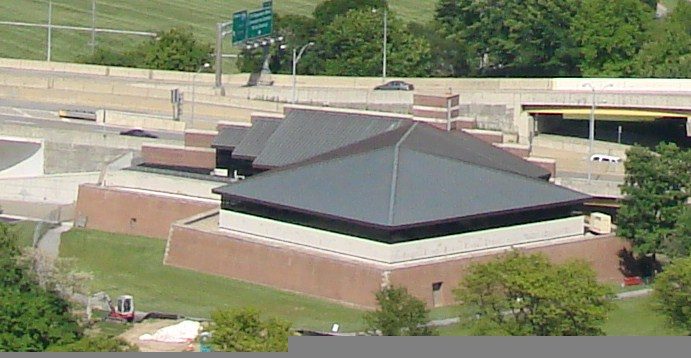
St. Clair Township, Columbiana County, Ohio Administration Building
Ohio›Columbiana County

St. Clair TownshipColumbiana County, OH

A town of 7,520.

4 bordering townsMap →
Photo: Roseohioresident · CC BY-SA 4.0
Photo of St. Clair Township

St. Clair Township, OH · Photo: Roseohioresident · CC BY-SA 4.0 · Source ↗

Is St. Clair Township a good place to live?

St. Clair Township gives you more for your money than most places: homes are within reach, about $162K for a typical one, or 2.8 years of the Salem area’s $58K median household income. It grades C+ overall, 698th among Ohio's 987 graded towns. The low prices come with trade-offs. Residents are less healthy than 93% of U.S. towns on CDC estimates. On the plus side, its schools rank ahead of 78% of Ohio towns. 15% of the land in St. Clair Township is conserved, against 3.7% in Ohio’s towns and 4.3% across U.S. towns. On history, just 111 of Ohio’s 1,718 towns do worse. Beaver Creek State Park, at 1,810 acres with 28 miles of trail, is the biggest park or preserve.

What makes St. Clair Township stand out

Where St. Clair Township beats most towns, and one thing worth knowing.

Get outside

32 miles of trails in St. Clair Township

15.1% of the town is conserved land, across 3 parks and preserves.

Map of trails and conserved land in St. Clair TownshipConservedTrails
1
Beaver Creek State Park28 mi of trails · 1,810 acres
Directions
2
Beaver Creek State Forest1,117 acres
3
Calcutta Community Park0.2 mi of trails · 1 acres
Directions
Trails © OpenStreetMap contributors · USGS PAD-US

How St. Clair Township grades

Each subject compared with towns across the country (schools within Ohio), ordered by how far St. Clair Township is from typical.

How grading works

Character Graded, but not part of the overall grade.
Described, not graded Taste, not quality: snow or an older crowd is neither good nor bad.

How TownRatings grades towns →

Calcutta, Ohio water tower
Calcutta, Ohio water tower, 2016
St. Clair Township’s story

St. Clair Township in pictures

Census counts: 8,080 in 1980, 7,804 in 2020. The archive holds 10 old photos and papers going back to 2004 and 6 maps from 1937 on.

Explore the history →
Getting set up

Moving to St. Clair Township: who provides what

Who provides power, water and the rest in St. Clair Township, and how to reach them.

The full setup list →
PowerOhio Edison16.0¢/kWh · EIA 2025HIFLD · EIA
WaterEast Liverpool City water systemNo health-based violations in 5 years · EPAEPA
Internet5 providers96% of addresses get 100/20 MbpsFCC
Trash & dumpNot on file yetWe don’t have St. Clair Township’s trash rules yet
SchoolsBeaver Local School DistrictWhich school depends on your addressNCES
Register to voteOnlineIn Ohio you can register online until 30 days before Election Day, in person until 30 days before Election Day, or by mail (postmarked 30 days before).vote.gov
Who runs elections hereDirector, Columbiana County Board of ElectionsColumbiana County; contacts on the Handbook page.FVAP, Aug 2020
ZIP code4392043920 99%Census 2020

EPA SDWIS (Oct 9, 2026) · HIFLD + EIA-861 2025 · Census 2020 ZCTAs · NCES 2024–25 · registration: vote.gov, updated Aug 3, 2026.

The data

Ordered by what stands out in St. Clair Township.

St. Clair Township pairs an A− for schools with modest home prices and sends many workers across the state line.

OutdoorsA

St. Clair Township has set aside 15.1% of its land for conservation

32 miles of trail in 3 parks and preserves. St. Clair Township’s trail density is 1.1 miles per square mile, where Ohio’s towns sit at 0.2 and U.S. towns at 0.4.

#82for trails in OH
15.1%
conserved · 2,846 of 18,820 acres
32 mi
of trails · 1.1 per sq mi
Biggest places to walkTrailsAcres
1. Beaver Creek State Park28 mi1,810
2. Beaver Creek State Forest—1,117
3. Calcutta Community Park0.2 mi1

Trails & parks © OpenStreetMap contributors · Conserved land: USGS PAD-US

SchoolsA−

St. Clair Township’s grade for schools is an A−

Its A− for schools comes with a B+ for cost of living: the typical home is worth about $162K.

Its public schools are run by the Beaver Local school district. Two of its 3 schools are below, each with why it’s listed. The largest public high school is Beaver Local High School, with 547 students.

78%of OH districts it outscoresA−School Grade
SchoolLevelStudentsLetter
Beaver Local Elementary SchoolLargest public elementary schoolGrades PK–4Grades PK–4619B
Beaver Local High SchoolLargest public high schoolGrades 9–12Grades 9–12547B−

NCES · EDFacts · graded within OH on state tests and graduation

HealthD

St. Clair Township’s grade for health is a D

18% of St. Clair Township adults report frequent physical distress.

7%healthier than U.S. townsDHealth Grade
St. Clair TownshipOhio townsU.S. towns
Frequent physical distress (CDC PLACES)18%15%14%
Smoke cigarettes (CDC PLACES)21%16%14%
Get no exercise (CDC PLACES)34%28%25%
Sleep under 7 hours (CDC PLACES)42%38%36%
32 measures vs. Ohio
0 better16 too close to call16 worse
What stands outSt. Clair TownshipOH
More adults with COPD11.4%8%
More older adults who have lost all their teeth20.9%15.3%
More smokers20.6%15.4%
East Liverpool City Hospital
5.5 mi away · emergency room
3 of 3
care shortages: primary care, dental, mental health
8th
percentile among OH towns

CDC PLACES 2025 · modeled estimates for adults · CMS · HRSA

Natural hazardsHazard risk grade A−

St. Clair Township faces a low natural-hazard risk, led by inland flooding

Expected storm and flood damage is lower than in 75% of U.S. communities. Since 2004, 3 flood insurance claims have been paid out in St. Clair Township.

25risk score of 100
FEMA risk score
25Low riskLowerHigher
Inland floodingTornadoes
3
paid flood claims since 2004

FEMA flood insurance claims · FEMA National Risk Index · OpenFEMA

Climate

Snowy winters and pleasant summers in St. Clair Township

Clair Township has chilly, snowy winters and pleasant summers. July afternoons reach 83°, January nights drop to 21° and about 44 inches of snow falls in a winter.

44″snow a winter

Typical low → high °F

Winter23–38°
Spring39–61°
Summer59–81°
Fall43–63°
Oct 26
typical first frost
Apr 28
typical last frost
+1.2°
vs. the 20th-century average

NOAA U.S. Climate Normals, 1991–2020

Work & commuteJobs & income grade C

Most of St. Clair Township’s workers commute out: the town has 0.8 jobs for each of them

22% of working residents cross a state line to work. Jobs based here fell from 3,184 in 2013 to 2,539.

Most working residents leave St. Since 2013, St. Clair Township has lost 645 jobs, to 2,539 in 2023. The median household income in St. Clair Township is $58,000.

11%work in town
St. Clair TownshipOhio townsU.S. towns
Median household income$58,000$75,000$80,000
Average trip to work22 minutes24 minutes25 minutes
Working residents who work in town11%6.8%8%
Below the poverty line11%9.1%9.6%

Where working residents work

In St. Clair Township11%
East Liverpool10%
Calcutta6%
Lisbon3%
Salem3%
19 mi
median commute distance
2,539
jobs based in St. Clair Township
Balanced
jobs vs. working residents
C
Walkability grade: more walkable than 29% of U.S. towns

Census LEHD 2023 · ACS

Nearby attractions

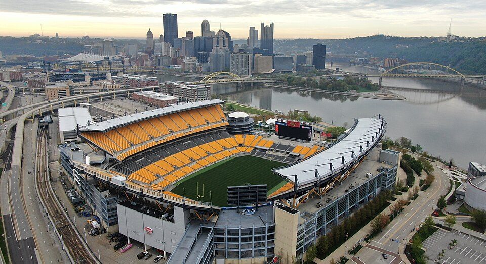
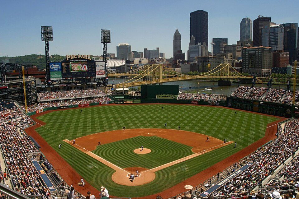
Acrisure Stadium and 56 more within 40 miles

Museums, parks, gardens and other places to visit around St. Clair Township. Close and well known come first.

All 79 attractions →
Sources: National Park Service · ski areas © OpenSkiMap / OpenStreetMap contributors · Wikidata · Wikipedia readership · photos via Wikimedia Commons
Photo credits

Acrisure Stadium: Fo2grfr, CC BY-SA 4.0 · Fort Duquesne: Sébastien Paquin, CC BY-SA 3.0 · PNC Park: alpineinc, CC BY 2.0 · PPG Paints Arena: Jleedev, CC BY-SA 4.0 · Meadowcroft Rockshelter: Lee Paxton, CC BY-SA 4.0 · Fort Pitt: Downtown_Pittsburgh_May_2008.jpg: Allie Caufield derivative work: GrapedApe (tal, CC BY 2.0

Keep exploring

Everything we know about St. Clair Township

19pages on St. Clair Township
After high school

Colleges nearby

4 within 15 miles of the center of St. Clair Township

About St. Clair Township

Township in Ohio, US

Official town website ↗

St. Clair Township is one of the eighteen townships of Columbiana County, Ohio, United States. As of the 2020 census the population was 7,804.

From Wikipedia, licensed CC BY-SA 4.0 · facts via Wikidata (CC0)

Area
30 sq mi
Elevation
1,148 ft

St. Clair Township’s neighbors

4 towns share a border with St. Clair Township.

Explore the map →
How the neighbors grade
TownOH rankOverallCostSafetySchoolsHealth
St. Clair Township#698C+B+—A−D
Middleton Township#310B+A−—A−C
Liverpool Township#840CA−—CD
Madison Township#819CB—A−D
Glenmoor——B−—C+C−

Glenmoor has fewer than 2,500 residents, so it gets subject grades but no overall grade. St. Clair Township, Middleton Township, Liverpool Township, Madison Township and Glenmoor report no FBI crime data of their own. Compare St. Clair Township with a neighbor →

Questions about St. Clair Township

Short answers, built from the data on this page.

Is St. Clair Township, OH a good place to live?

St. Clair Township grades C+ overall, better than 41% of U.S. towns and #698 of 987 in Ohio. It grades D for health and A− for schools. Health is its weak spot, with a D.

Is St. Clair Township, OH expensive?

Not for the area. Cost of living, which also weighs rents, property taxes and how many households pay 30% or more of their income for housing, grades B+.