Rushville dates to 1808, and 69% of its homes were built before 1940
1 place in town is on the National Register, among them a historic district with 87 buildings. Below: 2 old photos and papers, maps from 1909 on, and the census since 1870.
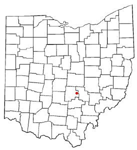
Rushville takes its name from Little Rush Creek, which runs between the villages of Rushville and West Rushville. The town was founded in 1808 by Joseph Turner and became a prosperous stop along the old Zane's Trace road constructed in 1797 by Colonel Ebenezer Zane. Rushville was known as a stop on the Underground Railroad in the years prior to the Civil War. Several fugitive slaves who died in Rushville while seeking freedom in Canada are buried in the nearby Pleasant Hill Cemetery.
Passages that mention Rushville, cut from the printed page as they were published.
History of Fairfield County, Ohio1912 · page 529Read the page →
Read the text
were more public spirited or wisely generous than was Jefferson J. Winegardner. He may not unjustly be called father of the town of Rushville, donating land and encouraging business enterprises and being particularly liberal in his gifts to the Reformed church, bestowing thirty-eight acres of land on it and donating almost the entire
Text read by machine from the scan; it may contain errors.
History of Fairfield County, Ohio1912 · page 220Read the page →
Read the text
drift filled valleys in northern Richland township, southward into the very narrow, tortuous, steep walled, rock floored gorge which the T. and O. C. Railroad follows from Rushville to Bremen. This gorge is the site of another old divide, and the old outlet, across which the ice stood, was to the northwestward past Pleasantville to the pre-glacial Muskingum.
Text read by machine from the scan; it may contain errors.
Scans and text from the Internet Archive. Books published in 1930 or earlier, which are in the public domain.
Timeline
Rushville, 1808 to 1937
Woven from the archive, old maps, post office records, the National Register and the people born here.
Nothing in the archives for these yearsWeddings on Main Street, storms, parades, school pictures, the old store. If it’s in your family album, it belongs here.
Founding dates: Wikidata, Wikipedia, the U.S. post office records of Blevins & Helbock (CC0) and the Census. Homes by year built: Census ACS 2020–24. National Register of Historic Places: National Park Service (list of May 22, 2026). Old photos, postcards and papers: Wikimedia Commons, the Library of Congress and other public archives, credited on each item’s page. Maps: U.S. Geological Survey historical topographic maps (via Esri) and Sanborn fire-insurance maps (Library of Congress). History text and census tables: Wikipedia (CC BY-SA 4.0). Places that used to be: USGS Geographic Names Information System (2021). How TownRatings grades history →
From Wikimedia Commons (3), the National Register of Historic Places (1), Wikipedia, Wikidata and Wikipedia for famous people, U.S. Geological Survey historical maps, U.S. Census counts (via Wikipedia), the USGS Geographic Names Information System and old county and town histories (Internet Archive). Archive images are copied here with their credits and licenses, shown on each photo’s page. Refreshed monthly.




 2004


