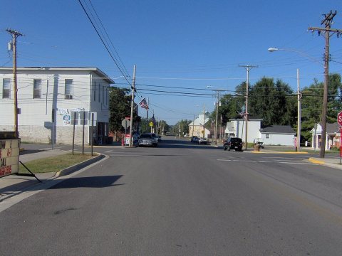
Rushylvania was originally called Claggstown, and under the latter name was platted in 1834. A post office called Rushylvania has been in operation since 1836.
Passages that mention Rushsylvania, cut from the printed page as they were published.
History of Logan County and Ohio1880 · page 450Read the page →
Read the text
Ozias, by Rodaker in 1830. In‘the year 1832 a water saw-mill was built by a man of the name of Sutton, about a mile east of the pike leading from Bellefontaine to Rushsylvania, and about the same time John Basil built a saw-mill on the Miami. About the year 1830, “Old Billy” Rubart built the first grist-mill in the township adjacent to Rodaker’s saw-
Text read by machine from the scan; it may contain errors.
History of Logan County and Ohio1880 · page 692Read the page →
Read the text
2, 1878, and was buried in the cemetery at Rushsylvania'; Covert, born Nov. 28, 1879, in Rushsylvania, Logan Co., O. JACOB GRABIEL, farmer;' P. O., Rushsylvania. John Grabiel, who was the father of John Grabiel and the grandfather of John and Jacob Grabiel, came from Shenandoah Co., Va., in 1814. John Grabiel, the father
Text read by machine from the scan; it may contain errors.
History of Logan County and Ohio1880 · page 442Read the page →
Read the text
Rushsylvania is located almost in the center of the township; Big Springs in the northeast corner, and Harper about three miles southwest of Rushsylvania, all on the Cleveland, Columbus, Cincinnati & Indianapolis Railway, which passes through the township from northeast to southwest. Walnut Grove is also a small village in the southeast corner of the
Text read by machine from the scan; it may contain errors.
History of Logan County and Ohio1880 · page 446Read the page →
Read the text
Rushsylvania is located almost in the center of the township; Big Springs in the northeast corner, and Harper about three miles southwest of Rushsylvania, all on the Cleveland, Columbus, Cincinnati & Indianapolis Railway, which passes through the township from northeast to southwest. Walnut Grove is also a small village in the southeast corner of the
Text read by machine from the scan; it may contain errors.
Scans and text from the Internet Archive. Books published in 1930 or earlier, which are in the public domain.
Timeline
Rushsylvania, 1863 to 1936
Woven from the archive, old maps, post office records, the National Register and the people born here.
Founding dates: Wikidata, Wikipedia, the U.S. post office records of Blevins & Helbock (CC0) and the Census. Homes by year built: Census ACS 2020–24. National Register of Historic Places: National Park Service (list of May 22, 2026). Old photos, postcards and papers: Wikimedia Commons, the Library of Congress and other public archives, credited on each item’s page. Maps: U.S. Geological Survey historical topographic maps (via Esri) and Sanborn fire-insurance maps (Library of Congress). History text and census tables: Wikipedia (CC BY-SA 4.0). Places that used to be: USGS Geographic Names Information System (2021). How TownRatings grades history →
From Wikimedia Commons (6), Wikipedia, Wikidata and Wikipedia for famous people, the US Post Offices dataset (Blevins & Helbock), the USGS Geographic Names Information System and old county and town histories (Internet Archive). Archive images are copied here with their credits and licenses, shown on each photo’s page. Refreshed monthly.


 2009
 2009
 2009
 2008
 2006
 2004