Kent dates to 1805, and 16% of its homes were built before 1940
More historic than 86% of U.S. towns · #223 of 993 in Ohio. What drives it
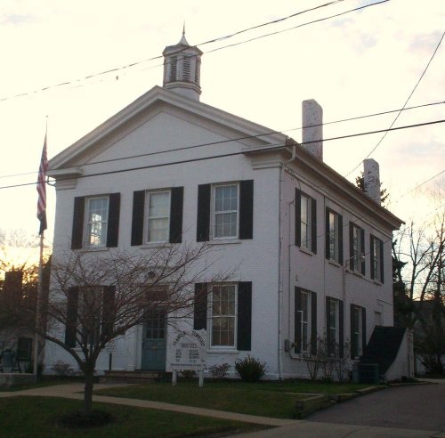
14 places in town are on the National Register, among them the May 4, 1970, Kent State Shootings Site, a National Historic Landmark, and three historic districts with 36 buildings between them. Below: 5 old photos and papers, maps from 1884 on, and the census since 1870.
Founding year: Wikidata. First post office: 1820.The full story ↓
History grade
What drives Kent’s History grade
On its age, its old homes and the National Register, Kent is more historic than 86% of U.S. towns, #223 of 993 in Ohio. All 3 inputs are above most U.S. towns; its National Register listings ranks highest and its share of homes from before 1940 lowest.
A
HistoryA character grade: shown, never part of Kent’s overall grade.
Ohio towns list about as much on the Register as the country (a typical Ohio town has 2.9 per 10,000 residents, the U.S. 2.4), so Kent’s 18.1 sits above most of its state (80% of Ohio towns have fewer) while its 49 historic buildings outnumber those of 85% of U.S. towns.
NoteThe founding year comes from Wikidata alone; no second source gives 1805.
How sure. Graded on any two of the three inputs instead, the letter would range from A− to A. The pre-1940 share is a Census survey estimate (±3.2 points).
Founding year: Wikidata (other dates in Quick answers). Homes: Census ACS 2020–24. National Register: National Park Service, May 2026 list; each listing counted once (boundary changes and added documentation belong to their listing), and a historic district counts its contributing buildings. How TownRatings grades history →
What stands out about Kent’s past
Read from the archive, the National Register and the record. The page puts what stands out first.
National Park Service, National Register of Historic Places. Photos from Wikimedia Commons, credited on each place’s page.
Every building
Kent, building by building, 1884–1919
Fire insurance maps drew every building, what it was made of and what it was used for, so insurers could price the risk of fire. Pick a year, then a sheet.
The region was originally inhabited by Native Americans, including the early Mound Builders. Around 1780, Captain Samuel Brady achieved notoriety for his activities in the area, including his leap of 21 feet (6 m) over the Cuyahoga River to avoid capture by a Native band. The site, known as Brady's Leap, is now a city park. Settlement by Europeans began in the late 1790s and early 19th century. As part of the Connecticut Western Reserve, the area was divided into survey townships in 1798 and almost all of what is now Kent was originally part of Town 3 Range 9, which would eventually be known as Franklin Township. Aaron Olmsted, a wealthy Connecticut merchant, had purchased the 16,000-acre (6,500 ha) township and named it for his son Aaron Franklin Olmsted.
Passages that mention Kent, cut from the printed page as they were published.
History of Portage County, Ohio1885 · page 292Read the page →
Read the text
On the 10th of March, 1851, the Ohio Legislature granted a charter to the Franklin & Warren Railroad Company, for the construction of a railroad from Franklin Mills (Kent), Portage County, to Warren, Trumbull County, and thence to the easti line of the State, with power to continue the road westward or southwestward from Franklin Mills to connect with any other railroad in Ohio. On the 21st of May, 1851, the company was organized by the following incorporators: Marvin Kent, Zenas Kent, L. V. Bierce, Thomas Earl, O.
Text read by machine from the scan; it may contain errors.
History of Portage County, Ohio. Containing a history of the county, its townships, towns, villages, schools, churches, industries, etc1885 · page 295Read the page →
Read the text
On the 10th of March, 1851, the Ohio Legislature granted a charter to the fVanklin & Warren Bailroad Company, for the ooostnietion of a railroad fnnn Franklin Mills (Kent), Portage County, to Warren, Trumbull County, and thence to the east line of the State, with power to continue the road westward or Houthwestward from Franklin Mills to connect with any other railroad in Ohio. On the 21st of May, 1851, the company was organized by the following incorporators: Marvin Kent, Zenas Kent, L. Y. Bierce, Thomas Earl, O.
Text read by machine from the scan; it may contain errors.
History of Portage County, Ohio1885 · page 357Read the page →
Read the text
John Rhodenbaugh, a citizen of Franklin Township, residing upon his farm aboiat three miles from the village of Kent, in that township, and about the same distance from flavenna, was foully murdered between 7 and 8 o'clock on the night of October 24, 1865, while returning home from Kent, and within a little more than a mile from his home. The spot chosen for the scene of the murder was upon the road leading from Ravenna to Hudson, passing between Lakes Brady and Pippin, at a pointwhere the road runs parallel with the C. & P. R. R., and within a few rods of the crossing of the latter with the
Text read by machine from the scan; it may contain errors.
History of Portage County, Ohio. Containing a history of the county, its townships, towns, villages, schools, churches, industries, etc1885Read the page →
Read the text
John Rhodunbangh, a citizen of Franklin Township, residing upon his farm about three miles from the village of Kent, in that township, and abont the ume distance from BaTenna, was foully murdered between 7 and 8 o'dook ou the night of October 24, 1865, while retorning luiine from Kent, and wittiin a littlp more than a mile from his homo. The spot chosen for the scene of the murder was upon the road loading from Ravenna to Hndson, passing between Lakes Brady and Pippin, at a point where the road runs parallel with the 0. A P. R. R. , and within a few rods of the Grossing of the latter with the
Text read by machine from the scan; it may contain errors.
Scans and text from the Internet Archive. Books published in 1930 or earlier, which are in the public domain.
Timeline
Kent, 1805 to 2016
Woven from the archive, old maps, post office records, the National Register and the people born here.
Nothing in the archives for these yearsWeddings on Main Street, storms, parades, school pictures, the old store. If it’s in your family album, it belongs here.
In 1805, according to Wikidata. Kent’s post office opened in 1820, and the census of 1870 counted 2,301 people here.
How does Kent rank for history?
Kent is more historic than 86% of U.S. towns, #223 of 993 in Ohio. The History grade combines the town’s founding era, the share of homes built before 1940 and its National Register listings. It’s a character grade, so it isn’t part of the overall grade. How it works.
What is on the National Register in Kent?
14 listings: 10 buildings, among them the Masonic Temple (listed 1974, the first), 3 historic districts, the Kent Industrial District, the West Main Street District and the Kentway Apartments Historic District, with 36 contributing buildings, and 1 site. 49 historic buildings in all.
How old are the homes in Kent?
16% of Kent’s homes were built before 1940 (Census estimate, ±3.2 points), against a typical 15% for an Ohio town; the median home was built in 1972.
Founding dates: Wikidata, Wikipedia, the U.S. post office records of Blevins & Helbock (CC0) and the Census. Homes by year built: Census ACS 2020–24. National Register of Historic Places: National Park Service (list of May 22, 2026). Old photos, postcards and papers: Wikimedia Commons, the Library of Congress and other public archives, credited on each item’s page. Maps: U.S. Geological Survey historical topographic maps (via Esri) and Sanborn fire-insurance maps (Library of Congress). History text and census tables: Wikipedia (CC BY-SA 4.0). Places that used to be: USGS Geographic Names Information System (2021).
From Wikimedia Commons (4), the Library of Congress (1), Wikidata (1), the National Register of Historic Places (14), Wikipedia, Wikidata and Wikipedia for famous people, U.S. Geological Survey historical maps, U.S. Census counts (via Wikipedia), the US Post Offices dataset (Blevins & Helbock), the USGS Geographic Names Information System, Sanborn fire insurance maps (Library of Congress) and old county and town histories (Internet Archive). Archive images are copied here with their credits and licenses, shown on each photo’s page. Refreshed monthly.


 ★ Landmark




 1909
 1910
 1914


