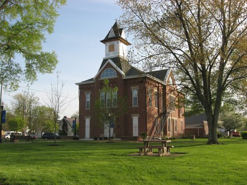
Johnstown dates to 1810, and 2 of its places are on the National Register
More historic than 67% of U.S. towns · #449 of 993 in Ohio. What drives it
Most of Johnstown was built recently: 9% of its homes predate 1940 and the median home dates from 1994. Its Register listings are the Monroe Township Hall-Opera House and the Johnstown Jail. Below: maps from 1900 on and the census since 1830.
Founding year: Wikidata. First post office: 1816.The full story ↓
History grade
What drives Johnstown’s History grade
On its age, its old homes and the National Register, Johnstown is more historic than 67% of U.S. towns, #449 of 993 in Ohio. Its age holds the grade up; its share of homes from before 1940 pulls it down.
B+
HistoryA character grade: shown, never part of Johnstown’s overall grade.
Ohio towns list about as much on the Register as the country (a typical Ohio town has 2.9 per 10,000 residents, the U.S. 2.4), so Johnstown’s 3.8 sits near the middle of its state (60% of Ohio towns have fewer) while its 2 listings outnumber those of 60% of U.S. towns.
How sure. Graded on any two of the three inputs instead, the letter would range from B− to B+. The pre-1940 share is a Census survey estimate (±4.4 points). Two sources give 1810.
Founding year: Wikidata (other dates in Quick answers). Homes: Census ACS 2020–24. National Register: National Park Service, May 2026 list; each listing counted once (boundary changes and added documentation belong to their listing), and a historic district counts its contributing buildings. How TownRatings grades history →
What stands out about Johnstown’s past
Read from the archive, the National Register and the record. The page puts what stands out first.
Every edition of the U.S. Geological Survey’s map of Johnstown. Tap a year, or press play to watch the town change.
1908Granville sheet · 1:62,500
U.S. Geological Survey historical topographic maps (public domain), via Esri’s collection of the scans. The red ring marks the center of Johnstown.
Every building
Johnstown, building by building, 1900–1913
Fire insurance maps drew every building, what it was made of and what it was used for, so insurers could price the risk of fire. Pick a year, then a sheet.
Johnstown is part of a four thousand acre (16 km2) tract of land deeded to John Brown, a revolutionary soldier, by President John Adams for military services in 1800. Brown sold the property in 1810 for $2.50 per acre, or $10,000, to Dr. Oliver Bigelow. Dr. Bigelow laid out and incorporated the village of Johnstown, donating the streets, alleys and the town square. In 1926 a nearly complete skeleton of a mastodon was found by a farmer named James Bailey, and subsequently sold to the Cleveland Museum of Natural History.
Passages that mention Johnstown, cut from the printed page as they were published.
History of Licking County, Ohio1881 · page 488Read the page →
Read the text
The Ohio Central railroad passes across its southwestern corner on its way from Granville to Johnstown and Hartford, but there is no station witr.in the limits of the township, and with this exception it is not troubled with railroads or telegraphs, and contains no important highways.
Text read by machine from the scan; it may contain errors.
Centennial History of the City of Newark and Licking County Ohio1909Read the page →
Read the text
No history of Johnstown would bo complete without extended and personal reference to McKindra 1). Shrader who is now the efficient and popular mayor of the city and is giving to Johnstown a practical, businesslike administration and is, moreover, well known through his connection with commercial interests here, being a dealer in hav, grain, live stock, vehicles and farm implements. A gentleman of determined spirit and progressive ideas, he carries forward to successful completion whatever lie undertakes, and it was through no wish on his part but as the result of a desire on the part of his fellow townsmen that he consented to
Text read by machine from the scan; it may contain errors.
Centennial History of the City of Newark and Licking County Ohio1909Read the page →
Read the text
formed a partnership with John Stevens and they conducted the business together until 1897, when Mr. Buxton retired after almost thirty years’ connection with mercantile interests in this city. Since that time he has devoted his attention to looking after his fine farming property near Johnstown, for he owns more than seven hundred acres of rich and productive land in this locality, all splendidly improved and well stocked. In November, 1883, he assisted in organizing the Johnstown Bank, the first banking institution of the towm. It was conducted as a private bank under the partnership name of Derthick, Buxton & Kasson. In the
Text read by machine from the scan; it may contain errors.
Scans and text from the Internet Archive. Books published in 1930 or earlier, which are in the public domain.
Timeline
Johnstown, 1810 to 1928
Woven from the archive, old maps, post office records, the National Register and the people born here.
In 1810, according to Wikidata. Johnstown’s post office opened in 1816, and the census of 1830 counted 217 people here.
How does Johnstown rank for history?
Johnstown is more historic than 67% of U.S. towns, #449 of 993 in Ohio. The History grade combines the town’s founding era, the share of homes built before 1940 and its National Register listings. It’s a character grade, so it isn’t part of the overall grade. How it works.
What is on the National Register in Johnstown?
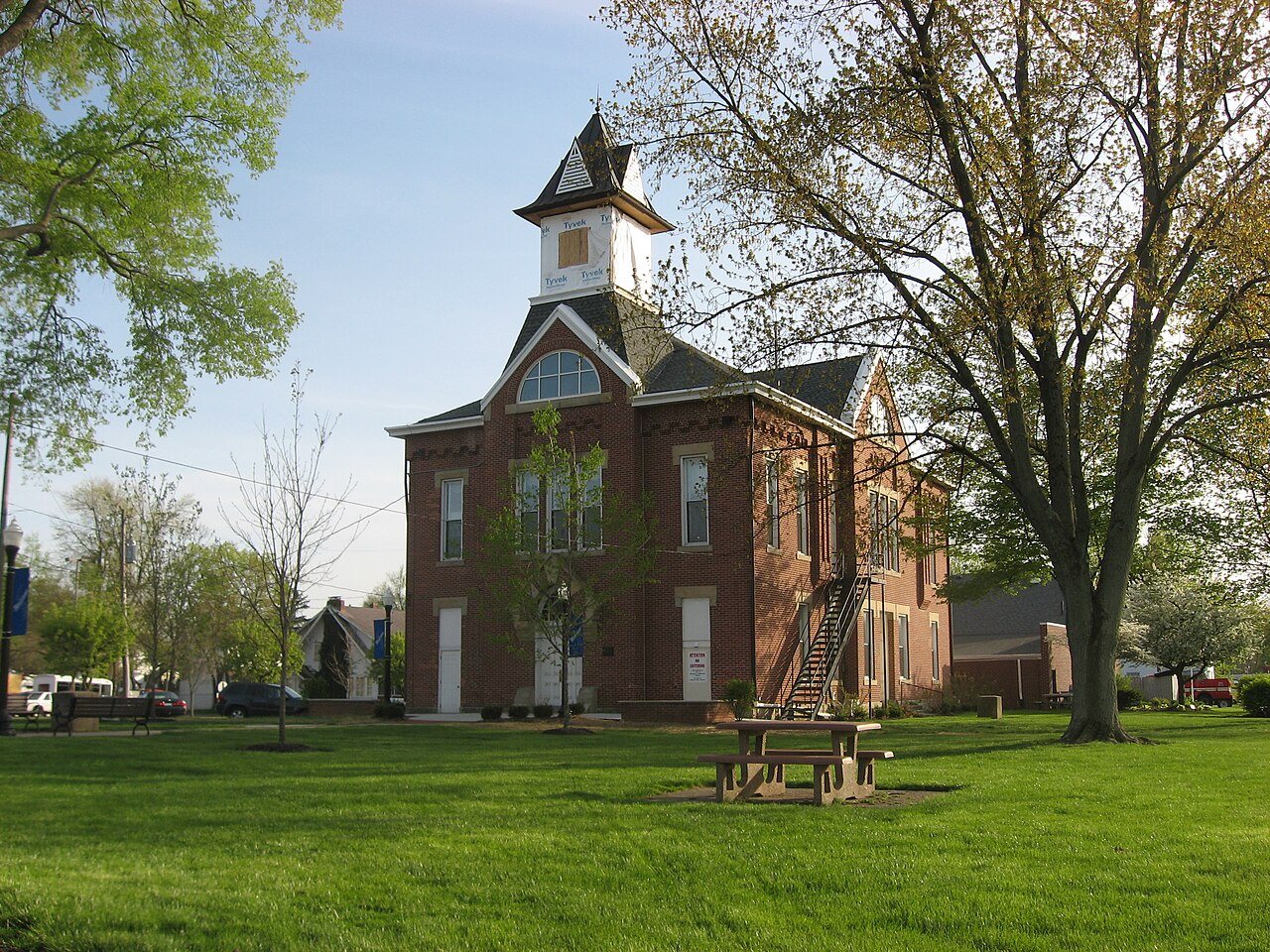
Two places: the Monroe Township Hall-Opera House (listed 1981) and the Johnstown Jail (2003).
How old are the homes in Johnstown?
9% of Johnstown’s homes were built before 1940 (Census estimate, ±4.4 points), against a typical 15% for an Ohio town; the median home was built in 1994.
Founding dates: Wikidata, Wikipedia, the U.S. post office records of Blevins & Helbock (CC0) and the Census. Homes by year built: Census ACS 2020–24. National Register of Historic Places: National Park Service (list of May 22, 2026). Old photos, postcards and papers: Wikimedia Commons, the Library of Congress and other public archives, credited on each item’s page. Maps: U.S. Geological Survey historical topographic maps (via Esri) and Sanborn fire-insurance maps (Library of Congress). History text and census tables: Wikipedia (CC BY-SA 4.0). Places that used to be: USGS Geographic Names Information System (2021).
From Wikimedia Commons (4), Wikidata (2), the National Register of Historic Places (2), Wikipedia, Wikidata and Wikipedia for famous people, U.S. Geological Survey historical maps, U.S. Census counts (via Wikipedia), the US Post Offices dataset (Blevins & Helbock), the USGS Geographic Names Information System, Sanborn fire insurance maps (Library of Congress) and old county and town histories (Internet Archive). Archive images are copied here with their credits and licenses, shown on each photo’s page. Refreshed monthly.


 2015
 2013
 2010
 2004