The Enon post office opened in 1838, the earliest record of the town by name. Wikidata gives 1850. Another post office, Layton (1837), opened inside today’s town and later closed.
2020 census: 2,449188 years
How historic is Enon?
B−
More historic than 47% of U.S. towns, on its age, its old homes and the National Register.
Founding year: the first Enon post office (Blevins & Helbock, CC0). Wikidata: 1850.The full story ↓
History grade
What drives Enon’s History grade
On its age, its old homes and the National Register, Enon is more historic than 47% of U.S. towns. Its age holds the grade up; its National Register listings pull it down.
B−
HistoryA character grade: shown, never part of Enon’s overall grade.
Ohio towns list about as much on the Register as the country (a typical Ohio town has 2.9 per 10,000 residents, the U.S. 2.4), so Enon’s 0.0 sits below most of its state (23% of Ohio towns have fewer) while its 0 listings outnumber those of 23% of U.S. towns.
How sure. Graded on any two of the three inputs instead, the letter would range from C to B. The pre-1940 share is a Census survey estimate (±6.6 points). The founding year is the first post office, not a stated founding date; Wikidata gives 1850.
Founding year: the first post office (other dates in Quick answers). Homes: Census ACS 2020–24. National Register: National Park Service, May 2026 list; each listing counted once (boundary changes and added documentation belong to their listing), and a historic district counts its contributing buildings. How TownRatings grades history →
What stands out about Enon’s past
Read from the archive, the National Register and the record. The page puts what stands out first.
Enon was platted in 1838. It is named for the river Ænon, in Israel, where the story of John the Baptist baptizing people takes place. A post office called Enon has been in operation since 1838. The village was incorporated in 1850. Mercury 7 astronaut Virgil I. "Gus" Grissom lived in Enon with his family while he was stationed at Wright-Patterson Air Force Base.
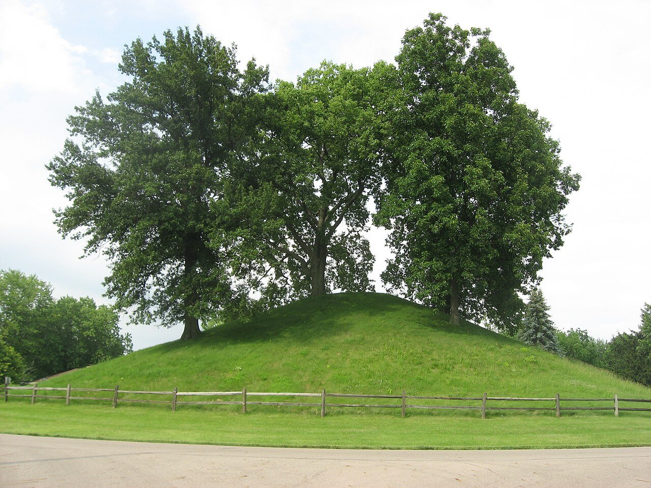
The Enon Adena Mound, also known as the Knob Prairie Mound, is Ohio's second largest conical Indian burial mound, and is located in Enon. This mound is believed to have been built by the Adena culture. The mound was reportedly used for reconnaissance by George Rogers Clark during the Battle of Piqua.
Passages that mention Enon, cut from the printed page as they were published.
The History of Clark County Ohio,1881 · page 728Read the page →
Read the text
iel Hertzler. who ran the mill and distillery suecessfully for about twenty years, amassing a large fortune. The property has changed hands several times since, but for nearly twenty years past has most of the time been lying idle. The village of Enon, to which reference has already been made, was founded in the year 1838, it being on the direct road from Springfield to Dayton, and nearly a central point between Springfield and Fairfield, and at the intersection of the road leading from Xenia to New Carlisle. Enon was established simultaneously with the location of the Springtield & Dayton Turnpike, which at this
Text read by machine from the scan; it may contain errors.
The History of Clark County Ohio,1881 · page 725Read the page →
Read the text
This building has long since been torn away, the society having built a commodious brick building in the village of Enon. The next church was erected by the Old-School Presbyterians. about a mile south of Muddy Run. near the Greene County line, in 1816, and was known as the Muddy Run Church. It was built of logs. had plank floor. shingle roof and glass windows; was about 24x30 feet. A brick building now occupies the site of this primitive structure. The congregation was ina flourishing condition until shattered by political animoslties, growing out of the question of slavery and kindred topics. As among
Text read by machine from the scan; it may contain errors.
20th century history of Springfield, and Clark County, Ohio1908 · page 324Read the page →
Read the text
En Enon is the principal village in Mad River Township, and is located on the Springfield and Dayton Turnpike, seven and a half miles southwest of the city of Springfield. It was originally platted in 1838, the time that the Springfield and Dayton I'oad was laid out, and was at the
Text read by machine from the scan; it may contain errors.
A standard history of Springfield and Clark County, Ohio1922 · page 408Read the page →
Read the text
house had its day and the stucco was a happy way of remodeling all of the others, the builders' art makes beautiful homes a possibility. While there are some very old houses in Springfield, in the better residence sections they have been replaced with modern mansions. In Enon there are many attractive old-time homes that are still in an excellent state of preservation— perhaps more quaint houses in Enon for its population than in any other Clark County town. There are houses in Enon built low to the ground, and standing flush with the pavement that hark back to other
Text read by machine from the scan; it may contain errors.
Scans and text from the Internet Archive. Books published in 1930 or earlier, which are in the public domain.
The Enon post office opened in 1838, the earliest record of the town by name (U.S. post office records). Wikidata gives 1850.
How does Enon rank for history?
Enon is more historic than 47% of U.S. towns. The History grade combines the town’s founding era, the share of homes built before 1940 and its National Register listings. It’s a character grade, so it isn’t part of the overall grade. How it works.
How old are the homes in Enon?
9% of Enon’s homes were built before 1940 (Census estimate, ±6.6 points), against a typical 15% for an Ohio town; the median home was built in 1968.
Founding dates: Wikidata, Wikipedia, the U.S. post office records of Blevins & Helbock (CC0) and the Census. Homes by year built: Census ACS 2020–24. National Register of Historic Places: National Park Service (list of May 22, 2026). Old photos, postcards and papers: Wikimedia Commons, the Library of Congress and other public archives, credited on each item’s page. Maps: U.S. Geological Survey historical topographic maps (via Esri) and Sanborn fire-insurance maps (Library of Congress). History text and census tables: Wikipedia (CC BY-SA 4.0). Places that used to be: USGS Geographic Names Information System (2021).
From Wikimedia Commons (2), Wikipedia, Wikidata and Wikipedia for famous people, the US Post Offices dataset (Blevins & Helbock), the USGS Geographic Names Information System and old county and town histories (Internet Archive). Archive images are copied here with their credits and licenses, shown on each photo’s page. Refreshed monthly.


 2015
 2004