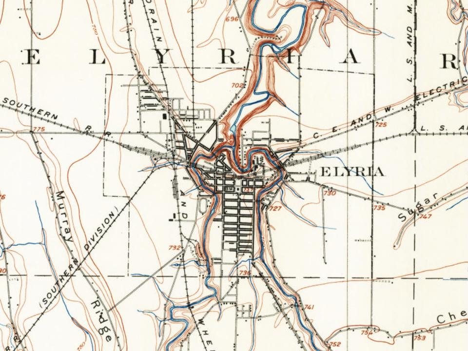
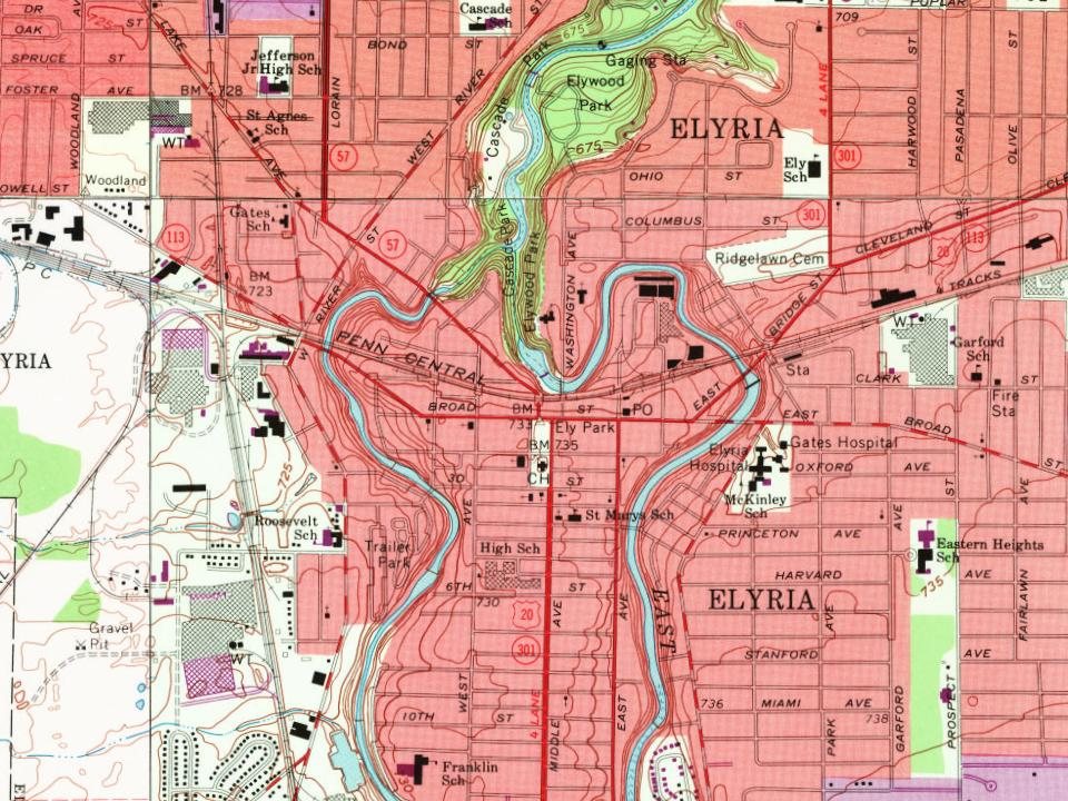
Elyria dates to 1817, and 19% of its homes were built before 1940
More historic than 91% of U.S. towns · #143 of 993 in Ohio. What drives it
37 places in town are on the National Register, among them two historic districts with 180 buildings between them. Below: 6 old photos and papers, maps from 1884 on, and the census since 1830.
Elyria dates its founding to 1817 (Wikidata and Wikipedia’s history agree). The census first counted it in 1830.
First census: 168 in 18302020 census: 52,656209 years
How did Elyria get its name?
The city's name is derived from the surname of its founder, Heman Ely, and Illyria, the historical name used by ancient Greeks and Romans to refer to the western Balkans.
How historic is Elyria?
A
More historic than 91% of U.S. towns, on its age, its old homes and the National Register.
Founding year: Wikidata; Wikipedia’s history section gives the same year. First post office: 1824. Name: Wikipedia, licensed CC BY-SA 4.0.The full story ↓
History grade
What drives Elyria’s History grade
On its age, its old homes and the National Register, Elyria is more historic than 91% of U.S. towns, #143 of 993 in Ohio. All 3 inputs are above most U.S. towns; its National Register listings ranks highest and its share of homes from before 1940 lowest.
A
HistoryA character grade: shown, never part of Elyria’s overall grade.
Ohio towns list about as much on the Register as the country (a typical Ohio town has 2.9 per 10,000 residents, the U.S. 2.4), so Elyria’s 40.9 sits above most of its state (87% of Ohio towns have fewer) while its 217 historic buildings outnumber those of 94% of U.S. towns.
How sure. Graded on any two of the three inputs instead, the letter would range from A− to A. The pre-1940 share (±1.7 points) is firm at this size. Two sources give 1817.
Founding year: Wikidata (other dates in Quick answers). Homes: Census ACS 2020–24. National Register: National Park Service, May 2026 list; each listing counted once (boundary changes and added documentation belong to their listing), and a historic district counts its contributing buildings. How TownRatings grades history →
What stands out about Elyria’s past
Read from the archive, the National Register and the record. The page puts what stands out first.
National Park Service, National Register of Historic Places. Photos from Wikimedia Commons, credited on each place’s page.
Every building
Elyria, building by building, 1884–1925
Fire insurance maps drew every building, what it was made of and what it was used for, so insurers could price the risk of fire. Pick a year, then a sheet.
The village of Elyria was founded in 1817 by Heman Ely, who built a log house, dam, gristmill, and sawmill on the village's site along the Black River. Ely began to build more houses to accommodate European-American settlers migrating to what was, at that time, within Huron County, Ohio.
By the turn of the 20th century, Elyria was a town of about 8,000. In 1908, Elyria Memorial Hospital was built. In the first half of the 20th century, the town developed some manufacturing, as well as a range of retail businesses.
Passages that mention Elyria, cut from the printed page as they were published.
High spots in the history of early Elyria1917Read the page →
Read the text
Judge Ely was at the time of Elyria’s founding, owner of the townsite and from the time of his location here in 1817 filled many positions of trust and responsibility. He was ‘‘angel” for the first Elyria newspaper, financing The Lorain Gazette, started by Park and Whittlesey in 1829, was instrumental in getting the court house located in Elyria, financed the erection of the first high school building and was as busy as Samuel the Prophet in promoting worthy public movements, although he wore his hair more like Elisha, starting a style here which has been
Text read by machine from the scan; it may contain errors.
High spots in the history of early Elyria1917Read the page →
Read the text
In February, 1833, an act was passed by the Ohio Legislature to incorporate the village of Elyria, and some departmental ramifications followed along in the next few years. Although a Board of Education was not organized until May, 1850, Elyria had one standard municipal department even before the town was incorporated.
Text read by machine from the scan; it may contain errors.
A standard history of Lorain county, Ohio1916Read the page →
Read the text
"At 36tli street, Lorain, the main transmission line branches into two parts, one line going to Amherst and South Amherst, and the other line going to Elyria, the line to Olmsted Falls and Berea branching ofl" from the Elyria line a sliort distance from Elyria and being controlled by a switch in the Elyria sub-station.
Text read by machine from the scan; it may contain errors.
Returning to Elyria, August, 1864, he soon engaged in whatever his hand might find. For eight years he was elected to various offices in the township of Elyria, for four years being deputy marshal of the Northern District of Ohio. Mr. Braman was elected sherifl" in 1872, and again in 1874.
Text read by machine from the scan; it may contain errors.
Scans and text from the Internet Archive. Books published in 1930 or earlier, which are in the public domain.
Timeline
Elyria, 1817 to 1985
Woven from the archive, old maps, post office records, the National Register and the people born here.
Nothing in the archives for these yearsWeddings on Main Street, storms, parades, school pictures, the old store. If it’s in your family album, it belongs here.
Abbe Road Trailer ParkColonial OaksPikewood ManorRiverview Mobile Home ParkTwin Lakes HomesWest Ridge Green
Gone or out of use
Hill AirportairportRichards AirportairportSaint Pauls Evangelical ChurchchurchSpring Valley Elementary SchoolschoolThomas Jefferson Elementary SchoolschoolWashington High Schoolschool
2cemeteries and burying grounds inside Elyria
North Murray RidgeRidgelawn
US Post Offices dataset (Blevins & Helbock, CC0). Places and cemeteries from the USGS Geographic Names Information System (2021).
Help out
Finish Elyria’s story
Most archives stop around 1920. The photos from after that are in family albums, not libraries.
Decades since 1900 with photos
00s10s20s30s40s50s60s70s80s90s
1 of 10 decades. The empty ones are waiting for someone’s album.
In 1817, according to Wikidata and Wikipedia’s history of the town. Elyria’s post office opened in 1824, and the census of 1830 counted 168 people here.
How does Elyria rank for history?
Elyria is more historic than 91% of U.S. towns, #143 of 993 in Ohio. The History grade combines the town’s founding era, the share of homes built before 1940 and its National Register listings. It’s a character grade, so it isn’t part of the overall grade. How it works.
What is on the National Register in Elyria?
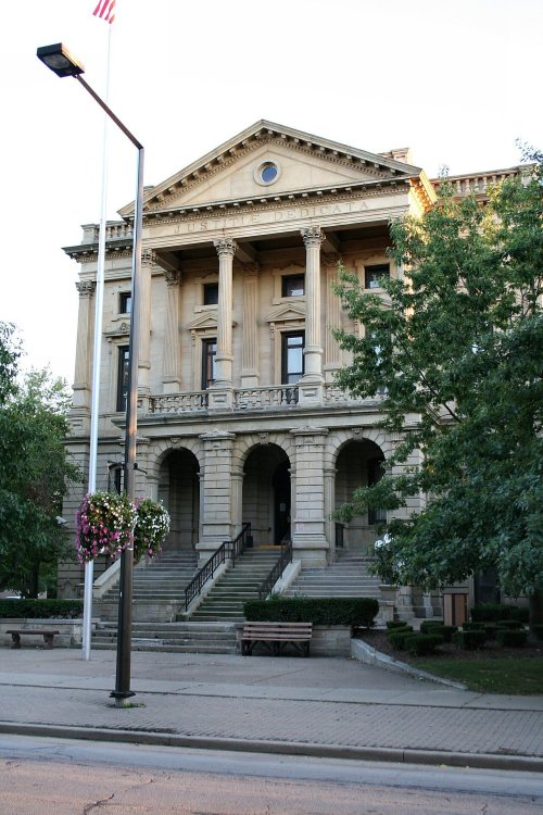
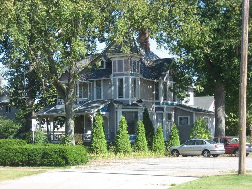
37 listings: 33 buildings, among them the Monteith Hall (listed 1974, the first), 2 historic districts, the Washington Avenue Historic District and the Elyria Downtown-West Avenue Historic District, with 180 contributing buildings, 1 structure, and 1 object. 217 historic buildings in all.
How old are the homes in Elyria?
19% of Elyria’s homes were built before 1940 (Census estimate, ±1.7 points), against a typical 15% for an Ohio town; the median home was built in 1967.
Founding dates: Wikidata, Wikipedia, the U.S. post office records of Blevins & Helbock (CC0) and the Census. Homes by year built: Census ACS 2020–24. National Register of Historic Places: National Park Service (list of May 22, 2026). Old photos, postcards and papers: Wikimedia Commons, the Library of Congress and other public archives, credited on each item’s page. Maps: U.S. Geological Survey historical topographic maps (via Esri) and Sanborn fire-insurance maps (Library of Congress). History text and census tables: Wikipedia (CC BY-SA 4.0). Places that used to be: USGS Geographic Names Information System (2021).
From the Library of Congress (6), the National Register of Historic Places (37), Wikipedia, Wikidata and Wikipedia for famous people, U.S. Geological Survey historical maps, U.S. Census counts (via Wikipedia), the US Post Offices dataset (Blevins & Helbock), the USGS Geographic Names Information System, Sanborn fire insurance maps (Library of Congress) and old county and town histories (Internet Archive). Archive images are copied here with their credits and licenses, shown on each photo’s page. Refreshed monthly.






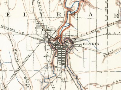


 1905
 1905
 1905
 1905
 1905