
The story
Read it all →How Congress came to be
From Wikipedia’s history of Congress.
Congress was originally called Waynesburg, and under the latter name was laid out in 1827.
Text from Wikipedia, licensed CC BY-SA 4.0.
Each edition grades its towns against each other only.
Below: maps from 1906 on and the census since 1870.
The Congress post office opened in 1832, the earliest record of the town by name.
Read from the archive, the National Register and the record. The page puts what stands out first.
The first neighbors to add old photos shape how Congress’s history is told.
From Wikipedia’s history of Congress.
Congress was originally called Waynesburg, and under the latter name was laid out in 1827.
Text from Wikipedia, licensed CC BY-SA 4.0.
Woven from the archive, old maps, post office records, the National Register and the people born here.
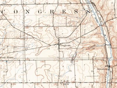 On the mapFirst mapped by the U.S. Geological Survey
Passages that mention Congress, cut from the printed page as they were published.

Reminiscences of Congress Township by Hon. Michael Totien and James Carlin. — In 1815 the first families moved into what is now Congress township. Some time during the first week in February Michael and Henry Totten accompanied George and Isaac Poe, and cut a trail from Wooster to where the village of Congress stands, which at that time was all forest, the lands having not been entered. We encamped with George Poe, about one-half mile from the village, until we could erect a cabin, which we built on section 27, on the lands owned by John Garver.
Text read by machine from the scan; it may contain errors.
Isaac Poe came to Wayne county in the spring of 1812, with his brother George, stopping in Wooster for a few years, and removing to Congress township April I, 1815. He had previously entered a quarter section of land, upon which a portion of the village of Congress now stands, where he lived three years, and then sold his farm to David Garver and Lawrence Rix. He then bought the John Lawrence farm, in Plain township, from Hon. Benjamin Jones, lived there a year, and sold it back to Mr. Jones, who sold it to Christian, father of John Lawrence, Esq., of Wooster township. From the Lawrence place he emigrated to Kentucky, thence
Text read by machine from the scan; it may contain errors.Scans and text from the Internet Archive. Books published in 1930 or earlier, which are in the public domain.
Every edition of the U.S. Geological Survey’s map of Congress. Tap a year, or press play to watch the town change.
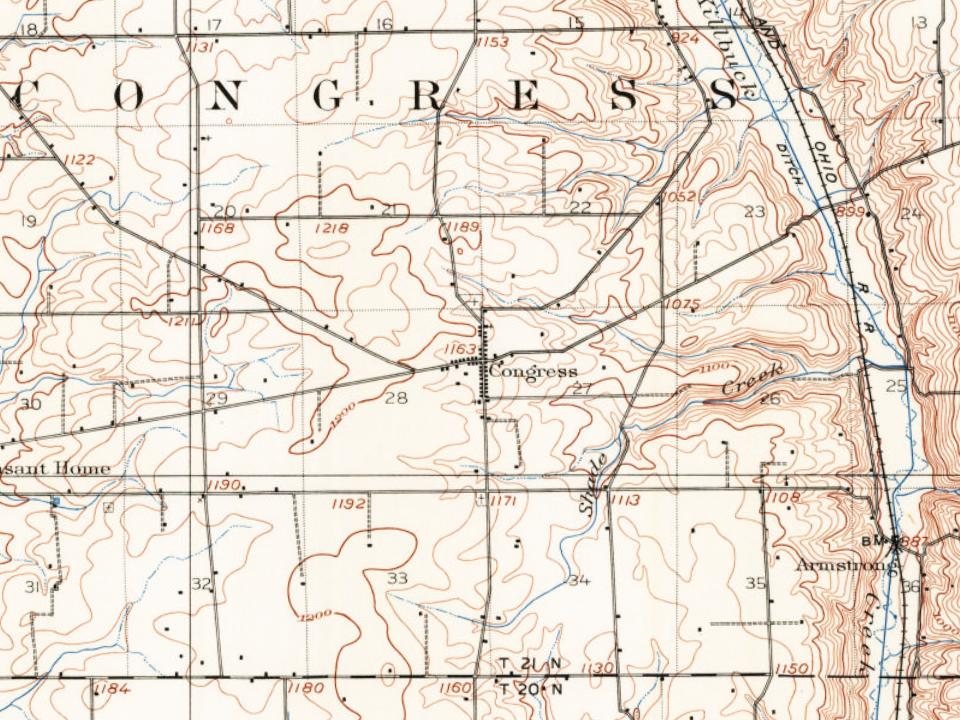
U.S. Geological Survey historical topographic maps (public domain), via Esri’s collection of the scans. The red ring marks the center of Congress.
Between 123 and 309 people in every census since 1870.
16 censuses, 1870–2020.
U.S. Census Bureau decennial counts, from the census table on Congress’ Wikipedia page.
Nobody well known was born in Congress itself, so here are the best known from just nearby.


Congress had its own post office from 1832 to 1907.
US Post Offices dataset (Blevins & Helbock, CC0). Places and cemeteries from the USGS Geographic Names Information System (2021).
The Congress post office opened in 1832, the earliest record of the town by name (U.S. post office records).
What the archives can’t tell you, neighbors can.
Founding dates: Wikidata, Wikipedia, the U.S. post office records of Blevins & Helbock (CC0) and the Census. Homes by year built: Census ACS 2020–24. National Register of Historic Places: National Park Service (list of May 22, 2026). Old photos, postcards and papers: Wikimedia Commons, the Library of Congress and other public archives, credited on each item’s page. Maps: U.S. Geological Survey historical topographic maps (via Esri) and Sanborn fire-insurance maps (Library of Congress). History text and census tables: Wikipedia (CC BY-SA 4.0). Places that used to be: USGS Geographic Names Information System (2021). How TownRatings grades history →
From Wikimedia Commons (1), Wikipedia, U.S. Geological Survey historical maps, U.S. Census counts (via Wikipedia), the US Post Offices dataset (Blevins & Helbock), the USGS Geographic Names Information System and old county and town histories (Internet Archive). Archive images are copied here with their credits and licenses, shown on each photo’s page. Refreshed monthly.
 2016
