Founding year: Wikidata. First post office: 1828.The full story ↓
History grade
What drives Waterloo’s History grade
On its age, its old homes and the National Register, Waterloo is more historic than 96% of U.S. towns, #114 of 758 in New York. All 3 inputs are above most U.S. towns; its share of homes from before 1940 ranks highest and its age lowest.
A+
HistoryA character grade: shown, never part of Waterloo’s overall grade.
New York towns list more on the Register than most of the country (a typical New York town has 12.3 per 10,000 residents, the U.S. 2.4), so Waterloo’s 122 sits above most of its state (78% of New York towns have fewer) while its 56 historic buildings outnumber those of 86% of U.S. towns.
NoteThe founding year comes from Wikidata alone; no second source gives 1800.
How sure. Graded on any two of the three inputs instead, the letter would range from A to A+. The pre-1940 share is a Census survey estimate (±6.8 points).
Founding year: Wikidata (other dates in Quick answers). Homes: Census ACS 2020–24. National Register: National Park Service, May 2026 list; each listing counted once (boundary changes and added documentation belong to their listing), and a historic district counts its contributing buildings. How TownRatings grades history →
What stands out about Waterloo’s past
Read from the archive, the National Register and the record. The page puts what stands out first.
The area was the domain of the Seneca tribe and Cayuga tribe, who were visited in the 17th century by Jesuit missionaries. The Sullivan Expedition passed through the area in 1779 to destroy the natives and their villages. After the war, the area was in the Central New York Military Tract, reserved for veterans.
The town was formed from the Town of Junius in 1829 and was named after Waterloo, Belgium likely after the Battle of Waterloo.
Every edition of the U.S. Geological Survey’s map of Waterloo. Tap a year, or press play to watch the town change.
1902Geneva sheet · 1:62,500
U.S. Geological Survey historical topographic maps (public domain), via Esri’s collection of the scans. The red ring marks the center of Waterloo.
Every building
Waterloo, building by building, 1886–1918
Fire insurance maps drew every building, what it was made of and what it was used for, so insurers could price the risk of fire. Pick a year, then a sheet.
His Royal Highness being also desirous of marking his sense of the distinguished bravery displayed by the non-commissioned officers and soldiers of the British forces, in the victory of Waterloo, has been most graciously pleased to order, that henceforth every non-commissioned officer, trumpeter, drummer, and private man, who served in the battle of Waterloo, or in any of the actions which imme-
Text read by machine from the scan; it may contain errors.
reaches the small village of Waterloo. Beyond this point the forest assumes a more straggling and dispersed appearance, until about a mile further, where at one extended ridge called the heights of Mount St. John, from a farm house on the Brussels road, the trees almost entirely disappear, and the country becomes quite open.* Along this eminence the British forces were disposed in two lines. The se-
Text read by machine from the scan; it may contain errors.
The difficulty with this reasoning, as it seems to us, Hes in the fact that it was not that he might be strong enough to defeat Welhngton that Napoleon needed to have all his army on the field of Waterloo, but in order to prevent his being overwhelmed by the union of the army of Bliicher to that of Wellington. With the army of Wellington the force Napoleon had at Waterloo was abundantly able to cope ; but against the two armies of
Text read by machine from the scan; it may contain errors.
Scans and text from the Internet Archive. Books published in 1930 or earlier, which are in the public domain.
Timeline
Waterloo, 1800 to 1995
Woven from the archive, old maps, post office records, the National Register and the people born here.
Nothing in the archives for these yearsWeddings on Main Street, storms, parades, school pictures, the old store. If it’s in your family album, it belongs here.
In 1800, according to Wikidata. Waterloo’s post office opened in 1828, and the census of 1830 counted 1,837 people here.
How does Waterloo rank for history?
Waterloo is more historic than 96% of U.S. towns, #114 of 758 in New York. The History grade combines the town’s founding era, the share of homes built before 1940 and its National Register listings. It’s a character grade, so it isn’t part of the overall grade. How it works.
How old are the homes in Waterloo?
50% of Waterloo’s homes were built before 1940 (Census estimate, ±6.8 points), against a typical 27% for a New York town; the median home was built in 1938.
Founding dates: Wikidata, Wikipedia, the U.S. post office records of Blevins & Helbock (CC0) and the Census. Homes by year built: Census ACS 2020–24. National Register of Historic Places: National Park Service (list of May 22, 2026). Old photos, postcards and papers: Wikimedia Commons, the Library of Congress and other public archives, credited on each item’s page. Maps: U.S. Geological Survey historical topographic maps (via Esri) and Sanborn fire-insurance maps (Library of Congress). History text and census tables: Wikipedia (CC BY-SA 4.0). Places that used to be: USGS Geographic Names Information System (2021).
From Wikimedia Commons (16), the Library of Congress (1), Wikidata (1), Wikipedia, Wikidata and Wikipedia for famous people, U.S. Geological Survey historical maps, U.S. Census counts (via Wikipedia), Sanborn fire insurance maps (Library of Congress) and old county and town histories (Internet Archive). Archive images are copied here with their credits and licenses, shown on each photo’s page. Refreshed monthly.
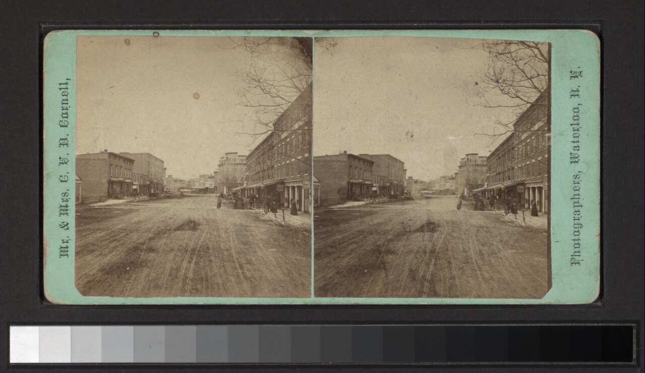


 1880
 1933
 1933
 1933
 1933
 1933
 2009
 2009
 2009
 2008
 2008
 2007
 2004
