Founding year: the first Walton post office (Blevins & Helbock, CC0).
History grade
What drives Walton’s History grade
On its age, its old homes and the National Register, Walton is more historic than 94% of U.S. towns, #182 of 758 in New York. All 3 inputs are above most U.S. towns; its share of homes from before 1940 ranks highest and its National Register listings lowest.
A
HistoryA character grade: shown, never part of Walton’s overall grade.
New York towns list more on the Register than most of the country (a typical New York town has 12.3 per 10,000 residents, the U.S. 2.4), so Walton’s 37.1 sits near the middle of its state (64% of New York towns have fewer) while its 9 historic buildings outnumber those of 75% of U.S. towns.
How sure. Graded on any two of the three inputs instead, the letter would range from A− to A+. The pre-1940 share is a Census survey estimate (±9.5 points). The founding year is the first post office, not a stated founding date.
Founding year: the first post office (other dates in Quick answers). Homes: Census ACS 2020–24. National Register: National Park Service, May 2026 list; each listing counted once (boundary changes and added documentation belong to their listing), and a historic district counts its contributing buildings. How TownRatings grades history →
What stands out about Walton’s past
Read from the archive, the National Register and the record. The page puts what stands out first.
Wikipedia doesn’t have a history of Walton yet. The photos, dates and memories neighbors add here are how it gets written.
Walton is a town in Delaware County, New York, United States. The population was 5,270 at the 2020 census. The town is in the west-central part of the county and contains the village of Walton. The town claims to be the "Scarecrow Capital of the World." Walton was formed in 1797 from the town of Franklin. The original settlement, near the site of the village of Walton, occurred in 1785.
Its first post office opened in 1801. Between the 2010 and 2020 censuses its population fell from 3,088 to 2,885 (-7%).
Intro from Wikipedia. Population: U.S. Census Bureau.
Every building
Walton, building by building, 1886–1911
Fire insurance maps drew every building, what it was made of and what it was used for, so insurers could price the risk of fire. Pick a year, then a sheet.
The next military event following the war of 1812, was the so-called "Anti-Rent war" of 1845. From the fact that there was little or no leased laud iu the town, Walton had consequently less sympathy for the " Auti-renters " than there was iu those parts of the county where the land was largely lease lots. The soldiers called out to aid the sheriff in the discharge of his duties were taken largely from the town of Walton and those towns where there was little or no anti-rent sympathy. Major James Marvin, of
Text read by machine from the scan; it may contain errors.
Seven days after the organization of Delaware county the town of Walton was organized. As originally organized the upper or northern boundary line was the line of White's patent, just above
Text read by machine from the scan; it may contain errors.
Scans and text from the Internet Archive. Books published in 1930 or earlier, which are in the public domain.
Timeline
Walton, 1813 to 1948
Woven from the archive, old maps, post office records, the National Register and the people born here.
The Walton post office opened in 1801, the earliest record of the town by name (U.S. post office records).
How does Walton rank for history?
Walton is more historic than 94% of U.S. towns, #182 of 758 in New York. The History grade combines the town’s founding era, the share of homes built before 1940 and its National Register listings. It’s a character grade, so it isn’t part of the overall grade. How it works.
How old are the homes in Walton?
62% of Walton’s homes were built before 1940 (Census estimate, ±9.5 points), against a typical 27% for a New York town; the median home was built in 1938.
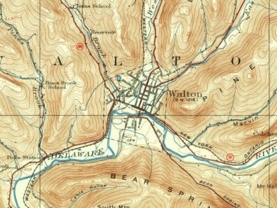
Founding dates: Wikidata, Wikipedia, the U.S. post office records of Blevins & Helbock (CC0) and the Census. Homes by year built: Census ACS 2020–24. National Register of Historic Places: National Park Service (list of May 22, 2026). Old photos, postcards and papers: Wikimedia Commons, the Library of Congress and other public archives, credited on each item’s page. Maps: U.S. Geological Survey historical topographic maps (via Esri) and Sanborn fire-insurance maps (Library of Congress). History text and census tables: Wikipedia (CC BY-SA 4.0). Places that used to be: USGS Geographic Names Information System (2021).
From Wikidata (1), Wikidata and Wikipedia for famous people, U.S. Geological Survey historical maps, U.S. Census counts (via Wikipedia), Sanborn fire insurance maps (Library of Congress) and old county and town histories (Internet Archive). Archive images are copied here with their credits and licenses, shown on each photo’s page. Refreshed monthly.