Poughkeepsie dates to 1686, and 41% of its homes were built before 1940
Among the most historic 1% of U.S. towns · #12 of 758 in New York. What drives it
79 places in town are on the National Register, among them the Matthew Vassar Estate, a National Historic Landmark, and eight historic districts with 455 buildings between them. Below: 11 old photos and papers, maps from 1887 on, and the census since 1850.
From Poughkeepsie’s archive · credits on each photo
Quick answers
How Poughkeepsie began, and where its name came from
When was Poughkeepsie founded?
1686
Poughkeepsie dates its founding to 1686 (Wikidata). The census first counted it in 1850.
First census: 11,511 in 18502020 census: 31,577340 years
How did Poughkeepsie get its name?
The name Poughkeepsie is derived from a word in the Wappinger tribe's Munsee language, roughly U-puku-ipi-sing, meaning 'the reed-covered lodge by the little-water place', referring to a spring or stream feeding into the Hudson River south of the downtown area.
How historic is Poughkeepsie?
A+
Among the most historic 1% of U.S. towns, on its age, its old homes and the National Register.
On its age, its old homes and the National Register, Poughkeepsie is among the most historic 1% of U.S. towns, #12 of 758 in New York. All 3 inputs put Poughkeepsie near the top nationally; its age ranks highest.
A+
HistoryA character grade: shown, never part of Poughkeepsie’s overall grade.
New York towns list more on the Register than most of the country (a typical New York town has 12.3 per 10,000 residents, the U.S. 2.4), so Poughkeepsie’s 178 sits above most of its state (81% of New York towns have fewer) while its 568 historic buildings outnumber those of 98% of U.S. towns.
NoteThe founding year comes from Wikidata alone; no second source gives 1686.
How sure. Graded on any two of the three inputs instead, the letter would still be A+. The pre-1940 share is a Census survey estimate (±3.2 points).
Founding year: Wikidata (other dates in Quick answers). Homes: Census ACS 2020–24. National Register: National Park Service, May 2026 list; each listing counted once (boundary changes and added documentation belong to their listing), and a historic district counts its contributing buildings. How TownRatings grades history →
What stands out about Poughkeepsie’s past
Read from the archive, the National Register and the record. The page puts what stands out first.
The country’s official list of buildings and places worth saving. One is a National Historic Landmark, the highest tier. Boundary changes and added documentation are counted with their listing.
English colonist Robert Sanders and Dutch colonist Myndert Harmense Van Den Bogaerdt acquired the land on which Poughkeepsie now sits from a local Native American tribe in 1686, and the first settlers were the families of Barent Baltus Van Kleeck and Hendrick Jans van Oosterom. The settlement grew quickly, and the Reformed Church of Poughkeepsie was established by 1720.
Fire insurance maps drew every building, what it was made of and what it was used for, so insurers could price the risk of fire. Pick a year, then a sheet.
Lost post offices, old corners and places now gone
Poughkeepsie’s post office has been open since 1786. Another post office, Friends Meeting House, opened and closed inside today’s town.
Poughkeepsie
1786–today
Friends Meeting House
1822–1824
17801900today
Hamlets and corners on the map
Hudson Heights
Gone or out of use
Cataract Steamer Company Number 4buildingCongregation Schomre HadathchurchDavy Crockett Hook And Labber Company Number 1buildingNativity Parochial SchoolschoolO H Booth Hose Company Number 2buildingPoughkeepsie ArmorymilitaryPoughkeepsie Fire Department Lady Washington CompanybuildingPoughkeepsie Fire Department Niagara Company Number 2buildingRialto TheatrebuildingStarlight TheaterbuildingStratford TheatrebuildingVassar Home For Aged MenbuildingVassar Institutebuilding
US Post Offices dataset (Blevins & Helbock, CC0). Places and cemeteries from the USGS Geographic Names Information System (2021).
Help out
Finish Poughkeepsie’s story
Most archives stop around 1920. The photos from after that are in family albums, not libraries.
Decades since 1900 with photos
00s10s20s30s40s50s60s70s80s90s
0 of 10 decades. The empty ones are waiting for someone’s album.
In 1686, according to Wikidata. Poughkeepsie’s post office opened in 1786, and the census of 1850 counted 11,511 people here.
How does Poughkeepsie rank for history?
Poughkeepsie is among the most historic 1% of U.S. towns, #12 of 758 in New York. The History grade combines the town’s founding era, the share of homes built before 1940 and its National Register listings. It’s a character grade, so it isn’t part of the overall grade. How it works.
What is on the National Register in Poughkeepsie?
79 listings: 69 buildings, among them the Matthew Vassar Estate (a National Historic Landmark since 1969), 8 historic districts with 455 contributing buildings, 1 site, and 1 structure. 568 historic buildings in all.
How old are the homes in Poughkeepsie?
41% of Poughkeepsie’s homes were built before 1940 (Census estimate, ±3.2 points), against a typical 27% for a New York town; the median home was built in 1952.
Founding dates: Wikidata, Wikipedia, the U.S. post office records of Blevins & Helbock (CC0) and the Census. Homes by year built: Census ACS 2020–24. National Register of Historic Places: National Park Service (list of May 22, 2026). Old photos, postcards and papers: Wikimedia Commons, the Library of Congress and other public archives, credited on each item’s page. Maps: U.S. Geological Survey historical topographic maps (via Esri) and Sanborn fire-insurance maps (Library of Congress). History text and census tables: Wikipedia (CC BY-SA 4.0). Places that used to be: USGS Geographic Names Information System (2021).
From Wikimedia Commons (9), the Library of Congress (2), Wikidata (1), the National Register of Historic Places (79), Wikipedia, Wikidata and Wikipedia for famous people, U.S. Geological Survey historical maps, U.S. Census counts (via Wikipedia), the US Post Offices dataset (Blevins & Helbock), the USGS Geographic Names Information System and Sanborn fire insurance maps (Library of Congress). Archive images are copied here with their credits and licenses, shown on each photo’s page. Refreshed monthly.


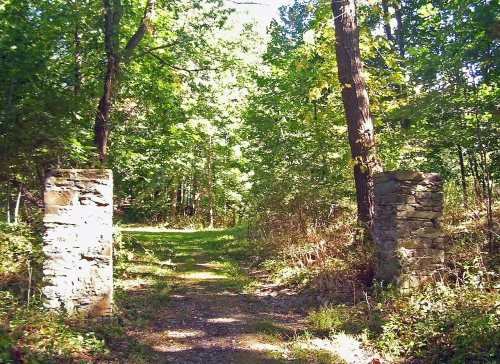 ★ Landmark

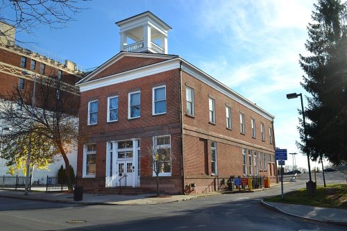


 c. 1760
 1761
 1852
 1852
 1853
 1853
 1856

