Founding year: Wikidata. First post office: 1786.The full story ↓
History grade
What drives Kinderhook’s History grade
On its age, its old homes and the National Register, Kinderhook is among the most historic 1% of U.S. towns. All 3 inputs put Kinderhook near the top nationally; its National Register listings ranks highest.
A+
HistoryA character grade: shown, never part of Kinderhook’s overall grade.
New York towns list more on the Register than most of the country (a typical New York town has 12.3 per 10,000 residents, the U.S. 2.4), so Kinderhook’s 2,332 sits above most of its state (99% of New York towns have fewer) while its 250 historic buildings outnumber those of 94% of U.S. towns.
NoteThe founding year comes from Wikidata alone; no second source gives 1750.
How sure. Graded on any two of the three inputs instead, the letter would still be A+. The pre-1940 share is a Census survey estimate (±10.1 points).
Founding year: Wikidata (other dates in Quick answers). Homes: Census ACS 2020–24. National Register: National Park Service, May 2026 list; each listing counted once (boundary changes and added documentation belong to their listing), and a historic district counts its contributing buildings. How TownRatings grades history →
What stands out about Kinderhook’s past
Read from the archive, the National Register and the record. The page puts what stands out first.
Nothing in the archives for these yearsWeddings on Main Street, storms, parades, school pictures, the old store. If it’s in your family album, it belongs here.
In 1609, Henry Hudson sailed as far north as Kinderhook on his exploration of the Hudson River and named the location "Kinderhoek". This means "children's corner" in Dutch, and is supposed to have been applied to this locality on account of the many Native American children who had assembled on one of the bluffs along the river to see his strange vessel (the Half Moon) sailing upstream. Hudson had mixed dealings with the local Mohican natives, ranging from peaceful trade to minor skirmishes. As the Dutch settled in the area, they were targeted by the natives for robbery and murder. Another version says that a Swede named Scherb, living in the forks of an Indian trail in the present town of Stuyvesant, had such a numerous family of children that the name of Kinderhook was used by the Dutch traders to designate that locality. A third theory about the town's name derives from a settler, na…
Passages that mention Kinderhook, cut from the printed page as they were published.
A history of old Kinderhook from aboriginal days to the present time1914 · page 32Read the page →
Read the text
Act to incorporate the Village of Kinderhook, in the County of Columbia." Sec. I. thus describes: Boundary Lines. . . . Beginning at and on the northerly side of Kinderhook creek, at a point where the division line between the town of Kinderhook and the town of Stuyvesant crosses the said creek near the dwelling house of Adam Van Alstyne, running thence north-easterly along the said northerly side of said creek and up the same to a post in the division
Text read by machine from the scan; it may contain errors.
A history of old Kinderhook from aboriginal days to the present time1914 · page 328Read the page →
Read the text
pelled to report the reprehensible action of the town of Stuyvesant. In December, 1827, it appealed to the legislature for the passage of a law to equalize the public bridges in the towns of Stuyvesant and Kinderhook, or to exonerate the town of Stuyvesant from the expenses of repairs on the long bridge (our village bridge) in the town of Kinderhook.
Text read by machine from the scan; it may contain errors.
History of Columbia County, New York. With illustrations and biographical sketches of some of its prominent men and pioneers1878 · page 232Read the page →
Read the text
The services of the Episcopal church were first regularly held in Kinderhook in the fall of 1850. These resulted in the organization of the present society, Jan. 18, 1851. An attractive house of worship was soon after commenced in the village of Kinderhook, which was consecrated June 22, 1852, by Rev. Carlton Chase. The rector. Rev. Fred. T.
Text read by machine from the scan; it may contain errors.
Scans and text from the Internet Archive. Books published in 1930 or earlier, which are in the public domain.
Timeline
Kinderhook, 1750 to 2010
Woven from the archive, old maps, post office records, the National Register and the people born here.
Fire insurance maps drew every building, what it was made of and what it was used for, so insurers could price the risk of fire. Pick a year, then a sheet.
1886Sheet 1 of 1
Edition
Sheets
BrickWoodStone
Sanborn Map Company, via the Library of Congress. Editions published in 1930 or earlier, which are in the public domain.
Then & now
Stand where they stood
No then-and-now pairs yet. Take a photo from the same spot as an old one and they appear here side by side.
Retake this viewIcabod [sic] Crane's schoolhouse, 1809
Find the spot, match the angle, and add your photo. It becomes the first then-and-now pair on Kinderhook’s page.
In 1750, according to Wikidata. Kinderhook’s post office opened in 1786, and the census of 1820 counted 3,963 people here.
How does Kinderhook rank for history?
Kinderhook is among the most historic 1% of U.S. towns. The History grade combines the town’s founding era, the share of homes built before 1940 and its National Register listings. It’s a character grade, so it isn’t part of the overall grade. How it works.
How old are the homes in Kinderhook?
41% of Kinderhook’s homes were built before 1940 (Census estimate, ±10.1 points), against a typical 27% for a New York town; the median home was built in 1953.
Founding dates: Wikidata, Wikipedia, the U.S. post office records of Blevins & Helbock (CC0) and the Census. Homes by year built: Census ACS 2020–24. National Register of Historic Places: National Park Service (list of May 22, 2026). Old photos, postcards and papers: Wikimedia Commons, the Library of Congress and other public archives, credited on each item’s page. Maps: U.S. Geological Survey historical topographic maps (via Esri) and Sanborn fire-insurance maps (Library of Congress). History text and census tables: Wikipedia (CC BY-SA 4.0). Places that used to be: USGS Geographic Names Information System (2021).
From Wikimedia Commons (14), the Library of Congress (4), Wikipedia, Wikidata and Wikipedia for famous people, U.S. Geological Survey historical maps, U.S. Census counts (via Wikipedia), Sanborn fire insurance maps (Library of Congress) and old county and town histories (Internet Archive). Archive images are copied here with their credits and licenses, shown on each photo’s page. Refreshed monthly.


 1809
 c. 1856
 1873
 1873
 1910
 1930
 1930
 1930
 1933
 1933
 1933
 1933
 1933
 1933
 1933
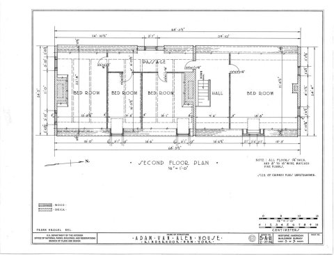 1933
 1933
 1933


