
Fenton in pictures
Census counts: 1,499 in 1870, a low of 1,050 in 1910, 6,441 in 2020. The archive holds 3 old photos and papers going back to 1876 and 5 maps from 1904 on.
1 place on the National Register of Historic Places.
Explore the history →Each edition grades its towns against each other only.
Fenton is a solid, middle-of-the-road choice. It grades C overall, 546th among New York's 745 graded towns, with no subject far below average. Its best mark is schools: its schools outperform 55% of the state's. Its lowest everyday mark is in health: residents are less healthy than 66% of U.S. towns on CDC estimates. A typical home there costs about $144K, 2.2 years of the Binghamton metro’s $65K median household income. Fenton’s trail density is 1.0 miles per square mile, above both the New York town median (0.4) and the median of U.S. towns (0.4). Only 73 of New York’s 1,216 towns score lower on history. Chenango Valley State Park, at 1,074 acres with 30.6 miles of trail, is the biggest park or preserve.
Where Fenton’s working residents go each day. Line width shows the share.
Census LEHD 2023
Each subject compared with towns across the country (schools within New York), ordered by how far Fenton is from typical.
How TownRatings grades towns →

Census counts: 1,499 in 1870, a low of 1,050 in 1910, 6,441 in 2020. The archive holds 3 old photos and papers going back to 1876 and 5 maps from 1904 on.
1 place on the National Register of Historic Places.
Explore the history →Who provides power, water and the rest in Fenton, and how to reach them.
EPA SDWIS (Oct 9, 2026) · HIFLD + EIA-861 2025 · Census 2020 ZCTAs · NCES 2024–25 · registration: vote.gov, updated Aug 3, 2026.
Ordered by what stands out in Fenton.
Fenton has homes that are cheap against local pay and has commutes shorter than most of New York, but it scores below Colesville and its other neighbors on health.
Count the trails in 3 parks and preserves and they come to 33 miles.
| Biggest places to walk | Trails | Acres |
|---|---|---|
| 1. Chenango Valley State Park | 30.6 mi | 1,074 |
| 2. Port Dickinson Jeanne and John D. Wilfley Community Park | 0.1 mi | 8 |
| 3. Hillcrest Park | — | 3 |
Trails & parks © OpenStreetMap contributors · Conserved land: USGS PAD-US
The largest public high school is Chenango Valley High School, with 507 students. Two of its 3 schools are shown below, with the reason for each. Its public schools are run by the Chenango Valley Central School District.
| School | Level | Students | Letter |
|---|---|---|---|
| Chenango Valley Middle SchoolLargest public middle schoolGrades 6–8 | Grades 6–8 | 379 | C |
| Chenango Valley High SchoolLargest public high schoolGrades 9–12 | Grades 9–12 | 507 | A+ |
NCES · EDFacts · graded within NY on state tests and graduation
The average commute for its 2,651 working residents takes 20.5 minutes, against 32.6 across New York.
For residents in Fenton, the share who live below the poverty line is 12%. Most people who work leave Fenton to do it: just 6% work in town. The typical journey to work locally is 21 minutes. Fenton: 7.1% of workers do their job from home, against 12% in New York’s towns and 11% across U.S. towns.
| Fenton | New York towns | U.S. towns | |
|---|---|---|---|
| Average trip to work | 21 minutes | 25 minutes | 25 minutes |
| Work from home | 7.1% | 12% | 11% |
| Below the poverty line | 12% | 9.5% | 9.6% |
| Working residents who work in town | 5.9% | 10% | 8% |
Census LEHD 2023 · ACS
All 6 graded neighbors score healthier than its C, from Colesville (C+) to Port Dickinson (A−).
Among adults in Fenton, 36% have obesity. In Fenton, 16% of adults report frequent physical distress.
| Fenton | New York towns | U.S. towns | |
|---|---|---|---|
| Frequent physical distress (CDC PLACES) | 16% | 14% | 14% |
| High blood pressure (CDC PLACES) | 40% | 34% | 35% |
| Smoke cigarettes (CDC PLACES) | 17% | 13% | 14% |
| Feel lonely (CDC PLACES) | 35% | 32% | 33% |
| What stands out | Fenton | NY |
|---|---|---|
| More adults with COPD | 10.1% | 6% |
| More older adults who have lost all their teeth | 19.2% | 12.8% |
| More smokers | 16.9% | 11.3% |
CDC PLACES 2025 · modeled estimates for adults · CMS · HRSA
July afternoons reach 82°, January nights drop to 15° and about 48 inches of snow falls in a winter.
NOAA U.S. Climate Normals, 1991–2020
Since 1979, Fenton has seen 36 flood insurance claims paid out. On expected storm and flood damage, Fenton sits above 56% of U.S. communities. 84% of the town’s expected losses from natural hazards come from inland flooding, followed by tornadoes at 6%. Federal disaster aid has reached households in Fenton after 9 declared disasters, most recently in 2018.
FEMA flood insurance claims · FEMA disaster declarations and aid · FEMA National Risk Index · OpenFEMA
At 2.2 years of the Binghamton metro’s $65K median household income, the typical home costs less against local pay than in 83% of New York towns; that ratio is one input to its B− for cost of living. The median property tax bill is $2,952, against $6,582 across New York, another input to its cost-of-living grade.
80% of households own their home in Fenton. Its typical rent stands at $1,021 a month.
| Fenton | New York towns | U.S. towns | |
|---|---|---|---|
| Households that own their home | 80% | 75% | 73% |
| Median rent | $1,021 a month | $1,103 a month | $1,185 a month |
Census ACS, 2020–24 · Zillow Home Value Index · Redfin Data Center
Museums, parks, gardens and other places to visit around Fenton. Close and well known come first.
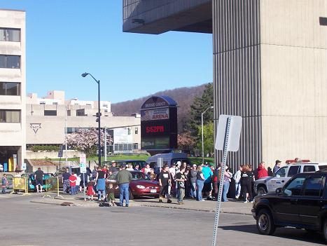
9 mi Stadium & arenaBroome County Veterans Memorial Arena
38 mi Stadium & arenaSchoellkopf Field27 mi Ski areaGreek Peak Mountain Resort43 runs · 828 ft vertical
39 mi MuseumHerbert F. Johnson Museum of Art80K visitors a year39 mi AttractionSagan Planet Walk35 mi Ski areaElk Mountain Ski Resort28 runs · 908 ft verticalBroome County Veterans Memorial Arena: Bmoore2009 at English Wikipedia, Public domain · Schoellkopf Field: Alex Sergeev, (www.asergeev.com) Originally uploaded by en:User:Cornell010, CC BY-SA 3.0 · Herbert F. Johnson Museum of Art: Dmadeo, CC BY-SA 3.0
2 within 15 miles of the center of Fenton
About 3 of every 100 Fenton residents are enrolled in college, against 7 across New York.
8 towns share a border with Fenton.
| Town | NY rank | Overall | Cost | Safety | Schools | Health |
|---|---|---|---|---|---|---|
| Fenton | #546 | C | B− | — | B | C |
| Chenango | #543 | C | B− | — | B | B− |
| Greene | #538 | C | B− | — | C+ | B− |
| Chenango Bridge | — | — | — | — | — | — |
| Colesville | #717 | D | C | — | C | C+ |
| Port Dickinson | — | — | B | — | B− | A− |
| Kirkwood | #518 | C | C+ | — | B | B− |
| Barker | — | — | B+ | — | B− | B− |
Port Dickinson and Barker have fewer than 2,500 residents, so they get subject grades but no overall grade. Fenton, Chenango, Greene, Colesville, Port Dickinson, Kirkwood and Barker report no FBI crime data of their own. Chenango Bridge isn’t graded (fewer than 1,000 residents, or not enough data). Compare Fenton with a neighbor →
Short answers, built from the data on this page.
Fenton grades C overall, better than 31% of U.S. towns and #546 of 745 in New York. It grades C for health and B for schools.
The typical home is worth about $144,000, 73% below the New York typical home. Cost of living, which also weighs rents, property taxes and how many households pay 30% or more of their income for housing, grades B−.