Founding year: Wikidata. First post office: 1795.The full story ↓
History grade
What drives Cooperstown’s History grade
On its age, its old homes and the National Register, Cooperstown is among the most historic 1% of U.S. towns. All 3 inputs are above most U.S. towns; its share of homes from before 1940 ranks highest and its age lowest.
A+
HistoryA character grade: shown, never part of Cooperstown’s overall grade.
New York towns list more on the Register than most of the country (a typical New York town has 12.3 per 10,000 residents, the U.S. 2.4), so Cooperstown’s 2,293 sits above most of its state (99% of New York towns have fewer) while its 509 historic buildings outnumber those of 97% of U.S. towns.
NoteThe founding year comes from Wikidata alone; no second source gives 1786.
How sure. Graded on any two of the three inputs instead, the letter would still be A+. The pre-1940 share is a Census survey estimate (±6.0 points).
Founding year: Wikidata (other dates in Quick answers). Homes: Census ACS 2020–24. National Register: National Park Service, May 2026 list; each listing counted once (boundary changes and added documentation belong to their listing), and a historic district counts its contributing buildings. How TownRatings grades history →
What stands out about Cooperstown’s past
Read from the archive, the National Register and the record. The page puts what stands out first.
Before European colonization, Iroquois Indians inhabited the area around the village and Otsego Lake. The name Otsego is from a Mohawk or Oneida word meaning "place of the rock", referring to the large boulder near the lake's outlet, today known as "Council Rock". It is a large boulder whose top is above the water's surface and can be seen from shore. It is believed to have been a meeting place for Native Americans prior to the American Revolutionary War. A small parcel of land near Council Rock was presented to the Village of Cooperstown in 1957, on the condition that it remain open to the public as a park.
Peaked at 2,909 in 1930; 1,794 people lived here in 2020.
16 censuses, 1860–2020.
U.S. Census Bureau decennial counts, from the census table on Cooperstown’s Wikipedia page.
Every building
Cooperstown, building by building, 1887–1915
Fire insurance maps drew every building, what it was made of and what it was used for, so insurers could price the risk of fire. Pick a year, then a sheet.
erstown was made by John Christopher Hartwick in 1761. In that year Hartwick obtained from the Provincial government a patent to the lands which, southwest of Cooperstown, still perpetuate his name, and began a settlement at the foot of Otsego Lake under the misapprehension that the site was included in his patent. It was not long before Hartwick discovered his error, and
Text read by machine from the scan; it may contain errors.
History of Otsego County, New York. With illustrations and biographical sketches of some of its prominent men and pioneers1878Read the page →
Read the text
After closing his mercantile business, Mr. Sill engaged in the produce trade, and continued the same up to August, 1854, when he moved to the village of Cooperstown, and entered into the hop and wool trade, under the firm-name of Scott, Pier & Sill, which firm dissolved after the expiration of one year, and was succeeded by the firm of Scott, Sill & Co., which firm remained in the trade about three year.s and was then dissolved ; after closing the business of the
Text read by machine from the scan; it may contain errors.
built at Morris. Eight years later Father Nash organized St. Matthew’s parish at Unadilla, and in 1811 completed the formal organization of Christ Church parish in Cooperstown, where the church building had been erected in 1807-10, and where Father Nash now came to be in partial residence as rector during seven years.* Aside from these parishes which so soon be-
Text read by machine from the scan; it may contain errors.
Scans and text from the Internet Archive. Books published in 1930 or earlier, which are in the public domain.
Timeline
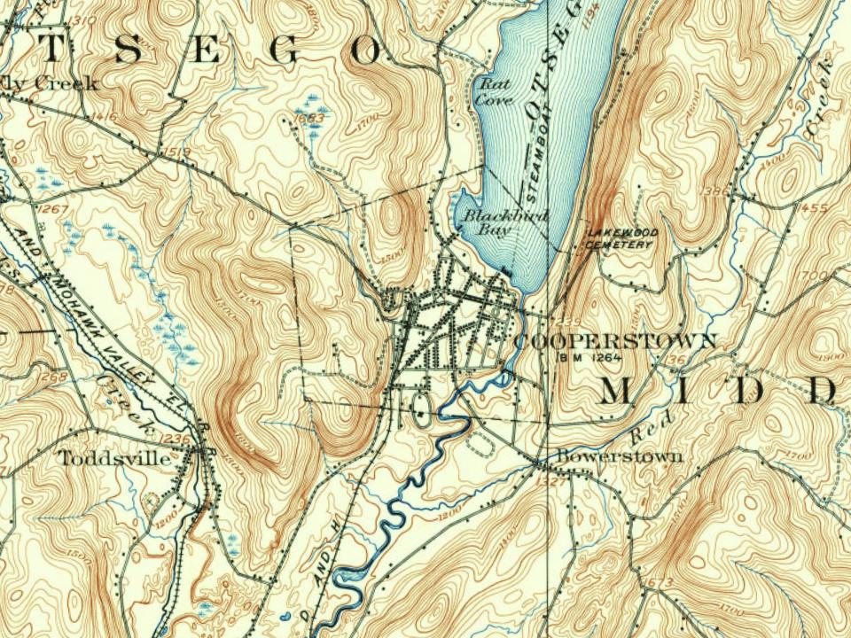
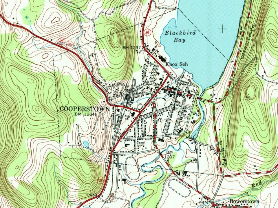
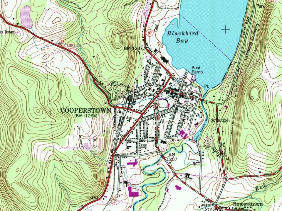
Cooperstown, 1786 to 1978
Woven from the archive, old maps, post office records, the National Register and the people born here.
Nothing in the archives for these yearsWeddings on Main Street, storms, parades, school pictures, the old store. If it’s in your family album, it belongs here.
In 1786, according to Wikidata. Cooperstown’s post office opened in 1795, and the census of 1860 counted 1,597 people here.
How does Cooperstown rank for history?
Cooperstown is among the most historic 1% of U.S. towns. The History grade combines the town’s founding era, the share of homes built before 1940 and its National Register listings. It’s a character grade, so it isn’t part of the overall grade. How it works.
How old are the homes in Cooperstown?
71% of Cooperstown’s homes were built before 1940 (Census estimate, ±6.0 points), against a typical 27% for a New York town; the median home was built in 1938.
Founding dates: Wikidata, Wikipedia, the U.S. post office records of Blevins & Helbock (CC0) and the Census. Homes by year built: Census ACS 2020–24. National Register of Historic Places: National Park Service (list of May 22, 2026). Old photos, postcards and papers: Wikimedia Commons, the Library of Congress and other public archives, credited on each item’s page. Maps: U.S. Geological Survey historical topographic maps (via Esri) and Sanborn fire-insurance maps (Library of Congress). History text and census tables: Wikipedia (CC BY-SA 4.0). Places that used to be: USGS Geographic Names Information System (2021).
From Wikimedia Commons (2), the Library of Congress (10), Wikipedia, Wikidata and Wikipedia for famous people, U.S. Geological Survey historical maps, U.S. Census counts (via Wikipedia), Sanborn fire insurance maps (Library of Congress) and old county and town histories (Internet Archive). Archive images are copied here with their credits and licenses, shown on each photo’s page. Refreshed monthly.





 1905
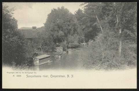 1905
 1905
 1905
 1905
 1905
 1905
 1905