On its age, its old homes and the National Register, Camillus is more historic than 87% of U.S. towns. All 3 inputs are above most U.S. towns; its share of homes from before 1940 ranks highest and its National Register listings lowest.
A
HistoryA character grade: shown, never part of Camillus’ overall grade.
New York towns list more on the Register than most of the country (a typical New York town has 12.3 per 10,000 residents, the U.S. 2.4), so Camillus’ 21.1 sits near the middle of its state (57% of New York towns have fewer) while its 3 listings outnumber those of 65% of U.S. towns.
NoteThe founding year comes from Wikidata alone; no second source gives 1799.
How sure. Graded on any two of the three inputs instead, the letter would range from A− to A. The pre-1940 share is a Census survey estimate (±6.2 points).
Founding year: Wikidata (other dates in Quick answers). Homes: Census ACS 2020–24. National Register: National Park Service, May 2026 list; each listing counted once (boundary changes and added documentation belong to their listing), and a historic district counts its contributing buildings. How TownRatings grades history →
What stands out about Camillus’ past
Read from the archive, the National Register and the record. The page puts what stands out first.
Most of the current-day Town of Camillus was part of the former Central New York Military Tract. Much of the southeastern portion of the town, corresponding to Fairmount, was not part of the Military Tract but was instead part of the original Onondaga Reservation territory that came under New York State control after the Treaty of Cayuga Bridge in 1795. This part of the town, originally incorporated into the Town of Onondaga, was annexed to Camillus in 1834. Joseph Sherwood, the first pioneer arrived around 1795 at the site of the village of Camillus. The Town of Camillus was formed in 1799 with land from the Town of Marcellus. Industrial development was promoted by the Erie Canal in 1825. Camillus was also on the railroad line linking Syracuse to Auburn in 1838. The Nine Mile Creek Aqueduct and Wilcox Octagon House are listed on the National Register of Historic Places.
Passages that mention Camillus, cut from the printed page as they were published.
... History of Onondaga County, New York1878 · page 327Read the page →
Read the text
its name from Hon. Martin Van Buren, then newly elected Governor of the State of New York. The territory embraced in it was originally part of the township of Camillus, of the Military Tract, and included in the town of Marcellus from the organization of the county in 1794 to the organization of the town of Camillus in 1799. On the 26th of March, 1829, it was taken from the northern part
Text read by machine from the scan; it may contain errors.
reelected by his neighbors to fill that position. He was appointed one of the commissioners ( 1829) to set off the town of Van Buren from the then large town of Camillus. He was appointed by the Legislature as commissioner to carry out many important trusts. He acted as arbitrator in numerous cases to adjust difficulties among men. He did much for the improvement of Onondaga County in ameliorat-
Text read by machine from the scan; it may contain errors.
Scans and text from the Internet Archive. Books published in 1930 or earlier, which are in the public domain.
Timeline
Camillus, 1799 to 1970
Woven from the archive, old maps, post office records, the National Register and the people born here.
Fire insurance maps drew every building, what it was made of and what it was used for, so insurers could price the risk of fire. Pick a year, then a sheet.
In 1799, according to Wikidata. the census of 1820 counted 5,791 people here.
How does Camillus rank for history?
Camillus is more historic than 87% of U.S. towns. The History grade combines the town’s founding era, the share of homes built before 1940 and its National Register listings. It’s a character grade, so it isn’t part of the overall grade. How it works.
How old are the homes in Camillus?
32% of Camillus’ homes were built before 1940 (Census estimate, ±6.2 points), against a typical 27% for a New York town; the median home was built in 1958.
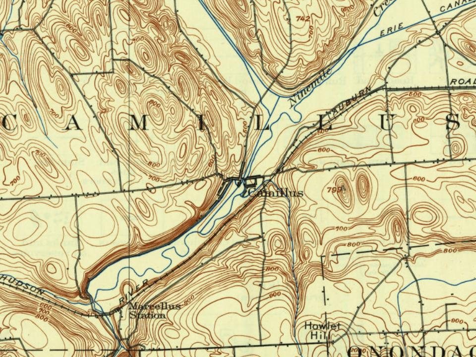
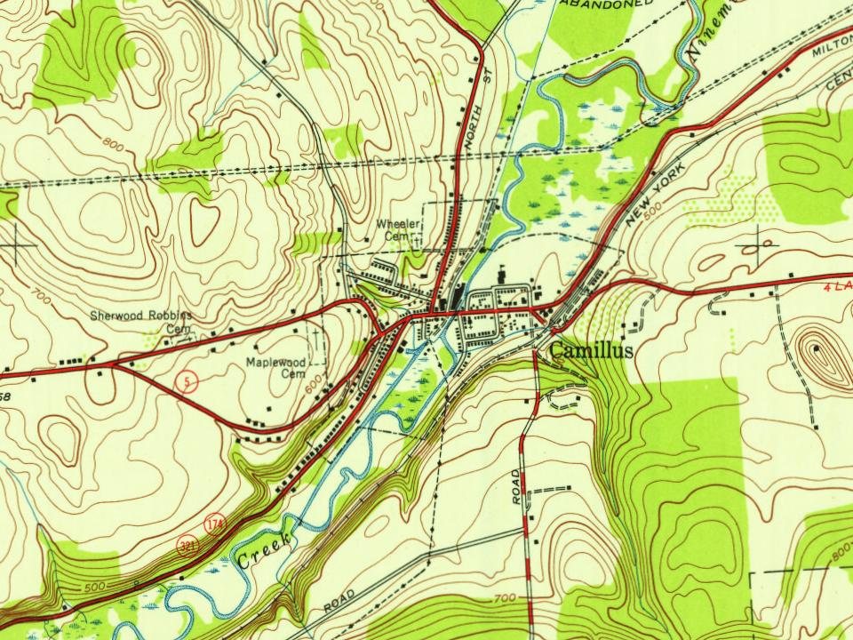
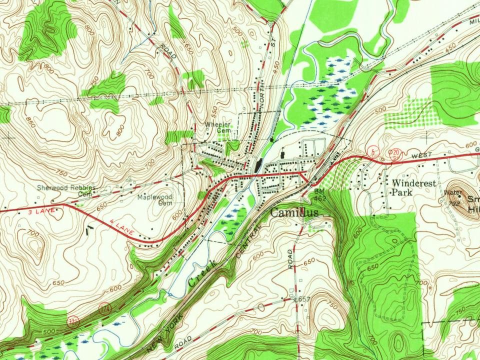
Founding dates: Wikidata, Wikipedia, the U.S. post office records of Blevins & Helbock (CC0) and the Census. Homes by year built: Census ACS 2020–24. National Register of Historic Places: National Park Service (list of May 22, 2026). Old photos, postcards and papers: Wikimedia Commons, the Library of Congress and other public archives, credited on each item’s page. Maps: U.S. Geological Survey historical topographic maps (via Esri) and Sanborn fire-insurance maps (Library of Congress). History text and census tables: Wikipedia (CC BY-SA 4.0). Places that used to be: USGS Geographic Names Information System (2021).
From Wikimedia Commons (12), Wikipedia, Wikidata and Wikipedia for famous people, U.S. Geological Survey historical maps, U.S. Census counts (via Wikipedia), Sanborn fire insurance maps (Library of Congress) and old county and town histories (Internet Archive). Archive images are copied here with their credits and licenses, shown on each photo’s page. Refreshed monthly.



 2008
 2008
 2007
 2007
 2007
 2007
 2007
 2007
 2007
 2007
 2007
 2006
