Bath dates to 1793, and 26% of its homes were built before 1940
More historic than 93% of U.S. towns · #196 of 758 in New York. What drives it
20 places in town are on the National Register, among them five historic districts with 143 buildings between them. Below: 5 old photos and papers, maps from 1888 on, and the census since 1820.
Founding year: Wikipedia. First post office: 1800.The full story ↓
History grade
What drives Bath’s History grade
On its age, its old homes and the National Register, Bath is more historic than 93% of U.S. towns, #196 of 758 in New York. All 3 inputs are above most U.S. towns; its National Register listings ranks highest and its age lowest.
A
HistoryA character grade: shown, never part of Bath’s overall grade.
New York towns list more on the Register than most of the country (a typical New York town has 12.3 per 10,000 residents, the U.S. 2.4), so Bath’s 147 sits above most of its state (80% of New York towns have fewer) while its 167 historic buildings outnumber those of 92% of U.S. towns.
NoteThe founding year comes from Wikipedia alone; no second source gives 1793.
How sure. Graded on any two of the three inputs instead, the letter would still be A. The pre-1940 share is a Census survey estimate (±3.8 points).
Founding year: Wikipedia (other dates in Quick answers). Homes: Census ACS 2020–24. National Register: National Park Service, May 2026 list; each listing counted once (boundary changes and added documentation belong to their listing), and a historic district counts its contributing buildings. How TownRatings grades history →
What stands out about Bath’s past
Read from the archive, the National Register and the record. The page puts what stands out first.
Lost post offices, old corners, places now gone and burying grounds
Bath’s post office has been open since 1800. Three other post offices opened and closed inside today’s town.
Bath
1800–today
Mud Creek
1824–1850
Kennedyville
1825–1852
Savona
1850–today
Kanona
1852–today
Sonora
1854–1904
18001910today
Hamlets and corners on the map
Brookwood Mobile Home ParkBuck SettlementCoss CornersDudley SettlementEast UnionHaverling HeightsJ and M Green Acres Mobile Home ParkKanonaKnight SettlementLake Country EstatesLake Country Estates Mobile Home ParkOld Field Mobile Home ParkSavonaSavona Estates Mobile Home ParkSonoraThe Homes Of Wildflower HillsUnionville
Gone or out of use
Arnold PitmineBath QuarrymineBlade PitmineDickinsons AirfieldairportSavona PitmineSchool Number 3schoolSteuben Crushed Stone Quarrymine
20cemeteries and burying grounds inside Bath
Babcock HollowBath NationalBuckChamberlainDurnianEagle ValleyGrantGroveHoly Sepulchre Roman CatholicKnightLookNondagaNorrisOld County HomePioneerSeamansSonoraSteuben County Farm HomeUnionvilleWillis
See all 20
Babcock Hollow Cemetery · Bath National Cemetery · Buck Cemetery · Chamberlain Cemetery · Durnian Cemetery · Eagle Valley Cemetery · Grant Cemetery · Grove Cemetery · Holy Sepulchre Roman Catholic Cemetery · Knight Cemetery · Look Cemetery · Nondaga Cemetery · Norris Cemetery · Old County Home Cemetery · Pioneer Cemetery · Seamans Cemetery · Sonora Cemetery · Steuben County Farm Home Cemetery · Unionville Cemetery · Willis Cemetery
US Post Offices dataset (Blevins & Helbock, CC0). Places and cemeteries from the USGS Geographic Names Information System (2021).
On the National Register
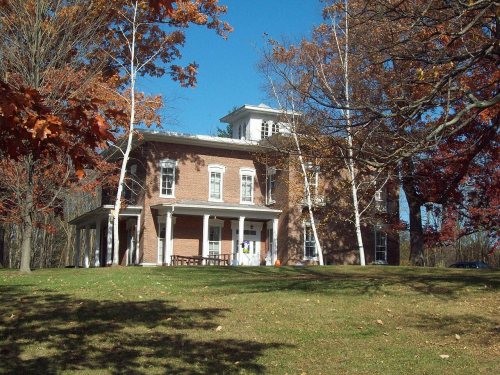
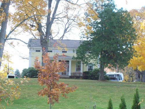
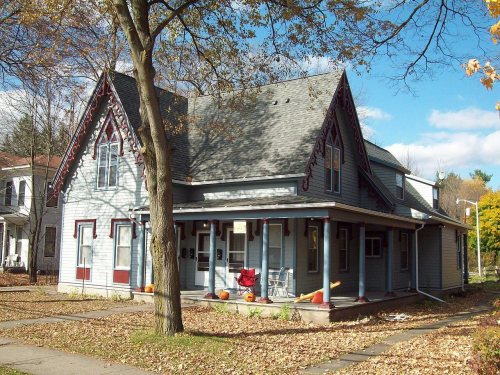
20 listings protect 167 historic buildings
The country’s official list of buildings and places worth saving.
The town was founded in 1793 and was part of a land investment by the wealthy British politician William Pulteney, and named after Bath, Somerset, in England, where he owned extensive estates. It was created along with Steuben County in 1796 and became a mother town of the county, eventually yielding land to seven later towns. The Lackawanna Railroad opened its mainline through Bath, and opened a station, in 1882.
The first jailhouse was built in 1796 which was constructed out of logs at a location just west of Pulteney Square. It was eventually replaced by a more durable structure made of stone.
Passages that mention Bath, cut from the printed page as they were published.
A history of Steuben County, New York, and its people1911 · page 193Read the page →
Read the text
John Niles, a Presbyterian clergyman. In 1807 the same clergyman became the first settled minister in the town of Bath. The first preaching services held in the town of Bath, of which any account now remains, were conducted by Rev. Seth Williston, a traveling missionary, in the summer of 1802, in the schoolhouse facing Pulteney square on the northwest corner. Here was organized on January 6, 1806, by the above named John Niles, "The Bath Religious Society." In 1795 a Baptist clergyman held serv-
Text read by machine from the scan; it may contain errors.
A history of Steuben County, New York, and its people1911 · page 194Read the page →
Read the text
A Catholic church was organized in the town of West Union in 1845, and in the town of Bath in 1846. At Perkinsville, town of "Wayland, a parochial school was founded in 1850, under the instruction of the Sisters of Mercy. It is well attended and has a good reputation. A Catholic church was organized in the town of Addison in 1854; town of.Cohocton, 1861; town of Caton, 1883; town of Prattsburg, 1887 ; town of Pulteney, 1888 ; town of Cameron, 1891 ; and in the town of Campbell the following year.
Text read by machine from the scan; it may contain errors.
Annals of Bath, from the year 1800 to the passing of the new municipal act1838 · page 249Read the page →
Read the text
Leland, the antiquary, mentions this chapel in his visit to Bath, in the year 1580. In the account which he gives of his entrance over the Old Bridge, he says — " Or ever I came to the bridge, at Bath, that is over Avon, I came down by a rokky hille, fuUe of springes of water ; and on this rokky hille is sette a long streate, as a suburbe to the cyte of Bath ; and in this streate there is a chapelle of St. Mary Magdalen.**
Text read by machine from the scan; it may contain errors.
Annals of Bath, from the year 1800 to the passing of the new municipal act1838 · page 129Read the page →
Read the text
December, the following petition was presented to Parliament by Sir Francis Burdett : — " The petition of John Allen, of the city of Bath, and Samuel Colleton Graves, of Henbury Fort, in the county of Devon, setting forth : — That at the last election of two citizens to represent the city of Bath in Parliament, Lord John Thynne and Charles Palmer, Esq., were candidates ; and that the notice of the said
Text read by machine from the scan; it may contain errors.
Scans and text from the Internet Archive. Books published in 1930 or earlier, which are in the public domain.
Timeline
Bath, 1793 to 1910
Woven from the archive, old maps, post office records, the National Register and the people born here.
Nothing in the archives for these yearsWeddings on Main Street, storms, parades, school pictures, the old store. If it’s in your family album, it belongs here.
Every edition of the U.S. Geological Survey’s map of Bath. Tap a year, or press play to watch the town change.
1910Bath sheet · 1:62,500
U.S. Geological Survey historical topographic maps (public domain), via Esri’s collection of the scans. The red ring marks the center of Bath.
Every building
Bath, building by building, 1888–1915
Fire insurance maps drew every building, what it was made of and what it was used for, so insurers could price the risk of fire. Pick a year, then a sheet.
In 1793, according to Wikipedia’s history of the town. Bath’s post office opened in 1800, and the census of 1820 counted 2,578 people here.
How does Bath rank for history?
Bath is more historic than 93% of U.S. towns, #196 of 758 in New York. The History grade combines the town’s founding era, the share of homes built before 1940 and its National Register listings. It’s a character grade, so it isn’t part of the overall grade. How it works.
What is on the National Register in Bath?
20 listings: 15 buildings, among them the Campbell-Rumsey House (listed 1983, the first), and 5 historic districts with 143 contributing buildings. 167 historic buildings in all.
How old are the homes in Bath?
26% of Bath’s homes were built before 1940 (Census estimate, ±3.8 points), against a typical 27% for a New York town; the median home was built in 1966.
Founding dates: Wikidata, Wikipedia, the U.S. post office records of Blevins & Helbock (CC0) and the Census. Homes by year built: Census ACS 2020–24. National Register of Historic Places: National Park Service (list of May 22, 2026). Old photos, postcards and papers: Wikimedia Commons, the Library of Congress and other public archives, credited on each item’s page. Maps: U.S. Geological Survey historical topographic maps (via Esri) and Sanborn fire-insurance maps (Library of Congress). History text and census tables: Wikipedia (CC BY-SA 4.0). Places that used to be: USGS Geographic Names Information System (2021).
From Wikimedia Commons (12), the National Register of Historic Places (20), Wikipedia, Wikidata and Wikipedia for famous people, U.S. Geological Survey historical maps, U.S. Census counts (via Wikipedia), the US Post Offices dataset (Blevins & Helbock), the USGS Geographic Names Information System, Sanborn fire insurance maps (Library of Congress) and old county and town histories (Internet Archive). Archive images are copied here with their credits and licenses, shown on each photo’s page. Refreshed monthly.








 1873
 1878
 2010
 2010
 2010
 2010
 2010
 2009
 2007


