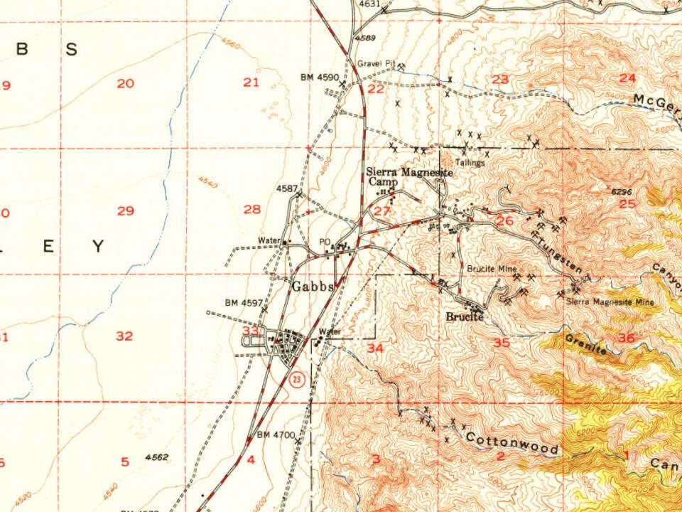
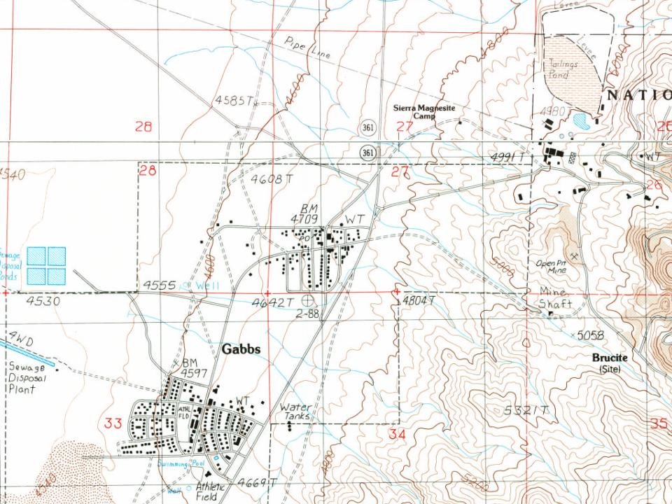
Most of Gabbs was built recently: 0.0% of its homes predate 1940 and the median home dates from 1963. Below: maps from 1948 on and the census since 1960.
Gabbs was founded circa December 1941 as a company town for Basic Magnesium, Inc. (BMI), which operated a magnesium production plant in the area. The town grew out of an earlier mining camp named Brucite (after the magnesium oxide brucite that occurred locally), and took the name of the surrounding Gabbs Valley, itself named after paleontologist William Gabb (who had studied fossil specimens from the area). World War II demand for magnesium fuelled the plant's expansion under the direction of the War Production Board, and policing, a jail, and a school district were established during 1942. Gabbs became a township in June 1943, with a population of 426. Settlements at North Gabbs, South Gabbs, and Tent City (which later largely merged into North Gabbs) were served by a library, city hall, parks, and tennis courts, and a succession of local newspapers. The city incorporated on March 29, …
Founding dates: Wikidata, Wikipedia, the U.S. post office records of Blevins & Helbock (CC0) and the Census. Homes by year built: Census ACS 2020–24. National Register of Historic Places: National Park Service (list of May 22, 2026). Old photos, postcards and papers: Wikimedia Commons, the Library of Congress and other public archives, credited on each item’s page. Maps: U.S. Geological Survey historical topographic maps (via Esri) and Sanborn fire-insurance maps (Library of Congress). History text and census tables: Wikipedia (CC BY-SA 4.0). Places that used to be: USGS Geographic Names Information System (2021). How TownRatings grades history →
From Wikimedia Commons (12), Wikipedia, U.S. Geological Survey historical maps, U.S. Census counts (via Wikipedia), the US Post Offices dataset (Blevins & Helbock) and the USGS Geographic Names Information System. Archive images are copied here with their credits and licenses, shown on each photo’s page. Refreshed monthly.
 2014
 2014
 2014
 2014
 2014
 2014
 2014
 2014
 2011
 2011
 2011
 2011