Eureka dates to 1864, and 15% of its homes were built before 1940
1 place in town is on the National Register, among them a historic district with 18 buildings. Below: 6 old photos and papers, maps from 1886 on, and old-book passages.
The town was first settled in 1864 by a group of silver prospectors from nearby Austin, who discovered rock containing a silver-lead ore on nearby Prospect Peak. According to tradition, the town was named from an incident when a prospector exclaimed "Eureka!" when he discovered deposits of silver ore. The town became the county seat in 1873, when Eureka County was carved out of adjacent Lander, Elko, and White Pine counties.
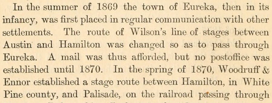
In the summer of 1869 the town of Eureka, then in its infancy, was first placed in regular communication with other settlements. The route of Wilson's line of stages between Austin and Hamilton was changed so as to pass through Eureka. A mail was thus afforded, but no postoffice was established until 1870. In the spring of 1870, Woodi'uff'& Ennor established a stage route between Hamilton, in White Pine county, and Pahsade, on the railroad pa;ssing through
Text read by machine from the scan; it may contain errors.
From 1869 dates the first successful treatment of the Eureka ores ; and in the train of that success came capital, labor, and increased facilities for transportation. In that year the towns of Palisade and Beowawe were located on the Central Pacific railroad, then just completed, and the town of Eureka, ninety miles south of Palisade, was laid out. The two original proprietors of Eureka were Major W. W. McCoy and Alonzo Monroe. These gentlemen respectively acquired
Text read by machine from the scan; it may contain errors.
Scans and text from the Internet Archive. Books published in 1930 or earlier, which are in the public domain.
Timeline
Eureka, 1850 to 1953
Woven from the archive, old maps, post office records, the National Register and the people born here.
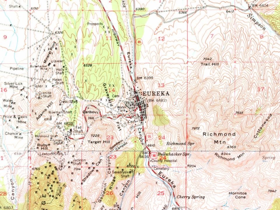
Every edition of the U.S. Geological Survey’s map of Eureka. Tap a year, or press play to watch the town change.
1953Eureka sheet · 1:62,500
U.S. Geological Survey historical topographic maps (public domain), via Esri’s collection of the scans. The red ring marks the center of Eureka.
Every building
Eureka, building by building, 1886–1907
Fire insurance maps drew every building, what it was made of and what it was used for, so insurers could price the risk of fire. Pick a year, then a sheet.
Founding dates: Wikidata, Wikipedia, the U.S. post office records of Blevins & Helbock (CC0) and the Census. Homes by year built: Census ACS 2020–24. National Register of Historic Places: National Park Service (list of May 22, 2026). Old photos, postcards and papers: Wikimedia Commons, the Library of Congress and other public archives, credited on each item’s page. Maps: U.S. Geological Survey historical topographic maps (via Esri) and Sanborn fire-insurance maps (Library of Congress). History text and census tables: Wikipedia (CC BY-SA 4.0). Places that used to be: USGS Geographic Names Information System (2021). How TownRatings grades history →
From Wikimedia Commons (6), the National Register of Historic Places (1), Wikipedia, Wikidata and Wikipedia for famous people, U.S. Geological Survey historical maps, the US Post Offices dataset (Blevins & Helbock), the USGS Geographic Names Information System, Sanborn fire insurance maps (Library of Congress) and old county and town histories (Internet Archive). Archive images are copied here with their credits and licenses, shown on each photo’s page. Refreshed monthly.




 1871
 1871
 1871
 1873