Founding year: the first Milltown post office (Blevins & Helbock, CC0). Wikidata: 1889.The full story ↓
History grade
What drives Milltown’s History grade
On its age, its old homes and the National Register, Milltown is more historic than 51% of U.S. towns, #304 of 468 in New Jersey. Its share of homes from before 1940 holds the grade up; its age pulls it down.
B−
HistoryA character grade: shown, never part of Milltown’s overall grade.
New Jersey towns list more on the Register than most of the country (a typical New Jersey town has 3.7 per 10,000 residents, the U.S. 2.4), so Milltown’s 1.4 sits near the middle of its state (37% of New Jersey towns have fewer) while its 1 listings outnumber those of 51% of U.S. towns.
How sure. Graded on any two of the three inputs instead, the letter would range from C to B. The pre-1940 share is a Census survey estimate (±5.8 points). The founding year is the first post office, not a stated founding date; Wikidata’s 1889 falls in the same era, so the grade doesn’t depend on which one is used.
Founding year: the first post office (other dates in Quick answers). Homes: Census ACS 2020–24. National Register: National Park Service, May 2026 list; each listing counted once (boundary changes and added documentation belong to their listing), and a historic district counts its contributing buildings. How TownRatings grades history →
What stands out about Milltown’s past
Read from the archive, the National Register and the record. The page puts what stands out first.
Every edition of the U.S. Geological Survey’s map of Milltown. Tap a year, or press play to watch the town change.
1888New Brunswick sheet · 1:62,500
U.S. Geological Survey historical topographic maps (public domain), via Esri’s collection of the scans. The red ring marks the center of Milltown.
Every building
Milltown, building by building, 1897–1918
Fire insurance maps drew every building, what it was made of and what it was used for, so insurers could price the risk of fire. Pick a year, then a sheet.
Long before the arrival of the first Europeans, the Lenape Native Americans had established settlements along the Lawrence Brook. The discovery of many artifacts in the area above today's municipal building (now a small county park) suggests the presence of a Native American settlement. In 1678, Thomas Lawrence, a New York baker, acquired a large area around the Lawrence Brook, which likely included today's Milltown. The Lawrence Brook was then called Piscopeek (and on later maps, Lawrence's Brook). The names and marks of several Native Americans (Quemareck, Quesiacs, Isarick, Metapis, Peckawan and Turantaca) appear on the bill of sale. In 1769, Fulcard Van Nordstrand advertised the sale of a large gristmill on the bank of Lawrence Brook. It would soon be called Lawrence Brook Mill. The 1903 classic western film The Great Train Robbery was shot in Milltown.
Passages that mention Milltown, cut from the printed page as they were published.
History of Middlesex County, New Jersey, 1664-19201921 · page 464Read the page →
Read the text
Borough of Milltown — Milltown, situated on Lawrence brook, and containing about two miles square, was created a borough in 1897. The area composing it was taken almost entirely from North Brunswick township, with a small portion of East Brunswick. It is about three miles from New Brunswick, with which it is connected by the tioHey line of the Public Service Company. The history of the borjugh is brief, and is practically that of North Brunswick. Its nucleus \v:\s the old grist-mill of Jacob I. Bergen, which he owned in 1800, and \'hich
Text read by machine from the scan; it may contain errors.
History of Middlesex County, New Jersey, 1664-19201921 · page 425Read the page →
Read the text
A grist mill was built at a very early day where Milltown is now situated, on the North Brunswick side of Lawrence brook, and about three-quarters of a mile from the borough. Early in 1800 it was owned by Jacob I. Bergen, and the place was known as Bergen's Mills. The water power was first utilized as early as 1750 to operate a saw mill and grist mill, which stood within the area afterward occupied by Parson's Brookford Snuf? Mills. A fulling mill was also erected, and when the domestic carding of wool ceased the building was converted
Text read by machine from the scan; it may contain errors.
Scans and text from the Internet Archive. Books published in 1930 or earlier, which are in the public domain.
Timeline
Milltown, 1870 to 1976
Woven from the archive, old maps, post office records, the National Register and the people born here.
The Milltown post office opened in 1870, the earliest record of the town by name (U.S. post office records). Wikidata gives 1889.
How does Milltown rank for history?
Milltown is more historic than 51% of U.S. towns, #304 of 468 in New Jersey. The History grade combines the town’s founding era, the share of homes built before 1940 and its National Register listings. It’s a character grade, so it isn’t part of the overall grade. How it works.
What is on the National Register in Milltown?
One place: the Milltown India Rubber Company (listed 1986).
How old are the homes in Milltown?
20% of Milltown’s homes were built before 1940 (Census estimate, ±5.8 points), against a typical 15% for a New Jersey town; the median home was built in 1963.
Founding dates: Wikidata, Wikipedia, the U.S. post office records of Blevins & Helbock (CC0) and the Census. Homes by year built: Census ACS 2020–24. National Register of Historic Places: National Park Service (list of May 22, 2026). Old photos, postcards and papers: Wikimedia Commons, the Library of Congress and other public archives, credited on each item’s page. Maps: U.S. Geological Survey historical topographic maps (via Esri) and Sanborn fire-insurance maps (Library of Congress). History text and census tables: Wikipedia (CC BY-SA 4.0). Places that used to be: USGS Geographic Names Information System (2021).
From Wikimedia Commons (9), Wikidata (1), the National Register of Historic Places (1), Wikipedia, Wikidata and Wikipedia for famous people, U.S. Geological Survey historical maps, U.S. Census counts (via Wikipedia), the US Post Offices dataset (Blevins & Helbock), the USGS Geographic Names Information System, Sanborn fire insurance maps (Library of Congress) and old county and town histories (Internet Archive). Archive images are copied here with their credits and licenses, shown on each photo’s page. Refreshed monthly.


 Date?
 2025
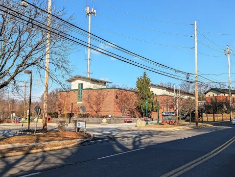 2025
 2023
 2023
 2021
 2013
 2012
 2007
