
View in, c. 1872
Randolph’s story
202 years in pictures
Census counts: 143 in 1830, a low of 67 in 1920, 328 in 2020. The archive holds 12 old photos and papers going back to 1872 and 2 maps from 1893 on.
- 1824Randolph is incorporated
Each edition grades its towns against each other only.

A town of 327, incorporated in 1824.
32% of residents are 65 or older in Randolph, against 20% in New Hampshire’s towns and 18% across U.S. towns. No town among the 127 in New Hampshire we compare has a lower July high than Randolph. 85% of the land in Randolph is conserved, above both the New Hampshire town median (18%) and the median of U.S. towns (4.3%). The biggest place to walk is Randolph Community Forest, 8,904 acres with 27.3 miles of trail. Randolph has fewer than 1,000 residents, too few for fair grades; the figures below are still real.
Where Randolph beats most towns.
In a town this size, neighbors are the best guide. Ask them anything.
Census counts: 143 in 1830, a low of 67 in 1920, 328 in 2020. The archive holds 12 old photos and papers going back to 1872 and 2 maps from 1893 on.
Who provides power, water and the rest in Randolph, and how to reach them.
EPA SDWIS (Oct 9, 2026) · HIFLD + EIA-861 2025 · Census 2020 ZCTAs · NCES 2024–25 · registration: vote.gov, updated Nov 19, 2024.
Ordered by what stands out in Randolph.
88 miles of trail in 7 parks and preserves. Randolph’s trail density is 1.9 miles per square mile.
| Biggest places to walk | Trails | Acres |
|---|---|---|
| 1. Randolph Community Forest | 27.3 mi | 8,904 |
| 2. Ice Gulch Town Forest | 5.7 mi | 2,735 |
| 3. Snyder Brook Scenic Area | 1.3 mi | 33 |
Trails & parks © OpenStreetMap contributors · Conserved land: USGS PAD-US
Since 2013, Randolph has lost 47 jobs, to 3 in 2023. The top destinations are Carroll (18%), Jefferson (9%) and Littleton (7%). Half commute less than 19 miles.
| Randolph | New Hampshire towns | U.S. towns | |
|---|---|---|---|
| Median household income | $102,000 | $103,000 | $80,000 |
| Below the poverty line | 6.7% | 6.8% | 9.6% |
| Average trip to work | 27 minutes | 28 minutes | 25 minutes |
Census LEHD 2023 · ACS
Expected storm and flood damage is higher than in 78% of U.S. communities.
FEMA National Risk Index · OpenFEMA
The typical Randolph home is worth about $403,000, up 9.1% in a year, 21% below the New Hampshire typical home. The median rent in Randolph is $1,667 a month.
| Randolph | New Hampshire towns | U.S. towns | |
|---|---|---|---|
| Median rent | $1,667 a month | $1,388 a month | $1,185 a month |
| Households that own their home | 83% | 82% | 73% |
Census ACS, 2020–24 · Zillow Home Value Index · Redfin Data Center
Among 127 New Hampshire towns, just 1 have a lower January low than Randolph. Randolph has cold, snowy winters and cool summers, with plenty of rain.
NOAA U.S. Climate Normals, 1991–2020
13% of Randolph adults binge drink. Among 127 New Hampshire towns, just 3 have a lower share of adults who sleep under 7 hours than Randolph. 10% of Randolph adults smoke cigarettes.
| Randolph | New Hampshire towns | U.S. towns | |
|---|---|---|---|
| Binge drink (CDC PLACES) | 13% | 16% | 16% |
| Frequent mental distress (CDC PLACES) | 13% | 16% | 17% |
| Sleep under 7 hours (CDC PLACES) | 29% | 33% | 36% |
| Yearly checkup (CDC PLACES) | 83% | 78% | 79% |
| What stands out | Randolph | NH |
|---|---|---|
| Fewer adults facing housing insecurity | 6.1% | 8.1% |
| Fewer adults facing a utility shut-off | 4.1% | 5.4% |
| More older adults who have lost all their teeth | 13.4% | 8.9% |
CDC PLACES 2025 · modeled estimates for adults · CMS · HRSA
Museums, parks, gardens and other places to visit around Randolph. Close and well known come first.
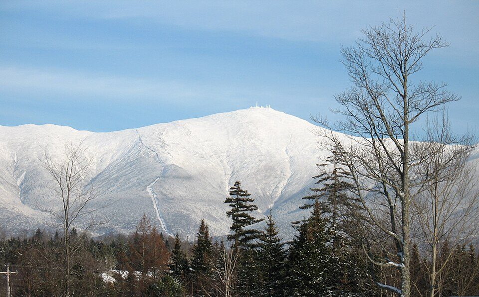 Big draw9 mi MountainMount Washington
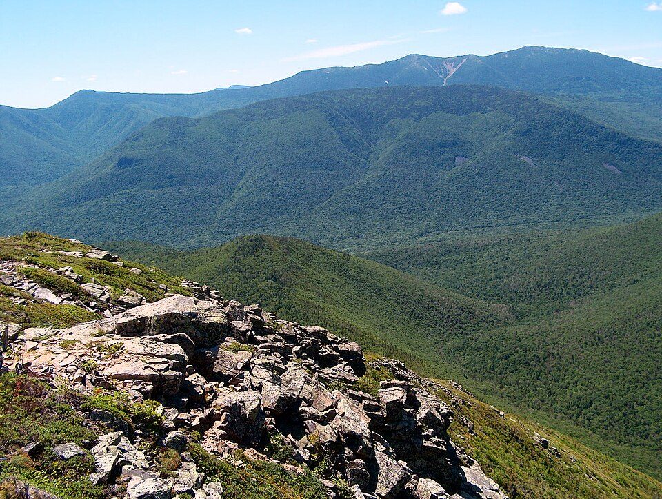 21 mi National forestWhite Mountain National Forest
 25 mi Scenic railwayConway Scenic Railroad
 25 mi Ski areaCannon Mountain104 runs · 2,201 ft vertical
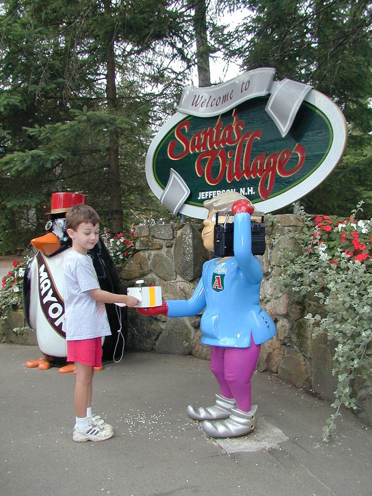 10 mi Theme parkSanta's Village
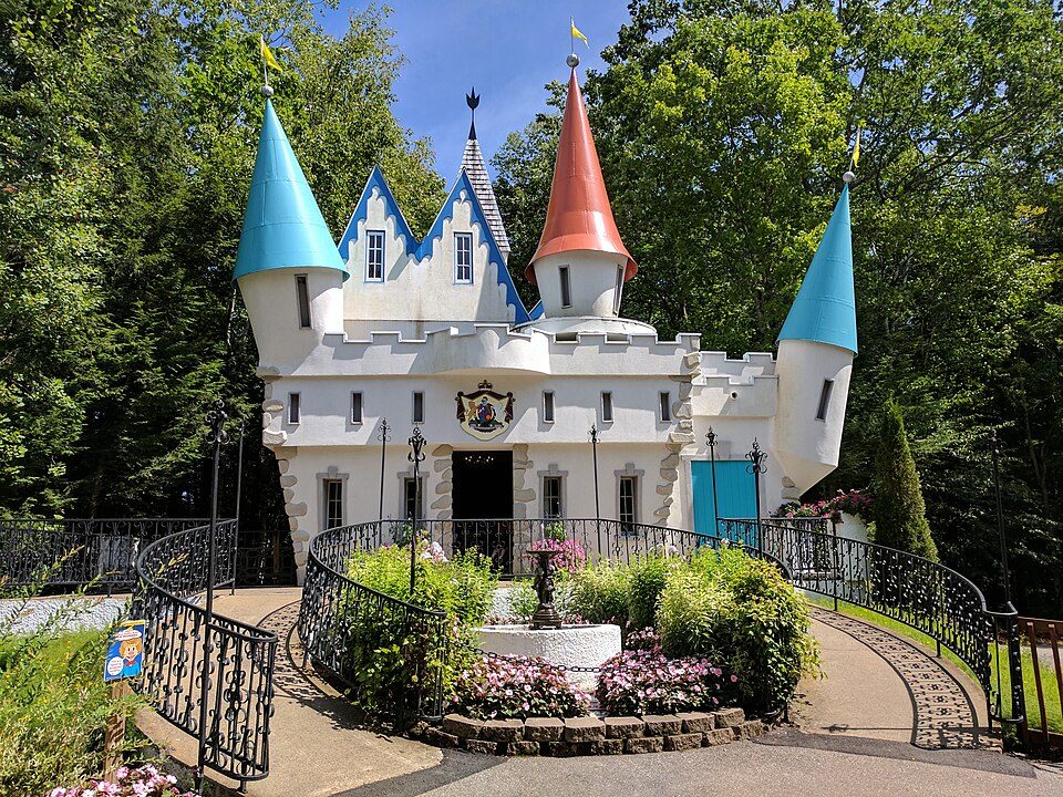 20 mi Theme parkStory Land
Mount Washington: wwoods, CC BY-SA 3.0 · White Mountain National Forest: Ken Gallager at English Wikipedia, Public domain · Conway Scenic Railroad: Pi.1415926535, CC BY-SA 3.0 · Cannon Mountain: Mikespenard at English Wikipedia, CC BY-SA 3.0 · Santa's Village: Alex McLeod, CC BY-SA 2.0 · Story Land: AnotherMaker, CC BY-SA 4.0
1 within 15 miles of the center of Randolph
About 6 of every 100 Randolph residents are enrolled in college, about the same as New Hampshire.
85% of the town is conserved land, across 7 parks and preserves.
Town in New Hampshire, United States
Randolph is a heavily forested town in Coös County, New Hampshire, United States, extending from the northern slopes of the White Mountains of the Presidential Range (to the south) to the Crescent Range and Berlin (to the north), with U.S. Route 2 cutting through the middle. The northern and southern parts of Randolph are within the White Mountain National Forest and the Ice Gulch Town Forest, while the central part is the settled portion of town. As of the 2020 census, the town had a population of 328. Randolph is part of the Berlin, NH-VT Micropolitan Statistical Area.
From Wikipedia, licensed CC BY-SA 4.0 · facts via Wikidata (CC0)
Short answers, built from the data on this page.
Randolph has fewer than 1,000 residents, too few for fair grades; the figures below are still real.


