Red Cloud’s post office opened in 1871, and 46% of its homes were built before 1940
27 places in town are on the National Register, among them the Cather House, a National Historic Landmark, and four historic districts with 92 buildings between them. Below: 3 old photos and papers, maps from 1886 on, and the census since 1880.
Fire insurance maps drew every building, what it was made of and what it was used for, so insurers could price the risk of fire. Pick a year, then a sheet.
The region of present-day Red Cloud was intermittently occupied and used as hunting grounds by the Pawnees until 1833. In that year, a treaty was signed in which the Pawnees surrendered their lands south of the Platte River. According to George Hyde, it is likely that the Pawnees did not realize that they were thereby giving up their lands, and that they were led to believe that they were only granting the Delawares and other relocated tribes permission to hunt in the area.
Nothing in the archives for these yearsWeddings on Main Street, storms, parades, school pictures, the old store. If it’s in your family album, it belongs here.
Peaked at 1,856 in 1920; 962 people lived here in 2020.
15 censuses, 1880–2020.
U.S. Census Bureau decennial counts, from the census table on Red Cloud’s Wikipedia page.
Questions about Red Cloud’s history
What year was Red Cloud founded?
The Red Cloud post office opened in 1871, the earliest record of the town by name (U.S. post office records).
What is on the National Register in Red Cloud?
27 listings: 19 buildings, among them the Cather House (a National Historic Landmark since 1971), 4 historic districts with 92 contributing buildings, 3 sites, and 1 structure. 113 historic buildings in all.
Founding dates: Wikidata, Wikipedia, the U.S. post office records of Blevins & Helbock (CC0) and the Census. Homes by year built: Census ACS 2020–24. National Register of Historic Places: National Park Service (list of May 22, 2026). Old photos, postcards and papers: Wikimedia Commons, the Library of Congress and other public archives, credited on each item’s page. Maps: U.S. Geological Survey historical topographic maps (via Esri) and Sanborn fire-insurance maps (Library of Congress). History text and census tables: Wikipedia (CC BY-SA 4.0). Places that used to be: USGS Geographic Names Information System (2021). How TownRatings grades history →
From Wikimedia Commons (8), the Library of Congress (1), Wikidata (9), the National Register of Historic Places (27), Wikipedia, Wikidata and Wikipedia for famous people, U.S. Geological Survey historical maps, U.S. Census counts (via Wikipedia), the US Post Offices dataset (Blevins & Helbock), the USGS Geographic Names Information System and Sanborn fire insurance maps (Library of Congress). Archive images are copied here with their credits and licenses, shown on each photo’s page. Refreshed monthly.


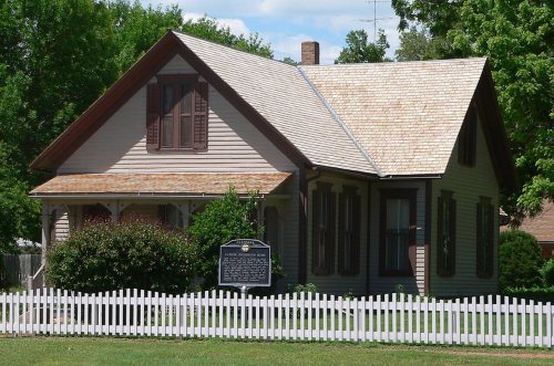 ★ Landmark





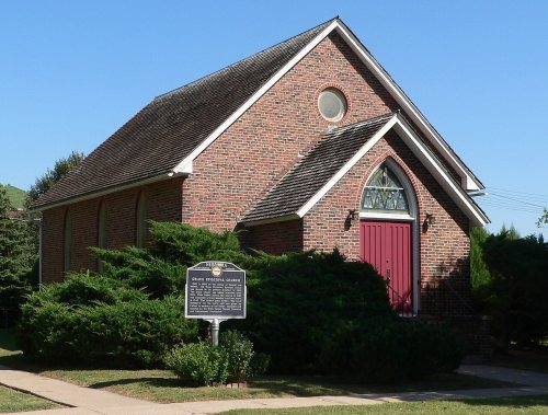


 2019
 2013
 2010
 2010
 2010
 2005

