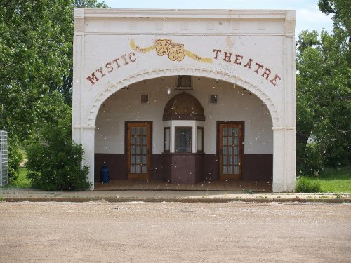
Marmarth dates its founding to 1907 (Wikidata). The census first counted it in 1910.
First census: 790 in 19102020 census: 101119 years
How did Marmarth get its name?
The name comes from a combination of letters in the first and middle names of Margaret Martha Finch, granddaughter of Albert J. Earling, president of the railroad at the time.
The area was originally inhabited by the Lakota- and Crow peoples, which may have been part of the 9th–12th centuries BCE Mound Builders civilization.
On September 2, 1864, Captain James L. Fisk of the Union Army was leading 200 gold-seekers in eighty-eight wagons from North Dakota to Montana. By the Deep Creek, approximately twelve miles east of today's Marmarth, the group was attacked by over a hundred Hunkpapa Sioux Indians led by the chief Sitting Bull. Sitting Bull was wounded, but saved by Jumping Bull and White Bull, while six Hunkpapas, ten soldiers, and two civilians were killed in the battle. The Site of Fort Dilts has been listed on the National Register of Historic Places since 1980.
Nothing in the archives for these yearsWeddings on Main Street, storms, parades, school pictures, the old store. If it’s in your family album, it belongs here.
Founding dates: Wikidata, Wikipedia, the U.S. post office records of Blevins & Helbock (CC0) and the Census. Homes by year built: Census ACS 2020–24. National Register of Historic Places: National Park Service (list of May 22, 2026). Old photos, postcards and papers: Wikimedia Commons, the Library of Congress and other public archives, credited on each item’s page. Maps: U.S. Geological Survey historical topographic maps (via Esri) and Sanborn fire-insurance maps (Library of Congress). History text and census tables: Wikipedia (CC BY-SA 4.0). Places that used to be: USGS Geographic Names Information System (2021). How TownRatings grades history →
From Wikimedia Commons (11), the Library of Congress (1), the National Register of Historic Places (1), Wikipedia, U.S. Geological Survey historical maps, U.S. Census counts (via Wikipedia), the US Post Offices dataset (Blevins & Helbock) and the USGS Geographic Names Information System. Archive images are copied here with their credits and licenses, shown on each photo’s page. Refreshed monthly.


 1914
 1915
 2007
 2007
 2007
 2007
 2007
 2007
 2007
 2007
 2007