Cooperstown’s post office opened in 1882, and 24% of its homes were built before 1940
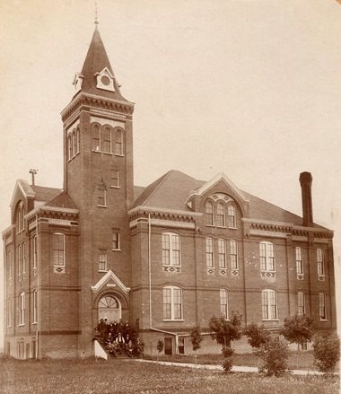
Its Register listings are the Griggs County Courthouse and the Northern Lights Masonic Lodge. Below: 1 old photo or paper, maps from 1893 on, and the census since 1890.
Peaked at 1,485 in 1970; 983 people lived here in 2020.
14 censuses, 1890–2020.
U.S. Census Bureau decennial counts, from the census table on Cooperstown’s Wikipedia page.
Every building
Cooperstown, building by building, 1893–1914
Fire insurance maps drew every building, what it was made of and what it was used for, so insurers could price the risk of fire. Pick a year, then a sheet.
The city is named for R. C. Cooper, a bonanza farmer who built the first wood-frame house in the area in 1880. Prior to Cooper's arrival, most settlers or the era lived in sod houses, covered wagons, tents, or log cabins (especially near the Sheyenne River where trees were numerous). Cooperstown was laid out on October 26, 1882, soon before the railroad was extended to that point.
Nothing in the archives for these yearsWeddings on Main Street, storms, parades, school pictures, the old store. If it’s in your family album, it belongs here.
Founding dates: Wikidata, Wikipedia, the U.S. post office records of Blevins & Helbock (CC0) and the Census. Homes by year built: Census ACS 2020–24. National Register of Historic Places: National Park Service (list of May 22, 2026). Old photos, postcards and papers: Wikimedia Commons, the Library of Congress and other public archives, credited on each item’s page. Maps: U.S. Geological Survey historical topographic maps (via Esri) and Sanborn fire-insurance maps (Library of Congress). History text and census tables: Wikipedia (CC BY-SA 4.0). Places that used to be: USGS Geographic Names Information System (2021). How TownRatings grades history →
From Wikimedia Commons (12), the National Register of Historic Places (2), Wikipedia, Wikidata and Wikipedia for famous people, U.S. Geological Survey historical maps, U.S. Census counts (via Wikipedia), the US Post Offices dataset (Blevins & Helbock), the USGS Geographic Names Information System and Sanborn fire insurance maps (Library of Congress). Archive images are copied here with their credits and licenses, shown on each photo’s page. Refreshed monthly.


 2008
 2008
 2008
 2008
 2008
 2008
 2008
 2008
 2008
 2008
 2008